Category:Archiestown
Jump to navigation
Jump to search
village in Moray, Scotland, UK  | |||||
| Upload media | |||||
| Instance of | |||||
|---|---|---|---|---|---|
| Location |
| ||||
| official website | |||||
 | |||||
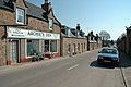
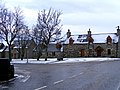
English: Archiestown is a small village in Moray, Scotland, named in honour of its founder Sir Archibald Grant of Monymusk. It is a typical 18th century planned village with a grid street-plan and spacious square. Originally intended as a weaving centre, it is better known for the nearby distilleries of Cardhu, Knockando, Tamdhu and The Macallan. It is also home to local independent football team Archiestown FC.
Français : Archiestown est un petit village de la région de Moray, situé à 25 kilomètres au sud d'Elgin et à 80 kilomètres à l'est d'Inverness.
Gàidhlig: 'S e baile ann am Moireabh a tha ann an Baile an Tuim (Beurla: Archiestown). 'S e seo na co-chomharran aige: 57° 29′ 3.34″ Tuath agus 3° 16′ 39.29″ Iar.
Norsk nynorsk: Archiestown er ein landsby i regionen Moray i Skottland. Han er kalla opp etter grunnleggjaren Sir Archibald Grant of Monymusk. Han er ein typisk planlagd by frå 1700-talet med gater i eit ruteplan og romlege plassar. Han var opphavleg meint som eit senter for veveindustrien, men er meir kjend for dei nærliggande destilleria Cardhu, Tamdhu, Knockando og The Macallan.

Media in category "Archiestown"
The following 79 files are in this category, out of 79 total.
-
 Approaching Archiestown from the South - geograph.org.uk - 725555.jpg 640 × 426; 175 KB
-
 Archiestown - geograph.org.uk - 1603530.jpg 640 × 480; 124 KB
-
 Archiestown - geograph.org.uk - 599080.jpg 640 × 480; 272 KB
-
 Archiestown 725506.jpg 640 × 426; 155 KB
-
 Archiestown Hotel - geograph.org.uk - 1393019.jpg 640 × 427; 69 KB
-
 Archiestown Memorial - geograph.org.uk - 1393018.jpg 640 × 427; 101 KB
-
 Archiestown War Memorial - geograph.org.uk - 560986.jpg 640 × 480; 161 KB
-
 Campers and Caravanning Club pitch. - geograph.org.uk - 213453.jpg 640 × 427; 93 KB
-
 Cattle near Mains of Corgyle - geograph.org.uk - 247007.jpg 640 × 480; 71 KB
-
 Club Moss - geograph.org.uk - 594704.jpg 640 × 427; 352 KB
-
 Dwellings at Archiestown - geograph.org.uk - 1603553.jpg 640 × 480; 100 KB
-
 Forest near Archiestown - geograph.org.uk - 594836.jpg 640 × 427; 234 KB
-
 Fungi (species unknown) - geograph.org.uk - 594639.jpg 640 × 416; 213 KB
-
 Fungi (species unknown) - geograph.org.uk - 594698.jpg 640 × 286; 189 KB
-
 Profusion of Speyside Snowdrops. - geograph.org.uk - 350065.jpg 640 × 426; 136 KB
-
 Rhynagarrie Farm, Morayshire. - geograph.org.uk - 213512.jpg 640 × 427; 96 KB
-
 River Spey from bridge at Carron - geograph.org.uk - 73321.jpg 640 × 427; 131 KB
-
 River Spey from bridge at Carron - geograph.org.uk - 73325.jpg 427 × 640; 90 KB
-
 Road South of Archiestown - geograph.org.uk - 725549.jpg 640 × 426; 136 KB
-
 Speyside Way near Carron House - geograph.org.uk - 539265.jpg 640 × 427; 122 KB
-
 The Archiestown Hotel - geograph.org.uk - 599072.jpg 640 × 480; 184 KB
-
 The joys of Spring by the Spey. - geograph.org.uk - 350058.jpg 640 × 426; 189 KB
-
 Who has one leg^ - geograph.org.uk - 560980.jpg 640 × 480; 123 KB
-

-
 Above Sandyhillock. - geograph.org.uk - 637034.jpg 640 × 480; 105 KB
-
 Above the Burn of Rothes - geograph.org.uk - 594577.jpg 640 × 427; 264 KB
-

-
 Archiestown - geograph.org.uk - 73277.jpg 640 × 427; 147 KB
-
 Archiestown Post Office - geograph.org.uk - 1149699.jpg 640 × 480; 119 KB
-
 Autumn Larches - geograph.org.uk - 594761.jpg 640 × 343; 214 KB
-
 Bishop's Stones - geograph.org.uk - 594623.jpg 640 × 427; 267 KB
-
 Bishop's Stones - geograph.org.uk - 594633.jpg 640 × 427; 257 KB
-
 Blackhillock farm - geograph.org.uk - 637045.jpg 640 × 480; 111 KB
-
 Bothy on Mannoch Hill - geograph.org.uk - 73297.jpg 640 × 427; 124 KB
-

-

-
 Cairn Cattoch - geograph.org.uk - 259773.jpg 640 × 480; 28 KB
-
 Cairn Cattoch - geograph.org.uk - 594581.jpg 640 × 385; 234 KB
-
 Carron - geograph.org.uk - 6576.jpg 640 × 420; 228 KB
-
 Clear Fell near Cairn Cattoch - geograph.org.uk - 594600.jpg 640 × 427; 249 KB
-
 Clear Fell near Cairn Cattoch - geograph.org.uk - 594607.jpg 640 × 427; 257 KB
-
 Conifer Plantations - geograph.org.uk - 594824.jpg 640 × 427; 279 KB
-
 Corgyle sign post. - geograph.org.uk - 246921.jpg 640 × 480; 130 KB
-
 Corshelloch - geograph.org.uk - 594813.jpg 427 × 640; 315 KB
-
 Corshellock - geograph.org.uk - 594792.jpg 640 × 427; 322 KB
-

-
 Downstream view of Pol Machree. - geograph.org.uk - 350085.jpg 640 × 426; 123 KB
-
 Forest near Archiestown - geograph.org.uk - 594594.jpg 640 × 427; 260 KB
-
 Forest Quarry near Archiestown - geograph.org.uk - 594567.jpg 640 × 427; 258 KB
-
 Forest Road near Archiestown - geograph.org.uk - 594564.jpg 459 × 640; 295 KB
-
 Forest Road near Archiestown - geograph.org.uk - 594710.jpg 640 × 427; 274 KB
-

-
 Gnarled Pine - geograph.org.uk - 594805.jpg 427 × 640; 325 KB
-
 Greenhill. - geograph.org.uk - 399768.jpg 640 × 480; 81 KB
-
 Hill of Stob - geograph.org.uk - 594719.jpg 640 × 427; 253 KB
-
 Hunt Hill - geograph.org.uk - 594576.jpg 427 × 640; 270 KB
-

-
 Looking West from Cairn Cattoch - geograph.org.uk - 594589.jpg 640 × 427; 274 KB
-
 Moorland track - geograph.org.uk - 73298.jpg 640 × 427; 91 KB
-
 Moorland track - geograph.org.uk - 73305.jpg 640 × 427; 97 KB
-
 Natural Regeneration - geograph.org.uk - 594751.jpg 640 × 427; 302 KB
-
 Near Corshellock - geograph.org.uk - 594799.jpg 640 × 427; 292 KB
-

-
 On the road to Annfield. - geograph.org.uk - 213515.jpg 640 × 427; 84 KB
-
 Rickety bridge. - geograph.org.uk - 399867.jpg 640 × 480; 134 KB
-
 Rough track. - geograph.org.uk - 399934.jpg 640 × 480; 116 KB
-
 Snowplough,salt and sand. - geograph.org.uk - 247012.jpg 640 × 480; 91 KB
-
 Sole customer. - geograph.org.uk - 399955.jpg 640 × 480; 66 KB
-
 Summit of Cairn Cattoch - geograph.org.uk - 594584.jpg 640 × 427; 231 KB
-
 The end of the path through the trees - geograph.org.uk - 562390.jpg 640 × 480; 131 KB
-
 The End of the Road - geograph.org.uk - 594777.jpg 640 × 427; 258 KB
-
 The Green at Archiestown - geograph.org.uk - 599076.jpg 640 × 480; 312 KB
-
 The Peerless village of Archiestown. - geograph.org.uk - 178153.jpg 640 × 427; 113 KB
-
 The red lane to Blackhillock Farm. - geograph.org.uk - 213476.jpg 640 × 427; 82 KB
-
 The westward view from Greenhill. - geograph.org.uk - 399825.jpg 640 × 480; 80 KB
-

-
 Tombreck and Carron turning. - geograph.org.uk - 213501.jpg 640 × 427; 97 KB
-
 Track to Cairn Cattoch - geograph.org.uk - 594571.jpg 640 × 427; 252 KB
-


_-_geograph.org.uk_-_594639.jpg)
_-_geograph.org.uk_-_594698.jpg)


