Category:Arêches-Beaufort
Jump to navigation
Jump to search
| Object location | | View all coordinates using: OpenStreetMap |
|---|
.JPG)  | |||||
| Upload media | |||||
| Instance of | |||||
|---|---|---|---|---|---|
| Part of | |||||
| Location | Beaufort, canton of Beaufort | ||||
| Located in or next to body of water |
| ||||
| Mountain range | |||||
| Elevation above sea level |
| ||||
| official website | |||||
 | |||||
Subcategories
This category has the following 6 subcategories, out of 6 total.
Media in category "Arêches-Beaufort"
The following 91 files are in this category, out of 91 total.
-
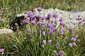 Allium schoenoprasum, Areches - img 44645.jpg 5,616 × 3,744; 8.31 MB
-
 Areches - img 44604.jpg 5,616 × 3,744; 8.28 MB
-
 Areches - img 44605.jpg 5,616 × 3,744; 9.67 MB
-
 Areches - img 44606.jpg 4,098 × 2,733; 3.86 MB
-
 Areches - img 44610.jpg 5,504 × 3,574; 5.73 MB
-
 Areches - img 44668.jpg 5,616 × 3,744; 7.61 MB
-
 Areches - panoramio (1).jpg 4,320 × 3,240; 4.34 MB
-
 Areches - panoramio (2).jpg 4,320 × 3,240; 3.77 MB
-
 Areches - panoramio.jpg 1,251 × 354; 67 KB
-
 Areches Beaufort3.jpg 800 × 600; 101 KB
-
 Areches, le Clou - img 44611.jpg 5,616 × 3,744; 9.36 MB
-
 Areches, le Clou - img 44612.jpg 5,616 × 3,744; 7.54 MB
-
 Areches, le Mont-Blanc - img 44649.jpg 3,744 × 5,616; 7.12 MB
-
 Arèche banner.jpg 2,100 × 300; 269 KB
-
 Arêches 2012 (14).JPG 1,936 × 1,288; 1.48 MB
-
 Arêches 2012 (16).JPG 1,936 × 1,288; 1.26 MB
-
 Arêches @ Col de la Bâthie.jpg 4,608 × 3,456; 7.01 MB
-
 Arêches et Beaufortain depuis Mont Bisanne en hiver (janvier 2024).JPG 3,264 × 2,448; 4.98 MB
-
 Arêches from Azureva.jpg 3,312 × 4,416; 2.37 MB
-
 Arêches from le Planey.jpg 4,416 × 3,312; 1.43 MB
-
 Arêches from road to Beaufort.jpg 4,416 × 3,312; 9.53 MB
-
 Arêches-Beaufort depuis Télésiège du Grand Mont (juillet 2024).JPG 3,200 × 2,404; 5.41 MB
-
 Arêches-Beaufort en hiver.png 1,266 × 845; 2.25 MB
-
 Arêches-Beaufort en été.png 1,334 × 885; 2.53 MB
-
 Astrantia minor, Areches - img 44648.jpg 5,616 × 3,744; 6.44 MB
-
 Beaufort - panoramio (1).jpg 3,000 × 4,000; 4.01 MB
-
 Beaufort - panoramio (2).jpg 4,000 × 3,000; 4.77 MB
-
 Beaufort - panoramio (3).jpg 3,000 × 4,000; 4.2 MB
-
 Beaufort - panoramio (4).jpg 4,000 × 3,000; 4.69 MB
-
 Beaufort - panoramio (5).jpg 4,000 × 3,000; 4.81 MB
-
 Beaufort l'ancienne gendarmerie imperiale - panoramio.jpg 3,000 × 4,000; 1.9 MB
-
 Beaufortain001.JPG 3,264 × 2,448; 1.77 MB
-
 Beaufortain002.JPG 3,264 × 2,448; 1.72 MB
-
 Boudin - panoramio (1).jpg 4,000 × 3,000; 4.83 MB
-
 Boudin - panoramio.jpg 4,000 × 3,000; 4.89 MB
-
 Campanula barbata, Areches - img 44682.jpg 3,744 × 5,616; 4.15 MB
-
 Chalet a boudin - panoramio (1).jpg 4,000 × 3,000; 1.9 MB
-
 Chalet a boudin - panoramio.jpg 4,000 × 3,000; 1.9 MB
-
 Chemin des Écolières à Arêches en été (juillet 2024).JPG 3,264 × 2,448; 3.13 MB
-
 Coenonympha gardetta, Areches - img 44636.jpg 5,616 × 3,744; 6.48 MB
-
 Coenonympha gardetta, Areches - img 44701.jpg 5,616 × 3,744; 5.22 MB
-
 Col du Pré depuis Arêches-Beaufort en été (juillet 2024).JPG 3,264 × 2,448; 5.85 MB
-
 Cystopteris alpina, Areches - img 44684.jpg 3,744 × 5,616; 4.34 MB
-
 Entre Tête et Plateau de Cuvy à Arêches en été (juillet 2024).JPG 3,264 × 2,448; 4.57 MB
-
 Environs de boudin - panoramio.jpg 4,000 × 3,000; 4.93 MB
-
 Fete a areches-beaufort - panoramio.jpg 1,600 × 1,200; 390 KB
-
 Fontaine à Arêches-Beaufort (septembre 2023).JPG 3,176 × 2,360; 3.63 MB
-
 Gens de l'alpe Musée dauphinois 2020 abc14.jpg 3,928 × 3,540; 2.23 MB
-
 Gens de l'alpe Musée dauphinois 2020 abc18.jpg 4,035 × 4,000; 2.35 MB
-
 Gentiana bavarica, Areches - img 44689.jpg 5,616 × 3,744; 7.4 MB
-
 Hauteurs est d'Arêches depuis télésiège en été (juillet 2024).JPG 3,099 × 2,268; 4.65 MB
-
 Hauteurs ouest d'Arêches depuis télésiège en été (juillet 2024).JPG 3,128 × 2,352; 5.77 MB
-
 Hauteurs sud d'Arêches en été (septembre 2023).JPG 3,036 × 2,256; 4.68 MB
-
 Hieracium aurantiacum, Areches - img 44681.jpg 5,616 × 3,744; 4.38 MB
-
 Jacobaea incana, Areches - img 44693.jpg 3,744 × 5,616; 7.85 MB
-
 La route du col du pré - panoramio.jpg 4,000 × 3,000; 4.93 MB
-
 La Serraz au sud d'Arêches en été (juillet 2024).JPG 3,228 × 2,416; 3.39 MB
-
 La vache de boudin - panoramio.jpg 4,000 × 3,000; 4.81 MB
-
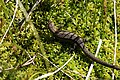 Lacerta vivipara, Areches - img 44638.jpg 5,616 × 3,744; 8.35 MB
-
 Lacerta vivipara, Areches - img 44640.jpg 4,560 × 3,047; 4.67 MB
-
 Le Praz - img 44817.jpg 5,616 × 3,744; 8.19 MB
-
 Le Praz - img 44818.jpg 5,616 × 3,744; 9.59 MB
-
 Les vaches de boudin - panoramio.jpg 4,000 × 3,000; 4.84 MB
-
 Leucorrhinia dubia, Areches - img 44621.jpg 2,944 × 1,957; 3.03 MB
-
 Leucorrhinia dubia, Areches - img 44626.jpg 3,024 × 1,896; 2.97 MB
-
 Lycopodium clavatum, Areches - img 44707.jpg 3,744 × 5,616; 7.62 MB
-
 Lycopodium clavatum, Areches - img 44708.jpg 5,616 × 3,744; 8.06 MB
-
 Miramella alpina, Areches - img 44642.jpg 2,629 × 1,754; 1.43 MB
-
 Miramella alpina, Areches - img 44644.jpg 3,432 × 2,282; 2.47 MB
-
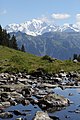
 Montagne d'Outray @ Col de la Bâthie.jpg 4,608 × 3,456; 5.67 MB
-
 Natrix natrix, Areches - img 44619.jpg 3,367 × 2,251; 2.45 MB
-
 Natrix natrix, Areches - img 44620.jpg 4,487 × 2,987; 4.98 MB
-
 Office de tourisme d'Arêches-Beaufort (septembre 2023).JPG 3,264 × 2,448; 3.77 MB
-
 Pente sous Tête de Cuvy à Arêches en été (juillet 2024) 2.JPG 3,264 × 2,448; 5.19 MB
-
 Pente sous Tête de Cuvy à Arêches en été (juillet 2024).JPG 3,264 × 2,448; 6.11 MB
-
 Pentes sous Tête de Cuvy à Arêches en été (juillet 2024).JPG 3,264 × 2,448; 4.95 MB
-
 Pyrola rotundifolia, Areches - img 44634.jpg 3,744 × 5,616; 5.86 MB
-
 Roche Parstire @ Col de la Grande Combe.jpg 4,608 × 3,456; 5.3 MB
-
 Rue principale de beaufort - panoramio.jpg 4,000 × 3,000; 4.84 MB
-
 Ruelle a beaufort - panoramio.jpg 3,000 × 4,000; 4.1 MB
-
 Saxifraga aizoides, Areches - img 44646.jpg 3,744 × 5,616; 5.87 MB
-
 Silene rupestris, Areches - img 44678.jpg 5,616 × 3,744; 5.03 MB
-
 Tarentaise cattle from Azureva.jpg 4,416 × 3,312; 2.82 MB
-
 Torrent Poncellamont à Arêches en été (juillet 2024).JPG 2,048 × 1,536; 2.6 MB
-
 Téléisège Le Bois d'Arêches en été (juillet 2024).JPG 3,264 × 2,448; 3.79 MB
-
 Vallon du Planay depuis Arêches en été (juillet 2024).JPG 3,264 × 2,448; 3.38 MB
-
 Vallon du Planay et Arêches depuis le plateau en été (juillet 2024).JPG 3,228 × 2,420; 3.72 MB
-
 Veronica fruticans, Areches - img 44755.jpg 5,616 × 3,744; 6.83 MB
-
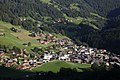
 Village d'Arêches depuis les hauteurs sud (septembre 2023).JPG 3,264 × 2,448; 3.76 MB
-
 Village d'Arêches depuis Télésiège Grand Mont en été (juillet 2024).JPG 3,158 × 2,340; 6.1 MB
-
 Vue d'Arêches depuis Télésiège Grand Mont en été (juillet 2024).JPG 3,264 × 2,448; 4.64 MB


.jpg)
.jpg)


.JPG)
.JPG)

.JPG)


.jpg)
.jpg)
.jpg)
.jpg)
.jpg)


.jpg)


.jpg)

.JPG)


.JPG)

.JPG)


.JPG)


.JPG)
.JPG)
.JPG)


.JPG)


.JPG)
_2.JPG)
.JPG)
.JPG)


.JPG)
.JPG)
.JPG)
.JPG)

.JPG)
.JPG)
.JPG)