Category:Aqueduct of the Yzeron river
Jump to navigation
Jump to search
| Object location | | View all coordinates using: OpenStreetMap |
|---|
|
This building is inscrit au titre des monuments historiques de la France. It is indexed in the base Mérimée, a database of architectural heritage maintained by the French Ministry of Culture, under the reference PA00117753
|

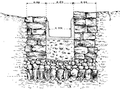
Ancient aqueduct in France  | |||||
| Upload media | |||||
| Instance of | |||||
|---|---|---|---|---|---|
| Location | Craponne, Metropolis of Lyon, Auvergne-Rhône-Alpes, Metropolitan France, France | ||||
| Street address |
| ||||
| Heritage designation |
| ||||
| Inception |
| ||||
 | |||||
Subcategories
This category has the following 2 subcategories, out of 2 total.
P
- Piles du Tourillon (19 F)
S
Media in category "Aqueduct of the Yzeron river"
The following 2 files are in this category, out of 2 total.
-
 Pile du pont de Grange-Blanche.png 1,156 × 719; 621 KB
-
 Section aqueduc à Vaugneray.png 1,597 × 1,178; 1.2 MB

