Category:April 2022 in York
Jump to navigation
Jump to search
Deutsch: Bilder, die im April 2022 in York aufgenommen worden sind. Bitte beachten Sie, dass dies weder das Datum des Uploads noch das Datum des Scannens eines Fotos ist.
English: Images/pictures taken in York during April 2022. Note this is not the date of the upload, nor the date a photo was scanned.
Español: Fotografías o imágenes tomadas en York durante abril 2022. No es la fecha de subida ni escaneo, sino la fecha en que las fotografías o imágenes se crearon.
Esperanto: Bildoj faritaj en York en aprilo 2022. Tio ne estas la dato, kiam la bildoj estis alŝutitaj aŭ skanitaj.
Français : Photographies ou images prises en York durant avril 2022. Ce n'est pas la date du téléchargement ou du scan.
Galego: Fotografías ou imaxes tomadas en York durante abril 2022. Non é a data de subida nin escaneamento, senón a data na que se crearon as fotografías ou imaxes.
Italiano: Fotografie o immagini scattate a York nel aprile 2022. Nota bene: la data non si riferisce né a quella di upload né a quella in cui la foto è stata digitalizzata.
Norsk bokmål: Bilder tatt i York i løpet av april 2022. Merk at dette ikke er datoen for opplasting, eller når et bilde har blitt skannet.
Norsk nynorsk: Bilete teke i York i løpet av april 2022. Merk at dette ikkje er datoen for opplasting, eller når eit bilete har vorte skanna.
Русский: Изображения, сделанные в York в течение апрель 2022 (не дата загрузки изображения).
Українська: Зображення, зроблені в York протягом квітень 2022. Зауважте, що це не дата завантаження чи дата сканування фотографії.
| April 2021 | ← | April 2022 | → | April 2023 | |||||||
| Jan | Feb | Mar | Apr | May | Jun | Jul | Aug | Sep | Oct | Nov | Dec |
| 295 | 261 | 308 | 272 | 353 | 264 | 347 | 203 | 141 | 50 | 13 | 16 |
|---|---|---|---|---|---|---|---|---|---|---|---|
Media in category "April 2022 in York"
The following 200 files are in this category, out of 272 total.
(previous page) (next page)-
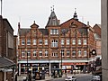
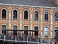
 144, 146 and 148 Micklegate, York.jpg 4,000 × 3,000; 5.28 MB
-
 19 and 21 Tanner Row York 01.jpg 3,456 × 4,608; 4.32 MB
-
 19 And 21 Tanner Row York 02.jpg 4,608 × 3,456; 3.89 MB
-
 19 And 21 Tanner Row York 03.jpg 4,608 × 3,456; 4.27 MB
-
 22 Parliament Street York 01.jpg 2,629 × 3,506; 2.49 MB
-
 22 Parliament Street York 02.jpg 2,434 × 3,245; 2.22 MB
-
 7029 at York Station - geograph.org.uk - 7144646.jpg 3,402 × 3,931; 2.36 MB
-
 803001 1E82.jpg 6,016 × 4,016; 22.36 MB
-
 91110 1Y84.jpg 6,016 × 4,016; 23.35 MB
-
 A1237 and crossing - geograph.org.uk - 7156245.jpg 1,024 × 683; 239 KB
-
 A19 near Whincover Farm - geograph.org.uk - 7162428.jpg 1,024 × 683; 197 KB
-
 Above Morrell Way - geograph.org.uk - 7141560.jpg 1,024 × 683; 241 KB
-
 Alcuin C and Chemistry E blocks - geograph.org.uk - 7160750.jpg 1,024 × 683; 202 KB
-
 Alcuin J block - geograph.org.uk - 7139168.jpg 1,024 × 683; 217 KB
-
 Alcuin Way - geograph.org.uk - 7158258.jpg 683 × 1,024; 214 KB
-
 Allotments near the Knavesmire - geograph.org.uk - 7144667.jpg 5,184 × 3,888; 6.57 MB
-
 Along Stublowe Place - geograph.org.uk - 7155966.jpg 1,024 × 683; 272 KB
-
 Apartment block, south side of York - geograph.org.uk - 7144664.jpg 5,184 × 3,888; 4.58 MB
-
 Askham Lane - geograph.org.uk - 7144682.jpg 4,872 × 3,568; 2.81 MB
-
 Balcony 37 Tanner Row York.jpg 3,850 × 3,339; 4.01 MB
-
 Bank in Heworth Holme - geograph.org.uk - 7148493.jpg 1,024 × 683; 297 KB
-
 Barn and duck pond - geograph.org.uk - 7156200.jpg 1,024 × 683; 249 KB
-
 Barnacle geese near Derwent - geograph.org.uk - 7139159.jpg 1,024 × 683; 317 KB
-
 Benches at the York Institute for Safe Autonomy - geograph.org.uk - 7143157.jpg 683 × 1,024; 193 KB
-
 Benches in Shambles Market - geograph.org.uk - 7145839.jpg 1,024 × 683; 156 KB
-
 Bird of prey on the racecourse - geograph.org.uk - 7155818.jpg 1,024 × 683; 144 KB
-
 Bluebells in Windmill Lane Woods - geograph.org.uk - 7158255.jpg 1,024 × 683; 409 KB
-
 Boats moored beside the Guildhall - geograph.org.uk - 7142624.jpg 1,024 × 683; 230 KB
-
 Brown's Nurseries - geograph.org.uk - 7150015.jpg 4,319 × 2,951; 1.84 MB
-
 Bus stop on Hull Road - geograph.org.uk - 7143141.jpg 1,024 × 683; 220 KB
-
 Bus stops along Lakeside Way - geograph.org.uk - 7143194.jpg 1,024 × 683; 167 KB
-
 Chemistry F Block - geograph.org.uk - 7139170.jpg 1,024 × 683; 178 KB
-
 Church Lane Building - geograph.org.uk - 7155979.jpg 1,024 × 683; 247 KB
-
 Cinder Lane - geograph.org.uk - 7137651.jpg 1,024 × 683; 253 KB
-
 Clifford's Tower at Night - geograph.org.uk - 7137259.jpg 1,024 × 498; 96 KB
-
 Clun Castle at York Station - geograph.org.uk - 7144638.jpg 5,184 × 3,888; 4.42 MB
-
 Coffee Yard - geograph.org.uk - 7145840.jpg 683 × 1,024; 183 KB
-
 Communications tower on Melrosegate - geograph.org.uk - 7148477.jpg 683 × 1,024; 241 KB
-
 Completed new housing - geograph.org.uk - 7158243.jpg 1,024 × 683; 354 KB
-

-
 Constructing a play park - geograph.org.uk - 7148508.jpg 1,024 × 683; 214 KB
-
 Construction of a park - geograph.org.uk - 7155962.jpg 1,024 × 683; 269 KB
-
 Construction of the new Energy Centre - geograph.org.uk - 7143143.jpg 1,024 × 683; 181 KB
-
 Construction of the new Energy Centre - geograph.org.uk - 7143147.jpg 1,024 × 683; 186 KB
-
 Construction progress at Millers Chase - geograph.org.uk - 7139171.jpg 1,024 × 683; 218 KB
-
 Construction site fence - geograph.org.uk - 7143209.jpg 1,024 × 683; 273 KB
-
 Corban Lane looking west - geograph.org.uk - 7150019.jpg 4,069 × 2,641; 1.45 MB
-
 Cowslips beside the lake - geograph.org.uk - 7143201.jpg 1,024 × 683; 188 KB
-
 Cycle parking at Designer Outlet - geograph.org.uk - 7141563.jpg 1,024 × 683; 291 KB
-
 Cycle path along Knavesmire Road - geograph.org.uk - 7137265.jpg 683 × 1,024; 267 KB
-
 Daffodils along Heslington Lane - geograph.org.uk - 7141561.jpg 1,024 × 683; 174 KB
-
 Daffodils and Andrew Derbyshire memorial - geograph.org.uk - 7139163.jpg 1,024 × 683; 377 KB
-
 Daffodils and J block - geograph.org.uk - 7139169.jpg 1,024 × 683; 216 KB
-
 Daffodils and Seebohm Rowntree Building - geograph.org.uk - 7137250.jpg 1,024 × 683; 292 KB
-
 Daffodils and snow - geograph.org.uk - 7137246.jpg 1,024 × 683; 322 KB
-
 Daffodils beneath a beech tree - geograph.org.uk - 7139161.jpg 683 × 1,024; 359 KB
-
 Daffodils beside Heath Moor Drive - geograph.org.uk - 7148462.jpg 1,024 × 683; 289 KB
-
 Daffodils beside the lake - geograph.org.uk - 7139160.jpg 1,024 × 683; 274 KB
-
 Daffodils near Berrick Saul - geograph.org.uk - 7139164.jpg 683 × 1,024; 224 KB
-
 Daffodils near Market Square - geograph.org.uk - 7139165.jpg 683 × 1,024; 189 KB
-
 Derwent College buildings - geograph.org.uk - 7139162.jpg 1,024 × 683; 204 KB
-
 Designer Outlet entrance - geograph.org.uk - 7141570.jpg 1,024 × 683; 199 KB
-
 Drain beside Elvington Lane - geograph.org.uk - 7160789.jpg 1,024 × 683; 200 KB
-
 Ebor Hall York 01.jpg 4,608 × 3,456; 5.22 MB
-
 Ebor Hall York 02.jpg 2,785 × 2,089; 1.87 MB
-
 Ebor Hall York 03.jpg 4,608 × 3,456; 5.1 MB
-
 Ebor Hall York 04.jpg 4,608 × 3,456; 5.45 MB
-
 Elvington Lane - geograph.org.uk - 7160798.jpg 1,024 × 683; 210 KB
-
 Energy Centre construction - geograph.org.uk - 7143145.jpg 683 × 1,024; 195 KB
-
 Energy Centre construction compound - geograph.org.uk - 7143153.jpg 1,024 × 683; 193 KB
-
 Even number houses - geograph.org.uk - 7143217.jpg 1,024 × 683; 247 KB
-
 Fairfax House - geograph.org.uk - 7145831.jpg 1,024 × 683; 312 KB
-
 Family of greylags - geograph.org.uk - 7155978.jpg 1,024 × 683; 359 KB
-
 Farmland along Westfield Lane - geograph.org.uk - 7149022.jpg 1,024 × 683; 138 KB
-
 Farmland beside the A19 - geograph.org.uk - 7162426.jpg 1,024 × 683; 190 KB
-
 Field drain and power cables - geograph.org.uk - 7160797.jpg 683 × 1,024; 229 KB
-
 Footpath beside Germany Beck - geograph.org.uk - 7148471.jpg 1,024 × 683; 218 KB
-
 Former railway shed near York station - geograph.org.uk - 7144660.jpg 5,183 × 3,194; 2.73 MB
-
 Fourth Avenue - geograph.org.uk - 7148481.jpg 1,024 × 683; 261 KB
-
 Foxwood Park - geograph.org.uk - 7144686.jpg 5,184 × 3,888; 6.76 MB
-
 Gate along Elvington Lane - geograph.org.uk - 7160792.jpg 1,024 × 683; 195 KB
-
 Grassy area beside Lakeside Way - geograph.org.uk - 7143206.jpg 1,024 × 683; 193 KB
-
 Great East Window York Minster - 51982102739.jpg 1,992 × 3,510; 5.54 MB
-
 Grey car park - geograph.org.uk - 7141564.jpg 1,024 × 683; 221 KB
-
 Hadrian Avenue - geograph.org.uk - 7156053.jpg 1,024 × 683; 198 KB
-
 Heslington Main Street - geograph.org.uk - 7160751.jpg 1,024 × 683; 236 KB
-
 Hessay (New Road) Level Crossing - geograph.org.uk - 7149032.jpg 1,024 × 683; 255 KB
-
 High Petergate - geograph.org.uk - 7145842.jpg 683 × 1,024; 170 KB
-
 Hob Laine - geograph.org.uk - 7156246.jpg 1,024 × 683; 260 KB
-
 Holgate Windmill 2.jpg 3,024 × 4,032; 2.6 MB
-
 Housing construction - geograph.org.uk - 7148470.jpg 1,024 × 683; 165 KB
-
 Hull Road - geograph.org.uk - 7143138.jpg 1,024 × 683; 211 KB
-
 Hull Road Park - geograph.org.uk - 7137654.jpg 1,024 × 683; 210 KB
-
 Ivy Cottage Queen Street York 01.jpg 4,608 × 3,456; 9.19 MB
-
 Ivy Cottage Queen Street York 02.jpg 4,608 × 3,456; 9.41 MB
-
 Ivy Cottage Queen Street York 03.jpg 4,608 × 3,456; 8.91 MB
-
 Ivy Cottage Queen Street York 04.jpg 4,608 × 3,456; 9.55 MB
-
 Ivy Cottage Queen Street York 05.jpg 4,608 × 3,456; 6.23 MB
-
 Jubilee Terrace - geograph.org.uk - 7156199.jpg 1,024 × 683; 213 KB
-
 Junction of paths - geograph.org.uk - 7158260.jpg 1,024 × 683; 392 KB
-
 Lake and Environment building - geograph.org.uk - 7155973.jpg 1,024 × 683; 209 KB
-
 Lake and York Institute for Safe Autonomy - geograph.org.uk - 7143197.jpg 1,024 × 683; 160 KB
-
 Lake at Derwent - geograph.org.uk - 7155924.jpg 1,024 × 683; 218 KB
-
 Lake from Vanbrugh Bridge - geograph.org.uk - 7155915.jpg 1,024 × 683; 167 KB
-
 Lake near Biology - geograph.org.uk - 7155971.jpg 1,024 × 683; 257 KB
-
 Lake near Central Hall - geograph.org.uk - 7155914.jpg 1,024 × 683; 251 KB
-
 Lake on Heslington East - geograph.org.uk - 7143187.jpg 1,024 × 683; 120 KB
-
 Lawrence Lane - geograph.org.uk - 7145835.jpg 1,024 × 683; 212 KB
-
 Lawrence Street - geograph.org.uk - 7145837.jpg 1,024 × 683; 165 KB
-
 Lay-by on the A19 - geograph.org.uk - 7162421.jpg 1,024 × 683; 153 KB
-
 Lendal Arches Tanners Moat 01.jpg 2,590 × 3,453; 2.56 MB
-
 Lendal Arches Tanners Moat 02.jpg 2,592 × 3,456; 2.63 MB
-
 Lendal Arches Tanners Moat York 01.jpg 4,608 × 3,456; 4.29 MB
-
 Lendal Arches Tanners Moat York 02.jpg 4,608 × 3,456; 4.58 MB
-
 Lendal Arches Tanners Moat York 03.jpg 4,608 × 3,456; 4.95 MB
-
 Lendal Arches Tanners Moat York 04.jpg 4,608 × 3,456; 4.39 MB
-
 Licence to crenellate^ - geograph.org.uk - 7144670.jpg 3,888 × 3,295; 1.99 MB
-

-
 Low sun on Naburn Lane - geograph.org.uk - 7141571.jpg 1,024 × 683; 269 KB
-

-
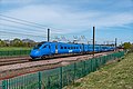
 Lumo train passing farmland near Poppleton - geograph.org.uk - 7156216.jpg 1,024 × 683; 234 KB
-
 Main Street near Hessay - geograph.org.uk - 7149039.jpg 1,024 × 683; 168 KB
-
 Margaret Street - geograph.org.uk - 7160755.jpg 1,024 × 683; 308 KB
-
 Mark IV Coaches - geograph.org.uk - 7137288.jpg 1,024 × 683; 233 KB
-
 Marygate Landing - geograph.org.uk - 7142607.jpg 1,024 × 683; 265 KB
-
 Marygate Landing across the River - geograph.org.uk - 7142619.jpg 1,024 × 683; 242 KB
-
 Military vehicles near the Minster - geograph.org.uk - 7137652.jpg 1,024 × 683; 311 KB
-
 Moor Lane, north of Skelton - geograph.org.uk - 7149983.jpg 4,320 × 3,240; 2.6 MB
-
 Moore Avenue - geograph.org.uk - 7158262.jpg 1,024 × 683; 168 KB
-
 Mud covered Lakeside Way - geograph.org.uk - 7143208.jpg 1,024 × 683; 161 KB
-
 Mulberry Hall York 1434.jpg 4,008 × 3,006; 2.86 MB
-
 Museum Gardens - geograph.org.uk - 7142605.jpg 1,024 × 683; 324 KB
-
 Nether Poppleton Millennium Green - geograph.org.uk - 7156203.jpg 1,024 × 683; 301 KB
-
 New Energy Centre - geograph.org.uk - 7143146.jpg 1,024 × 683; 212 KB
-
 New housing beside Windmill Lane Woods - geograph.org.uk - 7155967.jpg 1,024 × 683; 240 KB
-
 New housing development - geograph.org.uk - 7148466.jpg 1,024 × 683; 156 KB
-
 New path on Heslington East - geograph.org.uk - 7143210.jpg 1,024 × 683; 203 KB
-
 New path to Stublowe Place - geograph.org.uk - 7155959.jpg 683 × 1,024; 237 KB
-
 New Road (Hessay) Level Crossing - geograph.org.uk - 7149035.jpg 1,024 × 683; 234 KB
-
 New road on Clifton Ings - geograph.org.uk - 7138594.jpg 1,024 × 683; 259 KB
-
 Newey clock 22 George Hudson Street York.jpg 2,903 × 3,870; 2.9 MB
-
 Opening the crossing - geograph.org.uk - 7148909.jpg 1,024 × 683; 216 KB
-
 Ouse and Marygate Tower - geograph.org.uk - 7142618.jpg 1,024 × 683; 249 KB
-
 Outdoor Chess Board - geograph.org.uk - 7141566.jpg 1,024 × 683; 227 KB
-
 Park construction underway - geograph.org.uk - 7148507.jpg 1,024 × 683; 253 KB
-

-
 Path above University Road - geograph.org.uk - 7160749.jpg 1,024 × 683; 204 KB
-
 Path and beech trees - geograph.org.uk - 7137238.jpg 1,024 × 683; 266 KB
-
 Path and Germany Beck - geograph.org.uk - 7148476.jpg 1,024 × 683; 200 KB
-
 Path and solar lights - geograph.org.uk - 7148469.jpg 1,024 × 683; 188 KB
-
 Path at Moorlands - geograph.org.uk - 7150000.jpg 3,240 × 4,320; 2.95 MB
-
 Path being constructed - geograph.org.uk - 7148475.jpg 1,024 × 683; 237 KB
-
 Path beside Melrosegate - geograph.org.uk - 7148479.jpg 1,024 × 683; 384 KB
-
 Path beside Osbaldwick Beck - geograph.org.uk - 7137653.jpg 1,024 × 683; 264 KB
-
 Path beside the lake - geograph.org.uk - 7143174.jpg 1,024 × 683; 221 KB
-
 Path beside the lake - geograph.org.uk - 7155976.jpg 1,024 × 683; 322 KB
-
 Path from School Lane - geograph.org.uk - 7148465.jpg 1,024 × 683; 160 KB
-
 Path in the Science Park - geograph.org.uk - 7160753.jpg 1,024 × 683; 234 KB
-
 Path near Biology - geograph.org.uk - 7155969.jpg 1,024 × 683; 380 KB
-
 Path near Tang Hall Beck - geograph.org.uk - 7148485.jpg 683 × 1,024; 408 KB
-
 Path near the pool - geograph.org.uk - 7156237.jpg 1,024 × 884; 482 KB
-
 Path on Little Hob Moor - geograph.org.uk - 7137267.jpg 1,024 × 683; 204 KB
-
 Path on Walmgate Stray - geograph.org.uk - 7147561.jpg 1,024 × 683; 176 KB
-
 Path onto Heworth Holme - geograph.org.uk - 7148487.jpg 1,024 × 683; 349 KB
-
 Path onto Walmgate Stray - geograph.org.uk - 7158239.jpg 1,024 × 683; 287 KB
-
 Path over Heslington East - geograph.org.uk - 7143212.jpg 1,024 × 683; 174 KB
-
 Path over Osbaldwick Beck - geograph.org.uk - 7158264.jpg 1,024 × 683; 253 KB
-
 Path over Walmgate Stray - geograph.org.uk - 7155954.jpg 1,024 × 683; 267 KB
-
 Path over Walmgate Stray - geograph.org.uk - 7158241.jpg 1,024 × 683; 215 KB
-
 Path to Green Dykes Lane - geograph.org.uk - 7155921.jpg 1,024 × 683; 226 KB
-
 Path to Siwards Howe - geograph.org.uk - 7139167.jpg 1,024 × 683; 212 KB
-
 Path to Wentworth Way roundabout - geograph.org.uk - 7155956.jpg 1,024 × 683; 211 KB
-
 Path to Windmill Lane - geograph.org.uk - 7160752.jpg 683 × 1,024; 367 KB
-
 Path towards Barbican Mews - geograph.org.uk - 7145833.jpg 1,024 × 683; 232 KB
-
 Path under construction - geograph.org.uk - 7148472.jpg 1,024 × 683; 218 KB
-
 Paths and flood defence works - geograph.org.uk - 7142603.jpg 1,024 × 683; 270 KB
-
 Paths near University Road - geograph.org.uk - 7137232.jpg 1,024 × 683; 248 KB
-
 Pavement beside Naburn Lane - geograph.org.uk - 7141572.jpg 1,024 × 683; 264 KB
-
 Picnic area at the Designer Outlet - geograph.org.uk - 7141569.jpg 1,024 × 683; 295 KB
-
 Plainville Lane - geograph.org.uk - 7137656.jpg 1,024 × 683; 193 KB
-
 Playground beside Mallard Close - geograph.org.uk - 7156061.jpg 1,024 × 683; 328 KB
-
 Playpark under construction - geograph.org.uk - 7158248.jpg 1,024 × 683; 229 KB
-
 Plumer Avenue - geograph.org.uk - 7148499.jpg 1,024 × 683; 185 KB
-
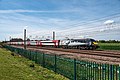
 Poppleton Level Crossing - geograph.org.uk - 7156244.jpg 1,024 × 683; 221 KB
-
 Poppleton level crossing and signal box - geograph.org.uk - 7156242.jpg 1,024 × 683; 216 KB
-
 Poppleton Millennium Green and passing train - geograph.org.uk - 7156219.jpg 1,024 × 683; 316 KB
-
 Post box on Heath Moor Drive - geograph.org.uk - 7148463.jpg 1,024 × 683; 226 KB
-
 Powerlines beside Elvington Lane - geograph.org.uk - 7160795.jpg 683 × 1,024; 174 KB
-
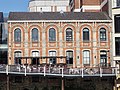
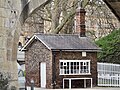
 Pump engine house York.jpg 3,546 × 2,659; 4.8 MB
-
 Queen Street bridge viewed through city wall.jpg 4,608 × 3,456; 4.99 MB
-
 Railings at Museum Gardens.jpg 4,608 × 3,456; 6.39 MB
-

-
 Rape fields beside the A64 - geograph.org.uk - 7141574.jpg 1,024 × 683; 245 KB
-
 Rest a while in the woods - geograph.org.uk - 7150008.jpg 3,240 × 4,320; 3.24 MB
-
 River Palace passing the Guildhall - geograph.org.uk - 7142626.jpg 1,024 × 683; 253 KB
-
 Ron Cooke Hub - geograph.org.uk - 7143192.jpg 1,024 × 683; 217 KB
-
 School Lane - geograph.org.uk - 7148502.jpg 1,024 × 683; 192 KB
-
 Service road near Constantine - geograph.org.uk - 7143154.jpg 1,024 × 683; 168 KB
-
 Side of Seebohm Rowntree Building - geograph.org.uk - 7141559.jpg 683 × 1,024; 254 KB
-
 Sign for flood works - geograph.org.uk - 7142600.jpg 1,024 × 683; 296 KB


_Level_Crossing_-_geograph.org.uk_-_7149032.jpg)


_Level_Crossing_-_geograph.org.uk_-_7149035.jpg)


