Category:April 2015 in York
Jump to navigation
Jump to search
Deutsch: Bilder, die im April 2015 in York aufgenommen worden sind. Bitte beachten Sie, dass dies weder das Datum des Uploads noch das Datum des Scannens eines Fotos ist.
English: Images/pictures taken in York during April 2015. Note this is not the date of the upload, nor the date a photo was scanned.
Español: Fotografías o imágenes tomadas en York durante abril 2015. No es la fecha de subida ni escaneo, sino la fecha en que las fotografías o imágenes se crearon.
Esperanto: Bildoj faritaj en York en aprilo 2015. Tio ne estas la dato, kiam la bildoj estis alŝutitaj aŭ skanitaj.
Français : Photographies ou images prises en York durant avril 2015. Ce n'est pas la date du téléchargement ou du scan.
Galego: Fotografías ou imaxes tomadas en York durante abril 2015. Non é a data de subida nin escaneamento, senón a data na que se crearon as fotografías ou imaxes.
Italiano: Fotografie o immagini scattate a York nel aprile 2015. Nota bene: la data non si riferisce né a quella di upload né a quella in cui la foto è stata digitalizzata.
Norsk bokmål: Bilder tatt i York i løpet av april 2015. Merk at dette ikke er datoen for opplasting, eller når et bilde har blitt skannet.
Norsk nynorsk: Bilete teke i York i løpet av april 2015. Merk at dette ikkje er datoen for opplasting, eller når eit bilete har vorte skanna.
Русский: Изображения, сделанные в York в течение апрель 2015 (не дата загрузки изображения).
Українська: Зображення, зроблені в York протягом квітень 2015. Зауважте, що це не дата завантаження чи дата сканування фотографії.
| April 2014 | ← | April 2015 | → | April 2016 | |||||||
| Jan | Feb | Mar | Apr | May | Jun | Jul | Aug | Sep | Oct | Nov | Dec |
| 15 | 103 | 46 | 52 | 94 | 83 | 88 | 69 | 96 | 271 | 138 | 128 |
|---|---|---|---|---|---|---|---|---|---|---|---|
Media in category "April 2015 in York"
The following 52 files are in this category, out of 52 total.
-
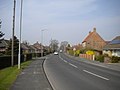
 Acomb Road going into York - geograph.org.uk - 4926137.jpg 4,608 × 3,456; 6.24 MB
-
 Beaconsfield Street, Acomb - geograph.org.uk - 4560837.jpg 1,024 × 768; 139 KB
-
 Biology greenhouses - geograph.org.uk - 4500753.jpg 640 × 480; 157 KB
-
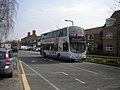
 Bus at Monks Cross park and ride site - geograph.org.uk - 4516061.jpg 1,024 × 768; 117 KB
-
 Bus on Green Lane, Acomb - geograph.org.uk - 4560835.jpg 1,024 × 768; 126 KB
-
 Bus on Station Road, Copmanthorpe - geograph.org.uk - 4515927.jpg 1,024 × 768; 167 KB
-
 Bus on The Village, Haxby - geograph.org.uk - 4516066.jpg 1,024 × 768; 138 KB
-
 Bus on West Nooks, Haxby - geograph.org.uk - 4516072.jpg 1,024 × 768; 120 KB
-
 Bus stop on Monks Cross Drive - geograph.org.uk - 4516053.jpg 1,024 × 768; 130 KB
-
 Bus turning circle, Park Gate, Strensall - geograph.org.uk - 4560857.jpg 1,024 × 768; 127 KB
-
 Derwent K Block bridge - geograph.org.uk - 4454272.jpg 480 × 640; 153 KB
-
 East end of Brecks Lane, Strensall - geograph.org.uk - 4560888.jpg 1,024 × 768; 179 KB
-

-
 Foss Bridge, York.jpg 3,264 × 2,448; 1.43 MB
-
 Foxwood Lane, Woodthorpe (1) - geograph.org.uk - 4516043.jpg 1,024 × 768; 113 KB
-
 Foxwood Lane, Woodthorpe (2) - geograph.org.uk - 4560845.jpg 1,024 × 768; 93 KB
-
 Hob Moor housing York - geograph.org.uk - 4429510.jpg 1,024 × 768; 176 KB
-
 Hull Road Park - geograph.org.uk - 4449888.jpg 640 × 480; 87 KB
-
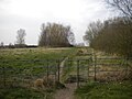 Kissing gate, Strensall - geograph.org.uk - 4560899.jpg 1,024 × 768; 177 KB
-
 Lendal Bridge - geograph.org.uk - 4450303.jpg 640 × 480; 128 KB
-
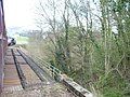
 Level crossing and signal box, Strensall - geograph.org.uk - 4560871.jpg 1,024 × 768; 138 KB
-
 Littlethorpe Close, Strensall - geograph.org.uk - 4560885.jpg 1,024 × 768; 126 KB
-
 Mill Lane, Wigginton (1) - geograph.org.uk - 4516076.jpg 1,024 × 768; 125 KB
-
 Mill Lane, Wigginton (2) - geograph.org.uk - 4516078.jpg 1,024 × 768; 148 KB
-
 Moon over Fulford MF - geograph.org.uk - 4454279.jpg 640 × 428; 46 KB
-
 Moor Lane, Dringhouses (2) - geograph.org.uk - 4516033.jpg 1,024 × 768; 116 KB
-
 Moor Lane, Dringhouses (3) - geograph.org.uk - 4516037.jpg 1,024 × 768; 135 KB
-
-
 Outside Biology - geograph.org.uk - 4449891.jpg 640 × 480; 191 KB
-

-
 Path to Broadway West - geograph.org.uk - 4454274.jpg 640 × 428; 60 KB
-
 Path to Spring Lane - geograph.org.uk - 4449909.jpg 480 × 640; 186 KB
-
 Platform 9, York Railway Station - geograph.org.uk - 4423375.jpg 640 × 480; 76 KB
-
 Platform 9, York Railway Station - geograph.org.uk - 4423377.jpg 640 × 480; 71 KB
-

-
 Roses is coming - geograph.org.uk - 4449903.jpg 640 × 480; 122 KB
-
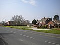
 Shops on The Village, Haxby - geograph.org.uk - 4516064.jpg 1,024 × 768; 247 KB
-
 South end of Chaloner's Road, Dringhouses - geograph.org.uk - 4516002.jpg 1,024 × 768; 188 KB
-
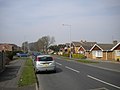
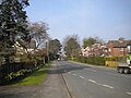 Station Road, Copmanthorpe - geograph.org.uk - 4515920.jpg 1,024 × 768; 185 KB
-
 Strensall signal box - geograph.org.uk - 4560878.jpg 1,024 × 768; 126 KB
-
 Tadcaster Road, Dringhouses - geograph.org.uk - 4515956.jpg 1,024 × 768; 245 KB
-
 Tesco Extra, Dringhouses - geograph.org.uk - 4515962.jpg 1,024 × 768; 125 KB
-
 The Hospitium, Museum Gardens - geograph.org.uk - 6500520.jpg 1,333 × 2,000; 3.37 MB
-
 The Judge's Lodgings, Lendal - geograph.org.uk - 6500519.jpg 1,408 × 2,000; 3.84 MB
-
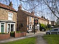 The Red Lion, Haxby - geograph.org.uk - 4516063.jpg 1,024 × 768; 298 KB
-
 Thornhills, Haxby - geograph.org.uk - 4516074.jpg 1,024 × 768; 127 KB
-
 Vanbrugh College - geograph.org.uk - 4449893.jpg 640 × 480; 66 KB
-
 View from an East Coast train near York station - geograph.org.uk - 4429506.jpg 1,024 × 811; 216 KB
-
 West end of Brecks Lane, Strensall - geograph.org.uk - 4560865.jpg 1,024 × 768; 141 KB
-
 West Nooks, Haxby - geograph.org.uk - 4516069.jpg 1,024 × 768; 132 KB
-
 Windsor Drive, Wigginton - geograph.org.uk - 4516075.jpg 1,024 × 768; 128 KB
-
 York Railway Station - geograph.org.uk - 4423365.jpg 640 × 480; 96 KB


_-_geograph.org.uk_-_4516043.jpg)
_-_geograph.org.uk_-_4560845.jpg)


_-_geograph.org.uk_-_4516076.jpg)
_-_geograph.org.uk_-_4516078.jpg)

_-_geograph.org.uk_-_4516033.jpg)
_-_geograph.org.uk_-_4516037.jpg)


