Category:April 2014 in Kent
Jump to navigation
Jump to search
Ceremonial counties of England: Bedfordshire · Berkshire · Buckinghamshire · Cambridgeshire · Cheshire · Cornwall · Cumbria · Derbyshire · Devon · Dorset · Durham · East Riding of Yorkshire · East Sussex · Essex · Gloucestershire · Greater London · Greater Manchester · Hampshire · Herefordshire · Hertfordshire · Kent · Lancashire · Leicestershire · Lincolnshire · Merseyside · Norfolk · North Yorkshire · Northamptonshire · Nottinghamshire · Oxfordshire · Shropshire · Somerset · South Yorkshire · Staffordshire · Suffolk · Surrey · Tyne and Wear · Warwickshire · West Midlands · West Sussex · West Yorkshire · Wiltshire ·
City-counties: Bristol ·
Former historic counties:
Other former counties:
City-counties: Bristol ·
Former historic counties:
Other former counties:
Deutsch: Bilder, die im April 2014 in Kent aufgenommen worden sind. Bitte beachten Sie, dass dies weder das Datum des Uploads noch das Datum des Scannens eines Fotos ist.
English: Images/pictures taken in Kent during April 2014. Note this is not the date of the upload, nor the date a photo was scanned.
Español: Fotografías o imágenes tomadas en Kent durante abril 2014. No es la fecha de subida ni escaneo, sino la fecha en que las fotografías o imágenes se crearon.
Esperanto: Bildoj faritaj en Kent en aprilo 2014. Tio ne estas la dato, kiam la bildoj estis alŝutitaj aŭ skanitaj.
Français : Photographies ou images prises en Kent durant avril 2014. Ce n'est pas la date du téléchargement ou du scan.
Galego: Fotografías ou imaxes tomadas en Kent durante abril 2014. Non é a data de subida nin escaneamento, senón a data na que se crearon as fotografías ou imaxes.
Italiano: Fotografie o immagini scattate a Kent nel aprile 2014. Nota bene: la data non si riferisce né a quella di upload né a quella in cui la foto è stata digitalizzata.
Norsk bokmål: Bilder tatt i Kent i løpet av april 2014. Merk at dette ikke er datoen for opplasting, eller når et bilde har blitt skannet.
Norsk nynorsk: Bilete teke i Kent i løpet av april 2014. Merk at dette ikkje er datoen for opplasting, eller når eit bilete har vorte skanna.
Русский: Изображения, сделанные в Kent в течение апрель 2014 (не дата загрузки изображения).
Українська: Зображення, зроблені в Kent протягом квітень 2014. Зауважте, що це не дата завантаження чи дата сканування фотографії.
| April 2013 | ← | April 2014 | → | April 2015 | |||||||
| Jan | Feb | Mar | Apr | May | Jun | Jul | Aug | Sep | Oct | Nov | Dec |
| 168 | 140 | 118 | 352 | 488 | 28 | 53 | 44 | 42 | 227 | 238 | 70 |
|---|---|---|---|---|---|---|---|---|---|---|---|
Subcategories
This category has the following 3 subcategories, out of 3 total.
Media in category "April 2014 in Kent"
The following 200 files are in this category, out of 349 total.
(previous page) (next page)-
 14 - 16, Garden St - geograph.org.uk - 3997215.jpg 640 × 430; 69 KB
-
 18 - 20, Garden St - geograph.org.uk - 3997221.jpg 640 × 430; 79 KB
-
 20 - 22, Church Rd - geograph.org.uk - 4045034.jpg 640 × 493; 78 KB
-
 22, Mount Ephraim Rd - geograph.org.uk - 4029305.jpg 640 × 430; 80 KB
-
 24, Mount Ephraim Rd - geograph.org.uk - 4029312.jpg 640 × 430; 70 KB
-
 375618 Departs Ashford International.jpg 4,288 × 2,848; 3.71 MB
-
 70 - 71, London Rd - geograph.org.uk - 4045153.jpg 640 × 430; 68 KB
-
 72, London Rd - geograph.org.uk - 4045156.jpg 640 × 430; 89 KB
-
 73, London Rd - geograph.org.uk - 4045157.jpg 640 × 430; 70 KB
-
 77, London Rd - geograph.org.uk - 4045163.jpg 640 × 430; 64 KB
-
 83, London Rd - geograph.org.uk - 4045174.jpg 640 × 430; 93 KB
-
 A sunny day in Dungeness - geograph.org.uk - 3929656.jpg 2,304 × 1,728; 860 KB
-
 A terraced row, Eridge Rd - geograph.org.uk - 4013753.jpg 640 × 414; 61 KB
-
 A21 passes through Robinsgate Wood - geograph.org.uk - 3919542.jpg 3,175 × 2,411; 1.27 MB
-
 A26 - A264 junction - geograph.org.uk - 4029319.jpg 640 × 430; 68 KB
-
 A26, Eridge Rd - geograph.org.uk - 4013715.jpg 640 × 430; 78 KB
-
 A267, Frant Rd - geograph.org.uk - 4006308.jpg 640 × 430; 93 KB
-
 Addison Rd - geograph.org.uk - 4035904.jpg 640 × 430; 79 KB
-
 Addison Rd - geograph.org.uk - 4035905.jpg 640 × 430; 74 KB
-
 Albany Hill - geograph.org.uk - 4035954.jpg 640 × 430; 95 KB
-
 Albion House - geograph.org.uk - 4017904.jpg 640 × 430; 66 KB
-
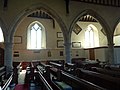
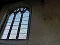
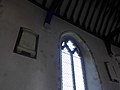
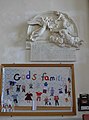
 All Saints, Lydd, art work - geograph.org.uk - 3932435.jpg 640 × 476; 63 KB
-
 All Saints, Lydd, banner - geograph.org.uk - 3932457.jpg 480 × 640; 51 KB
-
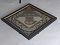
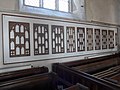
 All Saints, Lydd, benefactions board - geograph.org.uk - 3932459.jpg 480 × 640; 47 KB
-

-
 All Saints, Lydd, churchyard (a) - geograph.org.uk - 3932272.jpg 475 × 640; 74 KB
-
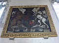 All Saints, Lydd, coat of arms - geograph.org.uk - 3932468.jpg 640 × 467; 74 KB
-
 All Saints, Lydd, font - geograph.org.uk - 3932440.jpg 640 × 480; 63 KB
-
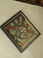
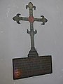
 All Saints, Lydd, hatchment (1) - geograph.org.uk - 3932462.jpg 640 × 480; 75 KB
-
 All Saints, Lydd, hatchment (2) - geograph.org.uk - 3932464.jpg 640 × 480; 46 KB
-
 All Saints, Lydd, hatchment (3) - geograph.org.uk - 3932480.jpg 480 × 640; 44 KB
-
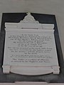
 All Saints, Lydd, incumbency board - geograph.org.uk - 3932443.jpg 480 × 640; 61 KB
-
 All Saints, Lydd, kneelers and pews - geograph.org.uk - 3932314.jpg 640 × 480; 85 KB
-
 All Saints, Lydd, lectern - geograph.org.uk - 3932478.jpg 480 × 640; 68 KB
-
 All Saints, Lydd, main altar - geograph.org.uk - 3932448.jpg 640 × 480; 61 KB
-
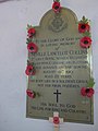
 All Saints, Lydd, memorial (a) - geograph.org.uk - 3932483.jpg 640 × 480; 61 KB
-
 All Saints, Lydd, memorial (b) - geograph.org.uk - 3932484.jpg 640 × 480; 71 KB
-
 All Saints, Lydd, memorial (c) - geograph.org.uk - 3932486.jpg 475 × 640; 75 KB
-
 All Saints, Lydd, memorial (d) - geograph.org.uk - 3932487.jpg 640 × 480; 66 KB
-
 All Saints, Lydd, memorial (e) - geograph.org.uk - 3932489.jpg 640 × 480; 38 KB
-
 All Saints, Lydd, memorial (f) - geograph.org.uk - 3932491.jpg 480 × 640; 48 KB
-
 All Saints, Lydd, memorial (g) - geograph.org.uk - 3932492.jpg 480 × 640; 76 KB
-
 All Saints, Lydd, memorial (h) - geograph.org.uk - 3932494.jpg 474 × 640; 55 KB
-
 All Saints, Lydd, memorial (I) - geograph.org.uk - 3932335.jpg 640 × 463; 30 KB
-
 All Saints, Lydd, memorial (IX) - geograph.org.uk - 3932371.jpg 640 × 435; 33 KB
-
 All Saints, Lydd, memorial (r) - geograph.org.uk - 3932512.jpg 640 × 480; 56 KB
-
 All Saints, Lydd, memorial (s) - geograph.org.uk - 3932516.jpg 640 × 480; 76 KB
-
 All Saints, Lydd, memorial (VIII) - geograph.org.uk - 3932360.jpg 480 × 640; 49 KB
-
 All Saints, Lydd, memorial (XII) - geograph.org.uk - 3932377.jpg 480 × 640; 30 KB
-
 All Saints, Lydd, memorial (XIII) - geograph.org.uk - 3932378.jpg 480 × 640; 39 KB
-

-
 Alleyway - geograph.org.uk - 4017577.jpg 640 × 430; 78 KB
-
 An old lamp post, Lansdowne Rd - geograph.org.uk - 4037806.jpg 351 × 640; 69 KB
-
 Approaching Fiveways - geograph.org.uk - 3984286.jpg 640 × 430; 70 KB
-
 Arriva Bus Depot - geograph.org.uk - 3991393.jpg 640 × 430; 61 KB
-
 Arriva Bus Depot - geograph.org.uk - 4028932.jpg 640 × 430; 65 KB
-
 Arriva bus on St John's Rd - geograph.org.uk - 3991494.jpg 640 × 430; 82 KB
-
 B ^ B, Frant Rd - geograph.org.uk - 4006321.jpg 640 × 430; 58 KB
-
 Bandstand, The Pantiles - geograph.org.uk - 4013800.jpg 640 × 430; 100 KB
-
 Bayham House - geograph.org.uk - 3991276.jpg 640 × 430; 84 KB
-
 Bedford Terrace - geograph.org.uk - 4017574.jpg 640 × 430; 89 KB
-
 Belleville - geograph.org.uk - 4029293.jpg 640 × 430; 64 KB
-
 Belvedere House - geograph.org.uk - 4045030.jpg 640 × 430; 88 KB
-
 Beulah Rd - geograph.org.uk - 3997183.jpg 640 × 430; 68 KB
-
 Birling Drive - geograph.org.uk - 4006316.jpg 640 × 430; 70 KB
-
 Blatchington Rd - geograph.org.uk - 3997408.jpg 640 × 430; 96 KB
-
 Blatchington Rd - geograph.org.uk - 3997411.jpg 640 × 430; 89 KB
-
 Blossom, Roedean Rd - geograph.org.uk - 3997426.jpg 640 × 430; 110 KB
-
 Boarded up - geograph.org.uk - 4017660.jpg 640 × 430; 86 KB
-
 BP filling Station - geograph.org.uk - 3993343.jpg 640 × 430; 76 KB
-
 BP Filling Station - geograph.org.uk - 4017939.jpg 640 × 430; 76 KB
-
 BP filling station, St John's Rd - geograph.org.uk - 3984245.jpg 640 × 430; 65 KB
-
 Bridge House - geograph.org.uk - 3991243.jpg 640 × 430; 92 KB
-
 Brighton Lake - geograph.org.uk - 4013758.jpg 640 × 430; 102 KB
-
 Brighton Lake - geograph.org.uk - 4013761.jpg 640 × 430; 104 KB
-
 Broadwater Court - geograph.org.uk - 4006804.jpg 640 × 430; 110 KB
-
 Broadwater Down - geograph.org.uk - 4006758.jpg 640 × 401; 93 KB
-
 Broadwater Down - geograph.org.uk - 4006809.jpg 640 × 430; 86 KB
-
 Broadwater Downs meets the A26 - geograph.org.uk - 4006816.jpg 640 × 430; 74 KB
-
 BT Building - geograph.org.uk - 3991370.jpg 640 × 430; 64 KB
-
 BT Building - geograph.org.uk - 4017911.jpg 640 × 430; 66 KB
-
 BT building, Culverden Park - geograph.org.uk - 3984260.jpg 640 × 430; 51 KB
-
 Byng Hall - geograph.org.uk - 3984227.jpg 430 × 640; 73 KB
-
 Caffè Nero and Greggs - geograph.org.uk - 3991289.jpg 640 × 430; 98 KB
-
 Calverley Grounds - geograph.org.uk - 3997229.jpg 640 × 430; 82 KB
-
 Calverley Grounds - geograph.org.uk - 3997230.jpg 640 × 430; 94 KB
-
 Calverley Precinct - geograph.org.uk - 3991292.jpg 640 × 430; 92 KB
-
 Camden Road Retro Centre - geograph.org.uk - 3984307.jpg 640 × 415; 65 KB
-
 Camden Square - geograph.org.uk - 3984299.jpg 640 × 430; 77 KB
-
 Camouflaged mast - geograph.org.uk - 4006819.jpg 430 × 640; 58 KB
-
 Care home, Upper Grosvenor Rd - geograph.org.uk - 4035682.jpg 640 × 430; 57 KB
-
 Cau - geograph.org.uk - 3984293.jpg 640 × 430; 78 KB
-
 Chalybeate spring, Brighton Lake - geograph.org.uk - 4013759.jpg 640 × 430; 92 KB
-
 Chase Vets, Eridge Rd - geograph.org.uk - 4013757.jpg 640 × 430; 109 KB
-
 Chatham, UK - panoramio (10).jpg 2,976 × 3,968; 4.13 MB
-
 Chatham, UK - panoramio (11).jpg 2,976 × 3,968; 3.16 MB
-
 Chatham, UK - panoramio (12).jpg 3,968 × 2,976; 2.88 MB
-
 Chatham, UK - panoramio (13).jpg 3,968 × 2,976; 2.22 MB
-
 Chatham, UK - panoramio (14).jpg 3,968 × 2,976; 3.36 MB
-
 Chatham, UK - panoramio (15).jpg 3,968 × 2,976; 2 MB
-
 Chatham, UK - panoramio (16).jpg 3,968 × 2,976; 3.04 MB
-
 Chatham, UK - panoramio (18).jpg 3,968 × 2,976; 3.01 MB
-
 Chatham, UK - panoramio (19).jpg 3,968 × 2,976; 3.19 MB
-
 Chatham, UK - panoramio (20).jpg 3,968 × 2,976; 3.1 MB
-
 Chatham, UK - panoramio (7).jpg 2,976 × 3,968; 4.1 MB
-
 Chatham, UK - panoramio (8).jpg 2,976 × 3,968; 3.92 MB
-
 Chatham, UK - panoramio (9).jpg 2,976 × 3,968; 3.73 MB
-
 Church of Christ - geograph.org.uk - 4035887.jpg 640 × 430; 73 KB
-
 Church of Christ - geograph.org.uk - 4063960.jpg 640 × 430; 56 KB
-
 Church Rd (A264) - geograph.org.uk - 4017673.jpg 640 × 430; 71 KB
-
 Church Rd (A264) - geograph.org.uk - 4029245.jpg 640 × 430; 81 KB
-
 Church View - geograph.org.uk - 4063973.jpg 640 × 430; 72 KB
-
 Cicero Language School - geograph.org.uk - 4035704.jpg 640 × 430; 82 KB
-
 Claridge House - geograph.org.uk - 4035687.jpg 640 × 430; 72 KB
-
 Clifton Place - geograph.org.uk - 3997276.jpg 640 × 430; 62 KB
-
 Clifton Rd - geograph.org.uk - 4063948.jpg 640 × 430; 56 KB
-
 Closed bookshop - geograph.org.uk - 4017572.jpg 640 × 430; 75 KB
-
 Colonnade, The Pantiles - geograph.org.uk - 4017509.jpg 640 × 430; 105 KB
-
 Cosmo - geograph.org.uk - 3991320.jpg 640 × 378; 58 KB
-
 Cotswold Outdoor - geograph.org.uk - 4045018.jpg 640 × 430; 78 KB
-
 Coyotes - geograph.org.uk - 4045033.jpg 640 × 479; 60 KB
-
 Crossroads, Upper Grosvenor Rd - geograph.org.uk - 3991242.jpg 640 × 430; 81 KB
-
 Dairy Crest Dairy - geograph.org.uk - 3984221.jpg 640 × 430; 53 KB
-
 Dairy Crest Dairy - geograph.org.uk - 3993359.jpg 640 × 430; 49 KB
-
 Date stone - geograph.org.uk - 3984237.jpg 640 × 430; 62 KB
-
 Derelict plot, Grosvenor Bridge - geograph.org.uk - 3997140.jpg 640 × 398; 72 KB
-
 Derelict site - geograph.org.uk - 4017676.jpg 640 × 430; 56 KB
-
 Dismantled bridge, Upper Cumberland Walk - geograph.org.uk - 3997404.jpg 640 × 430; 109 KB
-
 Driving Standards Agency - geograph.org.uk - 3991264.jpg 640 × 430; 66 KB
-
 Dual unit speed limit, Channel Tunnel terminal, Folkstone, 2014.jpg 939 × 1,236; 459 KB
-
 Duke of York - geograph.org.uk - 4017525.jpg 640 × 430; 85 KB
-
 Edwardian Houses - geograph.org.uk - 4063971.jpg 640 × 430; 71 KB
-
 Electrical sub-station - geograph.org.uk - 4013744.jpg 640 × 430; 122 KB
-
 Engine shed, Spa Valley Railway - geograph.org.uk - 4013768.jpg 640 × 430; 78 KB
-
 Entering Tunbridge Wells - geograph.org.uk - 4006691.jpg 640 × 430; 110 KB
-
 Entrance to Hargate Forest - geograph.org.uk - 4006745.jpg 640 × 430; 81 KB
-

-
-

-

-
 Eridge Rd (A26) - geograph.org.uk - 4013712.jpg 640 × 430; 102 KB
-
 Eridge Rd - geograph.org.uk - 4013740.jpg 640 × 430; 80 KB
-
 Eridge Rd - geograph.org.uk - 4013754.jpg 640 × 430; 83 KB
-
 ESSO filling station, Eridge Rd - geograph.org.uk - 4013765.jpg 640 × 409; 87 KB
-
 Ex-lamp post, Church Rd - geograph.org.uk - 4045029.jpg 430 × 640; 76 KB
-
 Farmers Market - geograph.org.uk - 4045020.jpg 640 × 430; 107 KB
-
 Ferndale Close - geograph.org.uk - 4035961.jpg 640 × 430; 112 KB
-
 First Church of Christ Scientist - geograph.org.uk - 4013793.jpg 640 × 430; 94 KB
-
 Flats by Grosvenor Bridge - geograph.org.uk - 3997145.jpg 640 × 430; 75 KB
-
 Flats off Ferndale - geograph.org.uk - 4035957.jpg 640 × 430; 73 KB
-
 Flats, Eridge Rd - geograph.org.uk - 4013743.jpg 640 × 393; 77 KB
-
 Flats, St John's Rd - geograph.org.uk - 4017929.jpg 640 × 430; 83 KB
-
 Folkestone Harbour - geograph-4002921-by-John-Baker.jpg 979 × 734; 249 KB
-
 Forge Farm - geograph.org.uk - 3971332.jpg 640 × 430; 62 KB
-
 Former gasworks - geograph.org.uk - 4035889.jpg 640 × 430; 63 KB
-
 Former gasworks - geograph.org.uk - 4035890.jpg 640 × 430; 78 KB
-
 Former King Charles School - geograph.org.uk - 4017568.jpg 430 × 640; 73 KB
-
 Former Royal Victoria Hotel - geograph.org.uk - 4013803.jpg 640 × 430; 68 KB
-

-
 Frant Rd (A267) - geograph.org.uk - 4006295.jpg 640 × 430; 79 KB
-
 Frant Rd (A267) - geograph.org.uk - 4006301.jpg 640 × 430; 109 KB
-
 Frant Rd - geograph.org.uk - 4006631.jpg 640 × 430; 105 KB
-
 Frant Rd - geograph.org.uk - 4006651.jpg 640 × 430; 112 KB
-
 Freeway exhaust and tyre centre - geograph.org.uk - 3993357.jpg 640 × 430; 63 KB
-
 Freeway Tyre and Exhaust Centre - geograph.org.uk - 4017954.jpg 640 × 430; 70 KB
-
 Garages, Dynevor Rd - geograph.org.uk - 4035861.jpg 640 × 438; 79 KB
-
 Glenmore Park - geograph.org.uk - 4006796.jpg 640 × 430; 90 KB
-
 Glynlea Cottage - geograph.org.uk - 4045031.jpg 640 × 430; 72 KB
-
 Grosvenor Lodge - geograph.org.uk - 3984275.jpg 640 × 430; 53 KB
-
 Grosvenor Lodge - geograph.org.uk - 3991334.jpg 640 × 430; 61 KB
-
 Grosvenor Medical Centre - geograph.org.uk - 3991258.jpg 640 × 430; 78 KB
-
 Grosvenor Park - geograph.org.uk - 3991346.jpg 640 × 430; 77 KB
-
 Grosvenor Recreation Ground - geograph.org.uk - 4035922.jpg 640 × 430; 71 KB
-
 Grove Tavern - geograph.org.uk - 3997254.jpg 640 × 430; 81 KB
-
 Hanover Chapel - geograph.org.uk - 4035618.jpg 640 × 430; 76 KB
-
 Hanover Chapel - geograph.org.uk - 4045193.jpg 640 × 430; 78 KB
-
 Hanover Lodge - geograph.org.uk - 4035613.jpg 430 × 640; 64 KB
-
 Hanover Lodge - geograph.org.uk - 4045192.jpg 430 × 640; 57 KB
-
 Hanover Rd - geograph.org.uk - 4029327.jpg 640 × 532; 76 KB
-
 Hanover Rd - geograph.org.uk - 4045188.jpg 640 × 430; 70 KB
-
 Hargate Close - geograph.org.uk - 4006798.jpg 640 × 430; 77 KB
-
 Hargate Water - geograph.org.uk - 4006813.jpg 640 × 430; 118 KB
-
 Haslett Close - geograph.org.uk - 3991236.jpg 640 × 430; 82 KB
-
 Henley Close - geograph.org.uk - 4035956.jpg 640 × 430; 89 KB
-
 Hilbert Close - geograph.org.uk - 4035951.jpg 640 × 430; 119 KB
-
 Hilbert Recreation Ground - geograph.org.uk - 3941102.jpg 480 × 640; 129 KB
-
 Hilbert Recreation Ground - geograph.org.uk - 3951362.jpg 9,638 × 2,800; 7.58 MB
-
 Hilbert Recreation Ground - geograph.org.uk - 3951363.jpg 640 × 427; 149 KB
-
 Hilbert Woods - geograph.org.uk - 4035920.jpg 640 × 430; 83 KB
-
 Holy Trinity Church Hall - geograph.org.uk - 4045027.jpg 640 × 430; 89 KB
-
 Hoopers - geograph.org.uk - 4017597.jpg 640 × 430; 74 KB
-
 Hoopers Store - geograph.org.uk - 4017618.jpg 640 × 430; 75 KB
-
 House by Tunbridge Wells Nursery - geograph.org.uk - 4013749.jpg 640 × 430; 90 KB
-
 Houses on Ferndale - geograph.org.uk - 4035964.jpg 640 × 430; 82 KB
-
 Hythe Beach - geograph.org.uk - 4072845.jpg 640 × 430; 80 KB
-
 Jewellers, High St - geograph.org.uk - 4017588.jpg 640 × 430; 76 KB
-
 Job Centre - geograph.org.uk - 3991325.jpg 430 × 640; 75 KB
-
 Job Centre, Tunbridge Wells - geograph.org.uk - 4028951.jpg 640 × 430; 99 KB
-
 Jordan House - geograph.org.uk - 4045038.jpg 430 × 640; 46 KB
-
 Kentish Gardens - geograph.org.uk - 4006799.jpg 640 × 430; 100 KB


_-_geograph.org.uk_-_3932272.jpg)


_-_geograph.org.uk_-_3932462.jpg)
_-_geograph.org.uk_-_3932464.jpg)
_-_geograph.org.uk_-_3932480.jpg)


_-_geograph.org.uk_-_3932483.jpg)
_-_geograph.org.uk_-_3932484.jpg)
_-_geograph.org.uk_-_3932486.jpg)
_-_geograph.org.uk_-_3932487.jpg)
_-_geograph.org.uk_-_3932489.jpg)
_-_geograph.org.uk_-_3932491.jpg)
_-_geograph.org.uk_-_3932492.jpg)
_-_geograph.org.uk_-_3932494.jpg)
_-_geograph.org.uk_-_3932335.jpg)
_-_geograph.org.uk_-_3932371.jpg)
_-_geograph.org.uk_-_3932512.jpg)
_-_geograph.org.uk_-_3932516.jpg)
_-_geograph.org.uk_-_3932360.jpg)
_-_geograph.org.uk_-_3932377.jpg)
_-_geograph.org.uk_-_3932378.jpg)


.jpg)
.jpg)
.jpg)
.jpg)
.jpg)
.jpg)
.jpg)
.jpg)
.jpg)
.jpg)
.jpg)
.jpg)
.jpg)


_-_geograph.org.uk_-_4017673.jpg)
_-_geograph.org.uk_-_4029245.jpg)


_-_geograph.org.uk_-_4013712.jpg)


_-_geograph.org.uk_-_4006295.jpg)
_-_geograph.org.uk_-_4006301.jpg)


