Category:April 2010 in North Yorkshire
Jump to navigation
Jump to search
Ceremonial counties of England: Bedfordshire · Berkshire · Buckinghamshire · Cambridgeshire · Cheshire · Cornwall · Cumbria · Derbyshire · Devon · Dorset · Durham · East Riding of Yorkshire · East Sussex · Essex · Gloucestershire · Greater London · Greater Manchester · Hampshire · Herefordshire · Hertfordshire · Isle of Wight · Kent · Lancashire · Leicestershire · Lincolnshire · Merseyside · Norfolk · North Yorkshire · Northamptonshire · Northumberland · Nottinghamshire · Oxfordshire · Rutland · Somerset · South Yorkshire · Staffordshire · Suffolk · Surrey · Tyne and Wear · Warwickshire · West Midlands · West Sussex · West Yorkshire · Wiltshire · Worcestershire
City-counties: Bristol ·
Former historic counties:
Other former counties:
City-counties: Bristol ·
Former historic counties:
Other former counties:
Deutsch: Bilder, die im April 2010 in North Yorkshire aufgenommen worden sind. Bitte beachten Sie, dass dies weder das Datum des Uploads noch das Datum des Scannens eines Fotos ist.
English: Images/pictures taken in North Yorkshire during April 2010. Note this is not the date of the upload, nor the date a photo was scanned.
Español: Fotografías o imágenes tomadas en North Yorkshire durante abril 2010. No es la fecha de subida ni escaneo, sino la fecha en que las fotografías o imágenes se crearon.
Esperanto: Bildoj faritaj en North Yorkshire en aprilo 2010. Tio ne estas la dato, kiam la bildoj estis alŝutitaj aŭ skanitaj.
Français : Photographies ou images prises en North Yorkshire durant avril 2010. Ce n'est pas la date du téléchargement ou du scan.
Galego: Fotografías ou imaxes tomadas en North Yorkshire durante abril 2010. Non é a data de subida nin escaneamento, senón a data na que se crearon as fotografías ou imaxes.
Italiano: Fotografie o immagini scattate a North Yorkshire nel aprile 2010. Nota bene: la data non si riferisce né a quella di upload né a quella in cui la foto è stata digitalizzata.
Norsk bokmål: Bilder tatt i North Yorkshire i løpet av april 2010. Merk at dette ikke er datoen for opplasting, eller når et bilde har blitt skannet.
Norsk nynorsk: Bilete teke i North Yorkshire i løpet av april 2010. Merk at dette ikkje er datoen for opplasting, eller når eit bilete har vorte skanna.
Русский: Изображения, сделанные в North Yorkshire в течение апрель 2010 (не дата загрузки изображения).
Українська: Зображення, зроблені в North Yorkshire протягом квітень 2010. Зауважте, що це не дата завантаження чи дата сканування фотографії.
| April 2009 | ← | April 2010 | → | April 2011 | |||||||
| Jan | Feb | Mar | Apr | May | Jun | Jul | Aug | Sep | Oct | Nov | Dec |
| 26 | 83 | 143 | 99 | 36 | 33 | 50 | 111 | 31 | 26 | 15 | 13 |
|---|---|---|---|---|---|---|---|---|---|---|---|
Subcategories
This category has only the following subcategory.
Y
Media in category "April 2010 in North Yorkshire"
The following 98 files are in this category, out of 98 total.
-

-
 60019 Bittern with 2nd tender at NRM York.jpg 4,362 × 2,178; 6.02 MB
-
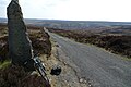
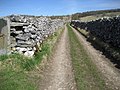 A Walled Track near Langcliffe - geograph.org.uk - 1810058.jpg 2,816 × 2,112; 2.35 MB
-
 An exposed oak (4526017406).jpg 3,872 × 2,592; 3.68 MB
-
 Arcow Quarry, Helwith Bridge - geograph.org.uk - 1806497.jpg 640 × 480; 63 KB
-
 Bettys Northallerton.jpg 636 × 477; 138 KB
-
 Black Horse, Skipton.jpg 1,224 × 1,632; 921 KB
-
 Blackbird (4526101778).jpg 2,666 × 1,777; 979 KB
-
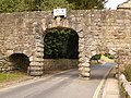 Bolton Abbey - arch over the B6160 - geograph.org.uk - 1901931.jpg 640 × 480; 104 KB
-
 Bolton Abbey - the green - geograph.org.uk - 1863947.jpg 640 × 480; 85 KB
-
 Bridleway to Ainthorpe and Danby - geograph.org.uk - 1800599.jpg 640 × 427; 302 KB
-
 Bullfinch (4526101084).jpg 2,448 × 1,632; 899 KB
-
 Burnsall Bridge - geograph.org.uk - 1821973.jpg 4,592 × 3,056; 5.36 MB
-
 Buttercrambe Road - geograph.org.uk - 1801395.jpg 2,816 × 2,112; 2.38 MB
-
 Cairn on Broughton Bank - geograph.org.uk - 1823124.jpg 480 × 640; 65 KB
-
 Cairn on Drake How - geograph.org.uk - 1825441.jpg 640 × 480; 76 KB
-
 Cleveland Way (4526027932).jpg 3,872 × 2,592; 3.7 MB
-
 Cottage in Rievaulx (4526058920).jpg 3,872 × 2,592; 4.89 MB
-
 Day 1, in a Keldy cabin (4525550115).jpg 2,520 × 3,776; 2.47 MB
-
 Dixon's Hollow (4526365372).jpg 2,048 × 1,536; 1.29 MB
-
 DSC 0001 (4526163862).jpg 3,872 × 2,592; 4.27 MB
-
 DSC 0017 (4526160614).jpg 2,891 × 1,929; 1.2 MB
-
 DSC 0038 (4525515755).jpg 3,872 × 2,592; 4.26 MB
-
 DSC 0055 (4525512481).jpg 3,872 × 2,592; 6.72 MB
-
 DSC 0059 (4526137240).jpg 2,592 × 3,872; 5.85 MB
-
 DSC 0086 (4526128582).jpg 3,872 × 2,592; 1.95 MB
-
 DSC 0088 (4526127052).jpg 3,872 × 2,592; 5.17 MB
-
 DSC 0096 (4525490249).jpg 3,872 × 2,592; 1.68 MB
-
 DSC 0150 (4525444799).jpg 3,872 × 2,592; 4.91 MB
-
 DSC 0181 (4525438611).jpg 3,872 × 2,592; 4.26 MB
-
 DSC 0207 (4525435571).jpg 3,872 × 2,592; 4.25 MB
-
 DSC 0211 (4526062242).jpg 3,872 × 2,592; 4.47 MB
-
 DSC 0226 (4525421851).jpg 3,872 × 2,592; 5.21 MB
-
 DSC 0266 (4525407177).jpg 3,872 × 2,592; 3.12 MB
-
 DSC 0281 (4525401807).jpg 3,872 × 2,592; 4.8 MB
-
 DSC 0306 (4525395447).jpg 3,872 × 2,592; 4.07 MB
-
 DSC 0319 (4525384947).jpg 3,872 × 2,592; 4.38 MB
-
 DSC 0338 (4525381551).jpg 3,872 × 2,592; 4.7 MB
-
 DSC 0339 (4526007404).jpg 3,872 × 2,592; 4.08 MB
-
 DSC 0371 (4526002064).jpg 2,592 × 3,872; 1.81 MB
-
 East Lane House - geograph.org.uk - 1809870.jpg 2,185 × 3,375; 1.85 MB
-
 Elizabeth II Postbox, Netherby (geograph 1815125).jpg 683 × 1,024; 151 KB
-
 Farm Track - geograph.org.uk - 1804228.jpg 2,876 × 1,652; 1.3 MB
-
 Farm Track - geograph.org.uk - 1804233.jpg 2,400 × 3,200; 3.62 MB
-
 Farm Track in North Dale - geograph.org.uk - 1804240.jpg 2,262 × 3,009; 2.08 MB
-
 Feeding these horses will make them bite! (4526078094).jpg 3,872 × 2,592; 4.71 MB
-
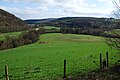
 Field beside Grange Wood - geograph.org.uk - 1801445.jpg 2,816 × 2,112; 2.84 MB
-
 Fleece Inn in Skipton.jpg 1,632 × 1,224; 480 KB
-
 Fleece Inn, Skipton.jpg 2,213 × 1,660; 464 KB
-
 Footpath to Low Paradise Farm - geograph.org.uk - 1801590.jpg 2,048 × 1,536; 2.08 MB
-
 Gateway to Moor Lodge - geograph.org.uk - 1806209.jpg 3,648 × 2,736; 3.71 MB
-
 Gorse-covered Green Cliff - geograph.org.uk - 1804237.jpg 3,200 × 2,400; 3.21 MB
-
 Hayburn Wyke (4526004190).jpg 3,872 × 2,592; 3 MB
-
 It's not that grim up north (4526131580).jpg 2,592 × 3,872; 4.09 MB
-
 Just some logs (4525538771).jpg 3,776 × 2,520; 3.65 MB
-
 Lazy Sheep (4526132780).jpg 2,073 × 1,381; 1.47 MB
-
 Little copse near Rievaulx Abbey (4526071196).jpg 3,872 × 2,592; 3.82 MB
-
 Lots of pigs live here (4526159672).jpg 3,872 × 2,592; 3.3 MB
-
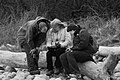
 Mum & Tanya playing scrabble (4526115722).jpg 3,776 × 2,520; 3.07 MB
-
 Near Scarborough (4526034314).jpg 3,872 × 2,592; 3.9 MB
-
 North York Moors (4525543825).jpg 3,776 × 2,520; 3.5 MB
-
 Nunnington Hall (4525493743).jpg 3,872 × 2,592; 4.6 MB
-
 Our Keldy Cabin (4525366427).jpg 3,776 × 2,520; 3.46 MB
-
 P1020277 (4525541283).jpg 3,776 × 2,520; 3.32 MB
-
 P1020306 (4525484113).jpg 3,776 × 2,520; 3.26 MB
-
 Peacock's tail (4525489101).jpg 3,872 × 2,592; 4.01 MB
-
 Pigs! (4525519277).jpg 3,872 × 2,592; 4.46 MB
-
 Planning (4525371081).jpg 3,872 × 2,592; 2.05 MB
-
 Random, noisy plane (4526079752).jpg 3,872 × 2,592; 2.08 MB
-
 Richard and Tanya (4526104412).jpg 3,776 × 2,520; 3.71 MB
-
 Richard on the North York Moors (4525548411).jpg 3,227 × 2,153; 2.46 MB
-
 Rievaulx Abbey (4526040020).jpg 3,872 × 2,592; 4.06 MB
-
 Rievaulx Abbey (4526045770).jpg 3,872 × 2,592; 4.2 MB
-
 Rievaulx Abbey (4526055464).jpg 3,872 × 2,592; 5.7 MB
-
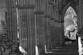
 Rievaulx Arches (4525413041).jpg 2,592 × 3,872; 3.33 MB
-
 Rievaulx Arches (4525418077).jpg 3,872 × 2,592; 2.56 MB
-
 Rose and Crown, Skipton.jpg 2,326 × 1,745; 785 KB
-
 Rusty Gate Hinge (4526165936).jpg 3,776 × 2,520; 2.71 MB
-
 Sainsbury's Taste The Difference Pigs (4526154618).jpg 3,872 × 2,592; 3.29 MB
-
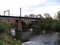 Skelton railway bridges - geograph.org.uk - 1837514.jpg 3,264 × 2,448; 1.76 MB
-
 Skipton War Memorial.jpg 2,400 × 1,800; 979 KB
-
 Spiral Staircase (4525463939).jpg 2,520 × 3,776; 2.64 MB
-
 Splash (4525546587).jpg 3,776 × 2,520; 3.7 MB
-
 St Mary's parish church, Lastingham.jpg 3,072 × 2,304; 2.48 MB
-
 Steps down (4526021948).jpg 2,592 × 3,872; 5.21 MB
-
 Tanya on Hayburn Wyke (4525999108).jpg 3,872 × 2,592; 3.79 MB
-
 The Craven, Skipton.jpg 2,652 × 1,989; 741 KB
-
 The Devonshire, Skipton.jpg 1,632 × 1,224; 637 KB
-
 The Train Not Standing.... - geograph.org.uk - 1800167.jpg 640 × 480; 129 KB
-
 Thicket Priory. - geograph.org.uk - 1830671.jpg 640 × 457; 200 KB
-
 Track over Slape Wath Moor - geograph.org.uk - 1825153.jpg 2,048 × 1,536; 1.38 MB
-
 Twin bridges - geograph.org.uk - 1837513.jpg 3,264 × 2,448; 1.32 MB
-
 Undulating Wolds' Field - geograph.org.uk - 1804238.jpg 3,192 × 1,676; 2.32 MB
-
 Uphill Single-track, Dalby Forest (4526107938).jpg 2,520 × 3,776; 5.14 MB
-
 Uphill Single-track, Dalby Forest (4526111278).jpg 3,776 × 2,520; 4.74 MB
-
 Whitby Goth Weekend (4550696165).jpg 2,048 × 1,362; 623 KB
-
 Whitby Goth Weekend (4550699573).jpg 2,048 × 1,362; 740 KB
-
 York - DRS 66412 and Fastrack 66301.jpg 1,024 × 768; 231 KB


.jpg)


.jpg)


.jpg)


.jpg)
.jpg)
.jpg)
.jpg)
.jpg)
.jpg)
.jpg)
.jpg)
.jpg)
.jpg)
.jpg)
.jpg)
.jpg)
.jpg)
.jpg)
.jpg)
.jpg)
.jpg)
.jpg)
.jpg)
.jpg)
.jpg)
.jpg)
.jpg)

.jpg)


.jpg)


.jpg)
.jpg)
.jpg)
.jpg)
.jpg)
.jpg)
.jpg)
.jpg)
.jpg)
.jpg)
.jpg)
.jpg)
.jpg)
.jpg)
.jpg)
.jpg)
.jpg)
.jpg)
.jpg)
.jpg)
.jpg)
.jpg)
.jpg)
.jpg)

.jpg)
.jpg)


.jpg)
.jpg)

.jpg)
.jpg)


.jpg)
.jpg)
.jpg)
.jpg)
