Category:April 2009 in County Down
Jump to navigation
Jump to search
English: Images taken in County Down, Northern Ireland in this month of 2009 (not the date of the upload).
| Jan | Feb | Mar | Apr | May | Jun | Jul | Aug | Sep | Oct | Nov | Dec | ||
| ← | 59 | 46 | 48 | 61 | 33 | 30 | 72 | 224 | 115 | 109 | 34 | 154 | → |
|---|
Subcategories
This category has the following 2 subcategories, out of 2 total.
B
Media in category "April 2009 in County Down"
The following 59 files are in this category, out of 59 total.
-
 Bench mark, Slievenaslat - geograph.org.uk - 1246630.jpg 523 × 402; 117 KB
-
 Boulder, Newcastle - geograph.org.uk - 1264882.jpg 524 × 334; 93 KB
-
 Castlewellan Castle (2) - geograph.org.uk - 1246274.jpg 581 × 363; 82 KB
-
 Chimneys, Castlewellan Castle - geograph.org.uk - 1247497.jpg 640 × 372; 68 KB
-
 Clanrye River at Croan Bridge - geograph.org.uk - 1245589.jpg 426 × 640; 99 KB
-
 Clanrye River at Ryan Bridge - geograph.org.uk - 1245576.jpg 426 × 640; 114 KB
-
 Clanrye River from Glenny's Bridge - geograph.org.uk - 1245554.jpg 426 × 640; 102 KB
-
 Dromara Road from Islandhill - geograph.org.uk - 1256974.jpg 640 × 480; 42 KB
-
 Drumadoney Townland (2) - geograph.org.uk - 1254617.jpg 640 × 480; 42 KB
-
 Drumadoney Townland - geograph.org.uk - 1254590.jpg 640 × 480; 60 KB
-

-
 Drystone walls near Castlewellan - geograph.org.uk - 1247887.jpg 640 × 364; 112 KB
-
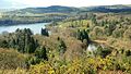
 Dundrum and the Mournes - geograph.org.uk - 1246024.jpg 640 × 381; 54 KB
-
 Eirford Park, Waringsford - geograph.org.uk - 1260844.jpg 640 × 480; 57 KB
-

-

-
 Felled tree, Castlewellan Forest Park - geograph.org.uk - 1246412.jpg 640 × 425; 147 KB
-
 Footbridge, Newcastle (2) - geograph.org.uk - 830525.jpg 640 × 429; 82 KB
-
 Footbridge, Newcastle (3) - geograph.org.uk - 1264459.jpg 596 × 414; 88 KB
-
 Forest road near Castlewellan - geograph.org.uk - 1247650.jpg 602 × 319; 90 KB
-
 Gate, Hillsborough Fort (1) - geograph.org.uk - 1251488.jpg 640 × 421; 96 KB
-
 Glenny's Bridge - geograph.org.uk - 1245547.jpg 640 × 426; 113 KB
-
 Head, Hillsborough Fort (1) - geograph.org.uk - 1251735.jpg 537 × 520; 115 KB
-
 Head, Hillsborough Fort (10) - geograph.org.uk - 1253136.jpg 639 × 451; 101 KB
-
 Head, Hillsborough Fort (11) - geograph.org.uk - 1253155.jpg 575 × 459; 106 KB
-
 Head, Hillsborough Fort (13) - geograph.org.uk - 1253184.jpg 601 × 542; 114 KB
-
 Islandhill, Drummiller Townland - geograph.org.uk - 1256945.jpg 640 × 480; 63 KB
-
 King Street, Newcastle - geograph.org.uk - 1264917.jpg 640 × 349; 99 KB
-
-
 Levallyreagh Road - geograph.org.uk - 1262940.jpg 640 × 480; 57 KB
-
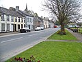
 Lisburn Street, Hillsborough - geograph.org.uk - 1251097.jpg 640 × 400; 71 KB
-
 Magherally Old Church (Front Entrance) - geograph.org.uk - 1247157.jpg 640 × 480; 101 KB
-
 Main Street, Hillsborough (1) - geograph.org.uk - 1251245.jpg 640 × 418; 88 KB
-
 Mourne view near Castlewellan - geograph.org.uk - 1247474.jpg 640 × 403; 64 KB
-
 Newcastle lifeboat called out (3) - geograph.org.uk - 1231066.jpg 640 × 425; 88 KB
-
 Path and roots, Newcastle - geograph.org.uk - 1264556.jpg 588 × 394; 123 KB
-
 Path to Slievenaslat (2) - geograph.org.uk - 1246582.jpg 574 × 385; 118 KB
-
 Path, Castlewellan Forest Park (1) - geograph.org.uk - 1246383.jpg 638 × 375; 115 KB
-
 Path, Castlewellan Forest Park (2) - geograph.org.uk - 1246440.jpg 584 × 352; 105 KB
-
 Path, Castlewellan Forest Park (2) - geograph.org.uk - 1247362.jpg 592 × 345; 103 KB
-
 Path, Castlewellan Forest Park - geograph.org.uk - 1247294.jpg 626 × 387; 114 KB
-
 Scarva Main Street - geograph.org.uk - 1272382.jpg 640 × 480; 109 KB
-
 Seat, Castlewellan Forest Park - geograph.org.uk - 1246470.jpg 640 × 362; 96 KB
-
 Signpost, Bangor - geograph.org.uk - 1239390.jpg 618 × 640; 515 KB
-
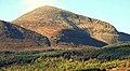 Slieve Donard (3) - geograph.org.uk - 1246177.jpg 640 × 352; 79 KB
-
 Slieve Donard (4) - geograph.org.uk - 1264381.jpg 640 × 414; 96 KB
-
 Slieve Donard (5) - geograph.org.uk - 1264413.jpg 640 × 376; 66 KB
-
 Slievenaslat viewpoint - geograph.org.uk - 1246661.jpg 640 × 367; 73 KB
-
 Stobart H3801 "Hazel" (PX07 BKN) 2007 Scania R420, 16 April 2009.jpg 640 × 410; 82 KB
-

-
 The Bannanstown Road near Castlewellan - geograph.org.uk - 1247577.jpg 640 × 374; 107 KB
-

-
 The Town Dock, Warrenpoint (3) - geograph.org.uk - 1278068.jpg 640 × 423; 80 KB
-
 Tree, Castlewellan - geograph.org.uk - 1246231.jpg 586 × 382; 99 KB
-
 Trig point, Slievenaslat - geograph.org.uk - 1246605.jpg 551 × 384; 95 KB
-
 Tullinisky Road, Kinallen - geograph.org.uk - 1254700.jpg 640 × 480; 75 KB
-
 Tullinisky Road, Waringsford - geograph.org.uk - 1254652.jpg 640 × 480; 69 KB
-
 Tullinisky Townland - geograph.org.uk - 1254693.jpg 640 × 480; 82 KB
-
 Waringsford Orange Hall.jpg 640 × 480; 53 KB


_-_geograph.org.uk_-_1246274.jpg)


_-_geograph.org.uk_-_1254617.jpg)


_-_geograph.org.uk_-_1246502.jpg)
_-_geograph.org.uk_-_1246528.jpg)

_-_geograph.org.uk_-_830525.jpg)
_-_geograph.org.uk_-_1264459.jpg)

_-_geograph.org.uk_-_1251488.jpg)

_-_geograph.org.uk_-_1251735.jpg)
_-_geograph.org.uk_-_1253136.jpg)
_-_geograph.org.uk_-_1253155.jpg)
_-_geograph.org.uk_-_1253184.jpg)


_-_geograph.org.uk_-_1247157.jpg)
_-_geograph.org.uk_-_1251245.jpg)

_-_geograph.org.uk_-_1231066.jpg)

_-_geograph.org.uk_-_1246582.jpg)
_-_geograph.org.uk_-_1246383.jpg)
_-_geograph.org.uk_-_1246440.jpg)
_-_geograph.org.uk_-_1247362.jpg)


_-_geograph.org.uk_-_1246177.jpg)
_-_geograph.org.uk_-_1264381.jpg)
_-_geograph.org.uk_-_1264413.jpg)

_2007_Scania_R420,_16_April_2009.jpg)
_-_geograph.org.uk_-_1247937.jpg)


_-_geograph.org.uk_-_1278068.jpg)


