Category:April 2008 in Kent
Jump to navigation
Jump to search
Deutsch: Bilder, die im April 2008 in Kent aufgenommen worden sind. Bitte beachten Sie, dass dies weder das Datum des Uploads noch das Datum des Scannens eines Fotos ist.
English: Images/pictures taken in Kent during April 2008. Note this is not the date of the upload, nor the date a photo was scanned.
Español: Fotografías o imágenes tomadas en Kent durante abril 2008. No es la fecha de subida ni escaneo, sino la fecha en que las fotografías o imágenes se crearon.
Esperanto: Bildoj faritaj en Kent en aprilo 2008. Tio ne estas la dato, kiam la bildoj estis alŝutitaj aŭ skanitaj.
Français : Photographies ou images prises en Kent durant avril 2008. Ce n'est pas la date du téléchargement ou du scan.
Galego: Fotografías ou imaxes tomadas en Kent durante abril 2008. Non é a data de subida nin escaneamento, senón a data na que se crearon as fotografías ou imaxes.
Italiano: Fotografie o immagini scattate a Kent nel aprile 2008. Nota bene: la data non si riferisce né a quella di upload né a quella in cui la foto è stata digitalizzata.
Norsk bokmål: Bilder tatt i Kent i løpet av april 2008. Merk at dette ikke er datoen for opplasting, eller når et bilde har blitt skannet.
Norsk nynorsk: Bilete teke i Kent i løpet av april 2008. Merk at dette ikkje er datoen for opplasting, eller når eit bilete har vorte skanna.
Русский: Изображения, сделанные в Kent в течение апрель 2008 (не дата загрузки изображения).
Українська: Зображення, зроблені в Kent протягом квітень 2008. Зауважте, що це не дата завантаження чи дата сканування фотографії.
| April 2007 | ← | April 2008 | → | April 2009 | |||||||
| Jan | Feb | Mar | Apr | May | Jun | Jul | Aug | Sep | Oct | Nov | Dec |
| 77 | 132 | 143 | 128 | 90 | 107 | 102 | 61 | 206 | 170 | 326 | 226 |
|---|---|---|---|---|---|---|---|---|---|---|---|
Subcategories
This category has the following 2 subcategories, out of 2 total.
D
- Detling Kit Car Show 2008 (111 F)
Media in category "April 2008 in Kent"
The following 126 files are in this category, out of 126 total.
-
 101 Steps - geograph.org.uk - 767483.jpg 430 × 640; 131 KB
-
 34067 Tangmere Folkestone Harbour Bridge.jpg 2,048 × 1,365; 309 KB
-
 34067 Tangmere Folkestone Harbour Swing Bridge.jpg 2,048 × 1,365; 310 KB
-
 34067 Tangmere Folkestone Harbour Viaduct.jpg 2,048 × 1,365; 209 KB
-

-
 A cottage opposite the Rising Sun - geograph.org.uk - 764295.jpg 600 × 450; 186 KB
-

-
 A Polish bar in Tunbridge Wells, Kent.jpg 640 × 430; 76 KB
-

-

-
 Badgars Close off Chapel Lane - geograph.org.uk - 756490.jpg 640 × 480; 159 KB
-
 Beau Nash Inn - geograph.org.uk - 768616.jpg 640 × 430; 63 KB
-
 Being renovated - geograph.org.uk - 799709.jpg 640 × 480; 73 KB
-
 Calverley Road, Tunbridge Wells - geograph.org.uk - 803820.jpg 640 × 480; 110 KB
-
 CalverleyCrescent.jpg 640 × 480; 79 KB
-
 Cambridge Street, Tunbridge Wells - geograph.org.uk - 799860.jpg 640 × 480; 88 KB
-
 Chapel Place, Tunbridge Wells - geograph.org.uk - 799800.jpg 640 × 480; 110 KB
-
 Cheyney Field, Upper Harbledown - geograph.org.uk - 770549.jpg 640 × 480; 192 KB
-

-
 Communications mast near Sheepfold - geograph.org.uk - 792488.jpg 480 × 640; 207 KB
-

-
 Double row of trees - geograph.org.uk - 799792.jpg 640 × 480; 129 KB
-
 Drinking Fountain, Camden Road - geograph.org.uk - 767338.jpg 430 × 640; 77 KB
-
 Elephant Rock, Rusthall - geograph.org.uk - 767457.jpg 640 × 430; 137 KB
-
 Entering Rusthall - geograph.org.uk - 767452.jpg 430 × 640; 79 KB
-

-
 Entrance to the Royal Victoria place - geograph.org.uk - 768636.jpg 430 × 640; 67 KB
-
 Ex-wind pump, now bird-box - geograph.org.uk - 746957.jpg 469 × 640; 54 KB
-
 Farmhouse, Smockham Farm - geograph.org.uk - 767443.jpg 640 × 430; 92 KB
-
 Field boundary with Down Wood - geograph.org.uk - 785998.jpg 640 × 480; 233 KB
-

-
 Folkestone Harbour Signal Box with Black Bunting.jpg 2,048 × 1,536; 451 KB
-
 Footpath across field - geograph.org.uk - 786079.jpg 640 × 480; 165 KB
-
 Footpath across the fields - geograph.org.uk - 786054.jpg 640 × 480; 185 KB
-
 Footpath across Tunbridge Wells Common - geograph.org.uk - 799789.jpg 640 × 480; 127 KB
-
 Footpath leading to High Rocks Road. - geograph.org.uk - 768550.jpg 430 × 640; 124 KB
-
 Footpath through a field - geograph.org.uk - 785093.jpg 640 × 480; 184 KB
-
 Footpath through a tunnel of trees - geograph.org.uk - 785974.jpg 640 × 480; 317 KB
-

-
 Footpath through the woods - geograph.org.uk - 786031.jpg 640 × 480; 280 KB
-
 Footpath through Warren Wood - geograph.org.uk - 790012.jpg 640 × 480; 287 KB
-
 Footpath through woods - geograph.org.uk - 799794.jpg 640 × 480; 151 KB
-
 Footpath to Brenchley - geograph.org.uk - 768736.jpg 640 × 430; 72 KB
-
 Footpath to Crundale church - geograph.org.uk - 790030.jpg 640 × 480; 275 KB
-
 Footpath to Stump Shave - geograph.org.uk - 785962.jpg 640 × 480; 208 KB
-
 Footpath to Stump Shave - geograph.org.uk - 786039.jpg 640 × 480; 240 KB
-
 Footpath towards the A28 Ashford Road - geograph.org.uk - 784156.jpg 640 × 480; 200 KB
-
 GreenhitheStationFastrack.JPG 2,710 × 1,356; 751 KB
-
 GreenhitheStationFastrack5309.JPG 2,048 × 1,536; 772 KB
-
 GreenhitheStationFastrack5310.JPG 2,048 × 1,536; 789 KB
-
 GreenhitheStationFastrack5315.JPG 2,048 × 1,536; 754 KB
-
 Hoopers, Tunbridge Wells - geograph.org.uk - 799818.jpg 640 × 480; 77 KB
-

-
 Kent and Sussex Hospital - geograph.org.uk - 768622.jpg 640 × 430; 54 KB
-
 Kentish Spring, Coxheath - geograph.org.uk - 780658.jpg 480 × 640; 160 KB
-
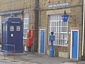 KentPoliceMuseum-2391.jpg 1,960 × 1,470; 636 KB
-
 Lenham railway station 1.jpg 640 × 480; 67 KB
-
 Level crossing, Folkestone Harbour - geograph.org.uk - 1618448.jpg 640 × 428; 82 KB
-
 Maidstone Barracks station - geograph.org.uk - 779487.jpg 640 × 446; 84 KB
-
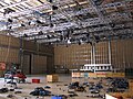 Maidstone Studio Five.jpg 1,600 × 1,200; 782 KB
-

-

-
 Monson Road, Tunbridge Wells. - geograph.org.uk - 768644.jpg 640 × 430; 70 KB
-
 Neville Park - geograph.org.uk - 768544.jpg 640 × 430; 119 KB
-
 Old advert, Stephens rd. - geograph.org.uk - 767361.jpg 640 × 430; 103 KB
-
 On call - geograph.org.uk - 799849.jpg 640 × 369; 62 KB
-

-
 Pedestrianised Calverley Road - geograph.org.uk - 803834.jpg 640 × 480; 106 KB
-

-
 Pleasure Boats at East Farleigh - geograph.org.uk - 777832.jpg 640 × 480; 125 KB
-
 Prince of Wales - geograph.org.uk - 768650.jpg 640 × 430; 69 KB
-
 Prunus spinosa - geograph.org.uk - 761498.jpg 640 × 480; 246 KB
-
 Rail-over-rail bridge, Maidstone - geograph.org.uk - 779481.jpg 640 × 480; 87 KB
-
 Railway bridge and pond - geograph.org.uk - 778712.jpg 640 × 480; 289 KB
-
 Railway bridge over the Medway - geograph.org.uk - 779475.jpg 640 × 480; 76 KB
-
 Railway line crossing the River Stour - geograph.org.uk - 784115.jpg 640 × 480; 200 KB
-
 Railway wagon cattle shelter - geograph.org.uk - 746967.jpg 640 × 471; 76 KB
-
 Road sign - geograph.org.uk - 767369.jpg 640 × 430; 132 KB
-
 Rocks at Rusthall - geograph.org.uk - 767477.jpg 640 × 430; 136 KB
-
 Royal Wells Hotel - geograph.org.uk - 768621.jpg 640 × 430; 75 KB
-
 St Mary Magdalene, Ruckinge - geograph.org.uk - 800526.jpg 640 × 480; 63 KB
-
 Rust Hall Farm - geograph.org.uk - 807464.jpg 640 × 359; 84 KB
-

-
 Sharp bend below Thurnham Castle - geograph.org.uk - 778061.jpg 640 × 480; 101 KB
-
 Sittingbourne to London railway, Bobbing - geograph.org.uk - 749906.jpg 640 × 480; 116 KB
-
 Smockham Farm - geograph.org.uk - 767445.jpg 640 × 430; 107 KB
-
 Southern Way, Folkestone - geograph.org.uk - 1618446.jpg 640 × 428; 81 KB
-
-
 St Johns recreation Ground - geograph.org.uk - 767436.jpg 640 × 430; 93 KB
-
 Stocklands Lane - geograph.org.uk - 767442.jpg 430 × 640; 103 KB
-
 Tangmere (Golden Arrow) on the Harbour Bridge for the last time.jpg 2,048 × 1,365; 241 KB
-
 Tangmere (Golden Arrow) on the Harbour Bridge.jpg 2,048 × 1,365; 314 KB
-
 Tangmere on the Harbour Viaduct.jpg 2,048 × 1,365; 275 KB
-

-
 The beach at Seasalter at low tide - geograph.org.uk - 772659.jpg 640 × 481; 80 KB
-

-
 The Beacon - geograph.org.uk - 807497.jpg 640 × 480; 98 KB
-
 The Beacon Hotel - geograph.org.uk - 767485.jpg 640 × 430; 100 KB
-
 The Bedford - geograph.org.uk - 799808.jpg 480 × 640; 66 KB
-
 The Bitter End - geograph.org.uk - 768666.jpg 640 × 430; 72 KB
-
 The Black Horse - geograph.org.uk - 768672.jpg 640 × 430; 70 KB
-

-
 The Ex Crystal Palace - geograph.org.uk - 768653.jpg 640 × 430; 73 KB
-
 The Final Depart of the Golden Arrow from Folkestone Harbour.jpg 2,048 × 1,365; 288 KB
-
 The George public house - geograph.org.uk - 784208.jpg 640 × 480; 184 KB
-
 The Kelsey Arms, Tunbridge Wells - geograph.org.uk - 767272.jpg 640 × 430; 70 KB
-
 The Mews - geograph.org.uk - 799844.jpg 640 × 480; 63 KB
-
 The Pantiles, Tunbridge Wells - geograph.org.uk - 799799.jpg 640 × 480; 152 KB
-

-
 The tower of St Mary's church, Chartham - geograph.org.uk - 783170.jpg 480 × 640; 221 KB
-
 Toad Rock - geograph.org.uk - 767454.jpg 640 × 430; 141 KB
-

-
 Towards Chetney Cottages - geograph.org.uk - 746988.jpg 640 × 480; 80 KB
-
 Train on Folkestone Harbour Branch - geograph.org.uk - 3302324.jpg 640 × 428; 106 KB
-

-
 Tunbridge Wells Common - geograph.org.uk - 799790.jpg 640 × 480; 135 KB
-
 Tunbridge Wells gothic - geograph.org.uk - 799683.jpg 640 × 480; 78 KB
-
 Upper Grosvenor Road, Tunbridge Wells - geograph.org.uk - 767295.jpg 640 × 430; 74 KB
-
 Upper Harbledown village sign - geograph.org.uk - 770551.jpg 480 × 640; 282 KB
-

-
 War memorial at Rusthall - geograph.org.uk - 807514.jpg 480 × 640; 124 KB
-
 Wheeler Street railway tunnel - geograph.org.uk - 779454.jpg 640 × 493; 73 KB
-
 Whitstable Harbour - geograph.org.uk - 1277120.jpg 640 × 480; 95 KB
-
-
 Gates on Chetney Marsh - geograph.org.uk - 746995.jpg 640 × 480; 88 KB
-


_on_the_Harbour_Bridge_for_the_last_time.jpg)
_on_the_Harbour_Bridge.jpg)


