Category:April 2008 in Herefordshire
Jump to navigation
Jump to search
Deutsch: Bilder, die im April 2008 in Herefordshire aufgenommen worden sind. Bitte beachten Sie, dass dies weder das Datum des Uploads noch das Datum des Scannens eines Fotos ist.
English: Images/pictures taken in Herefordshire during April 2008. Note this is not the date of the upload, nor the date a photo was scanned.
Español: Fotografías o imágenes tomadas en Herefordshire durante abril 2008. No es la fecha de subida ni escaneo, sino la fecha en que las fotografías o imágenes se crearon.
Esperanto: Bildoj faritaj en Herefordshire en aprilo 2008. Tio ne estas la dato, kiam la bildoj estis alŝutitaj aŭ skanitaj.
Français : Photographies ou images prises en Herefordshire durant avril 2008. Ce n'est pas la date du téléchargement ou du scan.
Galego: Fotografías ou imaxes tomadas en Herefordshire durante abril 2008. Non é a data de subida nin escaneamento, senón a data na que se crearon as fotografías ou imaxes.
Italiano: Fotografie o immagini scattate a Herefordshire nel aprile 2008. Nota bene: la data non si riferisce né a quella di upload né a quella in cui la foto è stata digitalizzata.
Norsk bokmål: Bilder tatt i Herefordshire i løpet av april 2008. Merk at dette ikke er datoen for opplasting, eller når et bilde har blitt skannet.
Norsk nynorsk: Bilete teke i Herefordshire i løpet av april 2008. Merk at dette ikkje er datoen for opplasting, eller når eit bilete har vorte skanna.
Русский: Изображения, сделанные в Herefordshire в течение апрель 2008 (не дата загрузки изображения).
Українська: Зображення, зроблені в Herefordshire протягом квітень 2008. Зауважте, що це не дата завантаження чи дата сканування фотографії.
| April 2007 | ← | April 2008 | → | April 2009 | |||||||
| Jan | Feb | Mar | Apr | May | Jun | Jul | Aug | Sep | Oct | Nov | Dec |
| 70 | 88 | 128 | 68 | 122 | 136 | 142 | 127 | 317 | 186 | 188 | 128 |
|---|---|---|---|---|---|---|---|---|---|---|---|
Media in category "April 2008 in Herefordshire"
The following 68 files are in this category, out of 68 total.
-
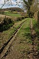
 Hereford to Shrewsbury line - geograph.org.uk - 148871.jpg 640 × 480; 282 KB
-
 Circle of pines - geograph.org.uk - 762715.jpg 640 × 480; 82 KB
-
 Colwall railway station 1.jpg 640 × 426; 76 KB
-
 Cottages, Staunton on Arrow - geograph.org.uk - 786159.jpg 640 × 536; 81 KB
-
 Cross roads at St Owen's Cross - geograph.org.uk - 780189.jpg 640 × 426; 52 KB
-
 Entrance to Bank Farm, West Malvern - geograph.org.uk - 776441.jpg 640 × 426; 113 KB
-

-

-
 Former engine shed, Ross-on-Wye - geograph.org.uk - 766972.jpg 640 × 480; 159 KB
-
 Former railway goods shed - geograph.org.uk - 762500.jpg 640 × 446; 97 KB
-
 GR postbox set into a flight of steps - geograph.org.uk - 748947.jpg 491 × 640; 177 KB
-
 Hyacinthoides at Castle Coppice - geograph.org.uk - 915923.jpg 640 × 480; 149 KB
-
 Junction 3 of the M50 near Gorsley - geograph.org.uk - 761554.jpg 640 × 426; 75 KB
-
 Local sandstone - geograph.org.uk - 757407.jpg 640 × 480; 175 KB
-

-
 Netherley Hall, Cradley - geograph.org.uk - 776331.jpg 640 × 426; 65 KB
-
 Oak in Harewood Park - geograph.org.uk - 762713.jpg 480 × 640; 102 KB
-
 Orchard, Glewstone - geograph.org.uk - 748969.jpg 640 × 480; 114 KB
-
 Pallet store adjoining Linton Wood - geograph.org.uk - 766190.jpg 640 × 426; 92 KB
-
 Phone box at Crocker's Ash - geograph.org.uk - 755275.jpg 640 × 453; 145 KB
-
 Phone box at Symonds Yat West - geograph.org.uk - 757412.jpg 640 × 488; 136 KB
-
 Post Office, Whitchurch - geograph.org.uk - 755298.jpg 447 × 640; 107 KB
-
 Register Office, Ross-on-Wye - geograph.org.uk - 754751.jpg 640 × 542; 135 KB
-
 Retail and Industrial Units, Harrow Road - geograph.org.uk - 748026.jpg 640 × 427; 217 KB
-
 River Wye and Huntsham Hill - geograph.org.uk - 757043.jpg 640 × 480; 124 KB
-
 Road from Llangrove arrives in Whitchurch - geograph.org.uk - 755324.jpg 640 × 439; 134 KB
-
 Road junction in Mathon - geograph.org.uk - 775451.jpg 640 × 426; 92 KB
-
 Road to Llangrove from Whitchurch - geograph.org.uk - 755317.jpg 480 × 640; 94 KB
-
 Ross-on-Wye Baptist Church, Broad Street - geograph.org.uk - 754296.jpg 640 × 483; 142 KB
-
 Rows of blackcurrants - geograph.org.uk - 762712.jpg 640 × 480; 109 KB
-
 School House - geograph.org.uk - 775584.jpg 640 × 426; 82 KB
-

-
 Spring ploughing at Gorsley Common - geograph.org.uk - 755520.jpg 640 × 426; 55 KB
-
 St David, Little Dewchurch - geograph.org.uk - 781667.jpg 640 × 361; 93 KB
-
 St David, Little Dewchurch - geograph.org.uk - 781671.jpg 640 × 480; 90 KB
-
 St Margaret of Antioch, Wellington - geograph.org.uk - 781449.jpg 640 × 362; 59 KB
-
 Steep driveway at Symonds Yat West - geograph.org.uk - 757417.jpg 640 × 480; 209 KB
-
 Steep steps on a public footpath - geograph.org.uk - 757274.jpg 480 × 640; 248 KB
-
 Stocks House dovecote, Wellington. - geograph.org.uk - 781465.jpg 640 × 466; 105 KB
-
 Strawberry Polytunnels - geograph.org.uk - 762764.jpg 640 × 480; 92 KB
-
 Tatty 'phone box at Wormelow - geograph.org.uk - 762702.jpg 480 × 640; 107 KB
-
 The Black Mountains from 30,000 feet - geograph.org.uk - 773884.jpg 479 × 639; 51 KB
-
 The Cliffe Arms, Mathon - geograph.org.uk - 775456.jpg 640 × 426; 72 KB
-
 The lake, The Ley, Weobley - geograph.org.uk - 779873.jpg 640 × 412; 85 KB
-
 The Ley, Weobley - geograph.org.uk - 779852.jpg 640 × 272; 42 KB
-
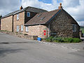
 The Post Office, Staunton on Arrow - geograph.org.uk - 786159.jpg 640 × 427; 394 KB
-
 The Stawne, Weobley - geograph.org.uk - 779836.jpg 640 × 404; 70 KB
-
 The War Memorial in Cradley - geograph.org.uk - 776328.jpg 426 × 640; 105 KB
-
 Town House, Mathon - geograph.org.uk - 775589 (cropped).jpg 261 × 261; 21 KB
-
 Town House, Mathon - geograph.org.uk - 775589.jpg 640 × 426; 86 KB
-
 Trees in a field near Colwall Stone - geograph.org.uk - 775439.jpg 640 × 426; 68 KB
-
 Victorian Postbox, Crocker's Ash - geograph.org.uk - 755279.jpg 640 × 480; 129 KB
-
 View to Bryngwyn Hill - geograph.org.uk - 762695.jpg 640 × 480; 92 KB
-
 War Memorial, Cradley - geograph.org.uk - 775605.jpg 426 × 640; 89 KB
-
 St Margaret of Antioch, Wellington - geograph.org.uk - 781455.jpg 433 × 640; 76 KB
-

-
 Window detail, Ross-on-Wye Baptist Church - geograph.org.uk - 754321.jpg 640 × 609; 198 KB
-
 Wormelow Garage and The Tump Inn - geograph.org.uk - 762698.jpg 640 × 480; 72 KB
-
 Wormelow Post Office and Stores - geograph.org.uk - 762700.jpg 640 × 480; 81 KB
-
 A40 passing through Ryeford - geograph.org.uk - 766961.jpg 640 × 480; 108 KB
-
 Approaching Crocker's Ash - geograph.org.uk - 755284.jpg 640 × 439; 133 KB
-
 Bulmers Cider - geograph.org.uk - 748076.jpg 640 × 427; 210 KB
-
 Cider Press Outside Bulmers Cider - geograph.org.uk - 748081.jpg 640 × 427; 289 KB
-
 Downton Bridge Aqueduct - geograph.org.uk - 769076.jpg 480 × 640; 111 KB
-
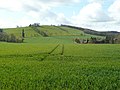
 Field to the north of Colwall Stone - geograph.org.uk - 775437.jpg 640 × 426; 73 KB
-
 Green lane near Little Woolpits, Ledbury - geograph.org.uk - 753492.jpg 426 × 640; 126 KB
-
 Hillside paddock near Crocker's Ash - geograph.org.uk - 755291.jpg 640 × 448; 216 KB
-
 Linked barns, Glewstone - geograph.org.uk - 748963.jpg 640 × 480; 133 KB


.jpg)


