Category:April 2007 in Highland (council area)
Jump to navigation
Jump to search
Council areas (municipalities) of Scotland: Aberdeen · Aberdeenshire · Argyll and Bute · Dumfries and Galloway · Edinburgh · Fife · Glasgow · Highland · Moray · North Lanarkshire · Scottish Borders ·
Deutsch: Bilder, die im April 2007 in Highland (council area) aufgenommen worden sind. Bitte beachten Sie, dass dies weder das Datum des Uploads noch das Datum des Scannens eines Fotos ist.
English: Images/pictures taken in Highland (council area) during April 2007. Note this is not the date of the upload, nor the date a photo was scanned.
Español: Fotografías o imágenes tomadas en Highland (council area) durante abril 2007. No es la fecha de subida ni escaneo, sino la fecha en que las fotografías o imágenes se crearon.
Esperanto: Bildoj faritaj en Highland (council area) en aprilo 2007. Tio ne estas la dato, kiam la bildoj estis alŝutitaj aŭ skanitaj.
Français : Photographies ou images prises en Highland (council area) durant avril 2007. Ce n'est pas la date du téléchargement ou du scan.
Galego: Fotografías ou imaxes tomadas en Highland (council area) durante abril 2007. Non é a data de subida nin escaneamento, senón a data na que se crearon as fotografías ou imaxes.
Italiano: Fotografie o immagini scattate a Highland (council area) nel aprile 2007. Nota bene: la data non si riferisce né a quella di upload né a quella in cui la foto è stata digitalizzata.
Norsk bokmål: Bilder tatt i Highland (council area) i løpet av april 2007. Merk at dette ikke er datoen for opplasting, eller når et bilde har blitt skannet.
Norsk nynorsk: Bilete teke i Highland (council area) i løpet av april 2007. Merk at dette ikkje er datoen for opplasting, eller når eit bilete har vorte skanna.
Русский: Изображения, сделанные в Highland (council area) в течение апрель 2007 (не дата загрузки изображения).
Українська: Зображення, зроблені в Highland (council area) протягом квітень 2007. Зауважте, що це не дата завантаження чи дата сканування фотографії.
| April 2006 | ← | April 2007 | → | April 2008 | |||||||
| Jan | Feb | Mar | Apr | May | Jun | Jul | Aug | Sep | Oct | Nov | Dec |
| 58 | 15 | 64 | 88 | 50 | 79 | 40 | 46 | 37 | 27 | 14 | 40 |
|---|---|---|---|---|---|---|---|---|---|---|---|
Subcategories
This category has the following 3 subcategories, out of 3 total.
Media in category "April 2007 in Highland (council area)"
The following 85 files are in this category, out of 85 total.
-
 Aboon them a' - geograph.org.uk - 418200.jpg 640 × 477; 279 KB
-

-
 Achairn Forest - geograph.org.uk - 404246.jpg 640 × 427; 127 KB
-
-
 Allt a' Choire - geograph.org.uk - 401911.jpg 640 × 425; 341 KB
-
 Allt Calder - geograph.org.uk - 396681.jpg 640 × 480; 113 KB
-
 Allt Calder - geograph.org.uk - 396721.jpg 640 × 480; 107 KB
-
 Allt Calder - geograph.org.uk - 396759.jpg 640 × 480; 121 KB
-
 Allt Gleann nan Eun - geograph.org.uk - 401368.jpg 640 × 480; 104 KB
-
 Allt Gleann nan Eun - geograph.org.uk - 405093.jpg 480 × 640; 106 KB
-
 Allt nam Fraoch-choire - geograph.org.uk - 407102.jpg 640 × 427; 297 KB
-
 Allt nam Fraoch-choire - geograph.org.uk - 407104.jpg 640 × 426; 260 KB
-
 Allt Vungie - geograph.org.uk - 405207.jpg 480 × 640; 148 KB
-
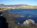 Along the north shore at Aodann Mhòr - geograph.org.uk - 417756.jpg 640 × 480; 104 KB
-
 Ancient Wall - geograph.org.uk - 409828.jpg 551 × 640; 192 KB
-
 Ardgour from Inchree - geograph.org.uk - 393663.jpg 640 × 480; 88 KB
-
 Ardroe - geograph.org.uk - 408874.jpg 640 × 480; 110 KB
-
 Armadale Castle Gardens - geograph.org.uk - 386013.jpg 425 × 640; 318 KB
-
 Armadale Home Farm - geograph.org.uk - 386077.jpg 640 × 425; 307 KB
-
 Auchterflow fields - geograph.org.uk - 408980.jpg 640 × 314; 47 KB
-
 Ba Bridge - geograph.org.uk - 397356.jpg 640 × 620; 142 KB
-
 BA8894 Wick - Edinburgh - geograph.org.uk - 436980.jpg 640 × 480; 58 KB
-
 Badlipster - geograph.org.uk - 404226.jpg 640 × 427; 60 KB
-
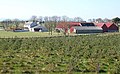 Bankhead Farm - geograph.org.uk - 385450.jpg 640 × 396; 86 KB
-
 Beinn a' Bha'ach Ard summit Trig point - geograph.org.uk - 677377.jpg 2,560 × 1,920; 2.44 MB
-
 Beinn a' Bheithir across Loch Leven - geograph.org.uk - 1022692.jpg 640 × 480; 52 KB
-
 Beinn Bhreac Bheag - geograph.org.uk - 396822.jpg 640 × 480; 70 KB
-
 Ben Alder Cliffs - geograph.org.uk - 420070.jpg 640 × 480; 98 KB
-
 Ben Alder from Ben Alder Path - geograph.org.uk - 420039.jpg 640 × 480; 116 KB
-
 Ben Alder Plateau - geograph.org.uk - 420096.jpg 640 × 480; 104 KB
-
 Ben Alder View - geograph.org.uk - 419977.jpg 640 × 480; 104 KB
-
 Ben Nevis from Corpach - geograph.org.uk - 1324605.jpg 429 × 640; 61 KB
-
 Ben Nevis Highland Centre - geograph.org.uk - 877205.jpg 640 × 480; 58 KB
-
 Ben Stack - geograph.org.uk - 604680.jpg 640 × 457; 93 KB
-

-
 Ben Stack from the Abhainn an Loin - geograph.org.uk - 396315.jpg 640 × 480; 58 KB
-
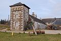
 Bilbster railway station in 2007.jpg 480 × 640; 138 KB
-
 Birch and Pine - geograph.org.uk - 410794.jpg 640 × 480; 112 KB
-
 Bridge on Fairy Glen Walk - geograph.org.uk - 501168.jpg 640 × 480; 140 KB
-
 Caledonian Hotel, Portree - geograph.org.uk - 404091.jpg 640 × 480; 74 KB
-
 Caolas na h-Airde - geograph.org.uk - 443796.jpg 640 × 480; 47 KB
-
 Dunvegan Castle - geograph.org.uk - 393790.jpg 480 × 640; 95 KB
-
 Fishing jetties in River Inver - geograph.org.uk - 408800.jpg 640 × 480; 67 KB
-
 Jetty, Lochaline - geograph.org.uk - 709543.jpg 640 × 427; 77 KB
-
 Kinlochan Forest - geograph.org.uk - 410781.jpg 640 × 480; 72 KB
-

-
 Loch Mudle and Forest - geograph.org.uk - 411038.jpg 640 × 463; 69 KB
-
 Loch Pattack - geograph.org.uk - 420006.jpg 640 × 480; 83 KB
-

-
 Lochan a' Chothruim - geograph.org.uk - 844226.jpg 640 × 424; 79 KB
-
 Lochan na Stainge - geograph.org.uk - 1227363.jpg 640 × 480; 59 KB
-
 Near Knockbain - geograph.org.uk - 408968.jpg 640 × 394; 72 KB
-
 Rickety bridge over River Moidart.jpg 2,848 × 2,136; 1.62 MB
-
 River Polloch - geograph.org.uk - 410819.jpg 640 × 480; 87 KB
-
 Ropes - geograph.org.uk - 506695.jpg 475 × 640; 181 KB
-
 Steep Road through the Forest - geograph.org.uk - 410773.jpg 640 × 480; 55 KB
-
 The Battery, Castletown - geograph.org.uk - 410842.jpg 640 × 427; 63 KB
-
 The Far North Line - geograph.org.uk - 414916.jpg 480 × 640; 132 KB
-
 The Inverianvie River - geograph.org.uk - 956473.jpg 640 × 480; 183 KB
-
 The mouth of the Morar - geograph.org.uk - 1159703.jpg 640 × 480; 44 KB
-
 The Plough Inn - geograph.org.uk - 501158.jpg 640 × 480; 82 KB
-
 Underpass of the A9 near Bogbain. - geograph.org.uk - 384482.jpg 640 × 426; 97 KB
-
 View towards Farrmheall - geograph.org.uk - 754907.jpg 640 × 480; 87 KB
-
 Allt Ruighe Spardain - geograph.org.uk - 418475.jpg 480 × 640; 189 KB
-
 Ariundle oakwoods - geograph.org.uk - 418470.jpg 640 × 480; 132 KB
-
 Ariundle phone box - geograph.org.uk - 412680.jpg 640 × 480; 124 KB
-
 Bellsgrove Lodge - geograph.org.uk - 410728.jpg 640 × 480; 110 KB
-
 Bridge over the Allt na Meinne - geograph.org.uk - 410718.jpg 640 × 480; 81 KB
-
 Bridge over the River Polloch - geograph.org.uk - 410809.jpg 640 × 480; 111 KB
-
 Building Amongst The Pines - geograph.org.uk - 410737.jpg 640 × 480; 119 KB
-
 By Bellton Wood - geograph.org.uk - 408977.jpg 640 × 459; 99 KB
-
 Forest Track - geograph.org.uk - 410788.jpg 640 × 480; 88 KB
-
 Forestry Work in Kinlochan Forest. - geograph.org.uk - 413035.jpg 640 × 480; 80 KB
-
 House and Telephone Box - geograph.org.uk - 410827.jpg 640 × 480; 82 KB
-
 Moss covered rocks - geograph.org.uk - 506693.jpg 640 × 480; 480 KB
-
 Mother and Son - geograph.org.uk - 389203.jpg 640 × 482; 356 KB
-
 Oakwood - geograph.org.uk - 440988.jpg 640 × 480; 185 KB
-
 Old Building in Ariundle - geograph.org.uk - 412823.jpg 640 × 480; 72 KB
-
 Post office, Lochaline - geograph.org.uk - 443795.jpg 640 × 474; 80 KB
-
 River Polloch - geograph.org.uk - 410813.jpg 640 × 480; 74 KB
-
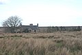
 Ruined Croft Building - geograph.org.uk - 410707.jpg 640 × 480; 82 KB
-
 Spot height 152 - geograph.org.uk - 409767.jpg 640 × 267; 56 KB
-
 Strontian Glen oakwood - geograph.org.uk - 440954.jpg 640 × 480; 177 KB
-
 Strontian water treatment plant - geograph.org.uk - 412677.jpg 640 × 480; 72 KB
-
 The fast waters of Allt nan Caileach - geograph.org.uk - 412672.jpg 640 × 480; 130 KB


