Category:April 2006 in the City of Wakefield
Media in category "April 2006 in the City of Wakefield"
The following 18 files are in this category, out of 18 total.
-
 Barnsley Road, Wakefield - geograph.org.uk - 626079.jpg 640 × 480; 66 KB
-

-
 Footpath in Haw Park Woods - geograph.org.uk - 151778.jpg 640 × 480; 171 KB
-
 Haw Park Woods - geograph.org.uk - 61761.jpg 640 × 480; 67 KB
-
 Haw Park Woods. - geograph.org.uk - 151770.jpg 640 × 480; 124 KB
-
 Haw Park Woods. - geograph.org.uk - 151772.jpg 640 × 480; 111 KB
-
 Haw Park Woods. - geograph.org.uk - 151775.jpg 640 × 480; 139 KB
-
 Haw Park Woods. - geograph.org.uk - 151780.jpg 640 × 480; 140 KB
-
 Land reclamation. - geograph.org.uk - 149758.jpg 640 × 480; 100 KB
-
 Ledger Lane, Outwood. - geograph.org.uk - 149723.jpg 640 × 480; 65 KB
-
 Lingwell Nook Lane. - geograph.org.uk - 149718.jpg 640 × 480; 69 KB
-
 Miners Memorial - geograph.org.uk - 287244.jpg 640 × 480; 122 KB
-
 Natural Totem Pole - geograph.org.uk - 413581.jpg 480 × 640; 68 KB
-
 Old and New - geograph.org.uk - 413569.jpg 640 × 480; 105 KB
-
 Outwood Railway Station - geograph.org.uk - 149721.jpg 640 × 480; 124 KB
-
 Reclaimed land. - geograph.org.uk - 149761.jpg 640 × 480; 86 KB
-
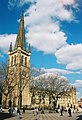
 St Peters church, Stanley. - geograph.org.uk - 149734.jpg 480 × 640; 122 KB
-