Category:April 2005 in County Down
Jump to navigation
Jump to search
English: Images taken in County Down, Northern Ireland in this month of 2005 (not the date of the upload).
| Jan | Feb | Mar | Apr | May | Jun | Jul | Aug | Sep | Oct | Nov | Dec | ||
| ← | 3 | 2 | 10 | 53 | 27 | 5 | 28 | 12 | 24 | 67 | 48 | 60 | → |
|---|
Media in category "April 2005 in County Down"
The following 53 files are in this category, out of 53 total.
-

-
 Abbey Road, Holywood - geograph.org.uk - 4846.jpg 640 × 420; 68 KB
-
 Audley's Castle, Strangford - geograph.org.uk - 3596.jpg 640 × 271; 21 KB
-
 Ballyhalbert Pier - geograph.org.uk - 3856.jpg 640 × 480; 40 KB
-
 Ballyrolly - geograph.org.uk - 4187.jpg 640 × 363; 60 KB
-
 Ballywalter - geograph.org.uk - 4191.jpg 640 × 238; 33 KB
-
 Ballywalter Harbour - geograph.org.uk - 4192.jpg 640 × 242; 23 KB
-
 Bluebells in the wood - geograph.org.uk - 6021.jpg 640 × 480; 158 KB
-
 Broom Hill - geograph.org.uk - 3834.jpg 640 × 226; 18 KB
-
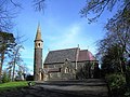
 Christ Church, Annaclone. - geograph.org.uk - 981414.jpg 640 × 480; 68 KB
-
 Church Road, Holywood - geograph.org.uk - 6006.jpg 640 × 480; 143 KB
-
 Cloghy Bay - geograph.org.uk - 3822.jpg 640 × 196; 17 KB
-
 Coast Path, Glencraig - geograph.org.uk - 5984.jpg 640 × 350; 52 KB
-
 Crawfordsburn Country Park - geograph.org.uk - 5991.jpg 640 × 375; 64 KB
-
 Cultra - geograph.org.uk - 5206.jpg 640 × 281; 29 KB
-
 Cunningburn Jetty - geograph.org.uk - 3579.jpg 640 × 480; 56 KB
-
 Donaghadee Harbour and Lighthouse - geograph.org.uk - 3868.jpg 640 × 360; 43 KB
-
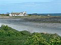
 Granagh Bay Nature Reserve - geograph.org.uk - 3601.jpg 640 × 233; 25 KB
-
 Grey Point - geograph.org.uk - 6000.jpg 640 × 310; 46 KB
-
 Halftide Rock - geograph.org.uk - 5986.jpg 640 × 363; 75 KB
-
 Helen's Bay Beach - geograph.org.uk - 6002.jpg 640 × 480; 70 KB
-
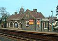
 Helen's Bay Railway Station - geograph.org.uk - 5998.jpg 640 × 455; 77 KB
-
 Helen's Bay station.jpg 1,260 × 896; 785 KB
-
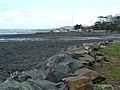
 Holywood Beach - geograph.org.uk - 5203.jpg 640 × 254; 37 KB
-
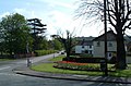
 Holywood Town Centre - geograph.org.uk - 4754.jpg 640 × 437; 49 KB
-
 Iron Field Gate - geograph.org.uk - 6007.jpg 640 × 480; 175 KB
-
 Kearney - geograph.org.uk - 3806.jpg 640 × 261; 26 KB
-
 Kiltonga Nature Reserve, Newtownards - geograph.org.uk - 3577.jpg 640 × 480; 65 KB
-
 Kircubbin Bay and Boatyard - geograph.org.uk - 3590.jpg 640 × 202; 22 KB
-
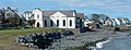
 Masonic Hall, Newtownards - geograph.org.uk - 3582.jpg 640 × 551; 49 KB
-
 Millin Bay - geograph.org.uk - 3798.jpg 640 × 368; 44 KB
-
 National Trust Land, Orlock Point - geograph.org.uk - 3863.jpg 640 × 264; 37 KB
-
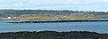
 North Down Coastal Path - geograph.org.uk - 5210.jpg 640 × 318; 33 KB
-

-

-
 Palace Barracks, Holywood - geograph.org.uk - 6020.jpg 640 × 480; 134 KB
-
 Quintin Castle - geograph.org.uk - 3802.jpg 640 × 383; 27 KB
-
 Quintin Castle crop.jpg 369 × 239; 69 KB
-

-
 Ringboy Point - geograph.org.uk - 3849.jpg 640 × 480; 58 KB
-
 Royal Belfast Golf Club, Craigavad - geograph.org.uk - 5982.jpg 640 × 391; 77 KB
-
-
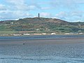 Scrabo Tower - geograph.org.uk - 3578.jpg 640 × 480; 53 KB
-
 Seafront Road, Cultra - geograph.org.uk - 5208.jpg 640 × 233; 27 KB
-
-
 Slipway at Crawfordsburn Country Park - geograph.org.uk - 5994.jpg 640 × 348; 72 KB
-
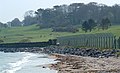
 South end of Cloughey Bay - geograph.org.uk - 3827.jpg 640 × 226; 26 KB
-
 South Rock Lighthouse - geograph.org.uk - 3813.jpg 640 × 228; 11 KB
-
 The Angus Rock, Strangford Lough - geograph.org.uk - 3608.jpg 640 × 352; 38 KB
-
 The Long Sand, Ballywalter - geograph.org.uk - 4193.jpg 640 × 267; 36 KB
-
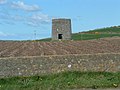 The Old Windmill, Knockinelder - geograph.org.uk - 3808.jpg 640 × 480; 57 KB
-
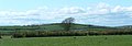
 Tieveshilly Hill - geograph.org.uk - 3793.jpg 640 × 480; 43 KB
-
 Windmill Hill, Portaferry - geograph.org.uk - 3599.jpg 640 × 327; 37 KB


