Category:Aonach Beag
Jump to navigation
Jump to search
1234m high mountain in Highland, Scotland, UK  | |||||
| Upload media | |||||
| Instance of | |||||
|---|---|---|---|---|---|
| Location | Highland, Scottish Highlands, Scotland | ||||
| Mountain range | |||||
| Topographic prominence |
| ||||
| Elevation above sea level |
| ||||
| Parent peak | |||||
| Different from | |||||
 | |||||
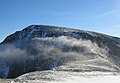
English: Aonach Beag is a mountain in the Highlands of Scotland. It is located about 3 km east of Ben Nevis on the north side of Glen Nevis, near the town of Fort William. Apart from Ben Nevis, Aonach Beag is the highest peak in the British Isles without the Cairngorm mountains of eastern Scotland.
Norsk bokmål: Aonach Beag er et fjell i Skottland, lokalisert i regionen Highland. Fjellet ligger om lag 3 kilometer øst for Ben Nevis, ikke langt fra Fort William. Aonach Beag har en høyde på 1 234 meter over havet, og en primærfaktor på 404 meter.
Polski: Aonach Beag – szczyt w paśmie Ben Nevis, w Grampianach Zachodnich. Leży w Szkocji, w regionie Highland. Jest to siódmy co do wysokości szczyt w Szkocji.
Media in category "Aonach Beag"
The following 30 files are in this category, out of 30 total.
-
 An Aghaidh Gharbh - geograph.org.uk - 185876.jpg 640 × 480; 73 KB
-
 Aonach Beag - geograph.org.uk - 112930.jpg 640 × 443; 62 KB
-
 Aonach Beag - geograph.org.uk - 221828.jpg 640 × 480; 46 KB
-
 Aonach Beag - geograph.org.uk - 3366265.jpg 2,592 × 1,944; 1.43 MB
-
 Aonach Beag 8.9.08.jpg 1,024 × 768; 379 KB
-
 Aonach Beag and the Carn Mòr Dearg Arete - geograph.org.uk - 3308668.jpg 1,600 × 1,055; 275 KB
-
 Aonach Beag and the col below Aonach Mor - geograph.org.uk - 2226510.jpg 800 × 534; 106 KB
-
 Aonach Beag from Aonach Mòr - geograph.org.uk - 3683904.jpg 4,608 × 3,456; 5.34 MB
-
 Aonach Beag from near the ruins, Glen Nevis - geograph.org.uk - 3683953.jpg 4,608 × 3,456; 4.62 MB
-
 Aonach Beag summit cairn - towards Aonach Mor - geograph.org.uk - 2488799.jpg 3,968 × 2,976; 2.95 MB
-
 Aonach Beag summit ridge - geograph.org.uk - 2488830.jpg 3,968 × 2,976; 2.79 MB
-
 Aonach beag.jpg 417 × 261; 26 KB
-
 Aonach Beag.JPG 1,107 × 1,209; 423 KB
-
 Aonach Mor - geograph.org.uk - 112928.jpg 640 × 462; 78 KB
-
 Lunchtime on Stob Coire Easain (Grey Corries).jpg 2,048 × 1,368; 1.14 MB
-
 Path leading down to the bealach and Aonach Beag - geograph.org.uk - 2488368.jpg 3,968 × 2,976; 2.93 MB
-
 Path up Aonach Beag - geograph.org.uk - 2488841.jpg 3,968 × 2,976; 2.8 MB
-
 Ridge east of Mullach nan Coirean - geograph.org.uk - 238848.jpg 640 × 478; 133 KB
-
 Rocky descent of Aonach Beag - geograph.org.uk - 2489636.jpg 3,968 × 2,976; 2.98 MB
-
 Snow cornice below Aonach Beag (from the bealach) - geograph.org.uk - 2489643.jpg 3,968 × 2,976; 3.02 MB
-
 Snow cornice below the bealach - geograph.org.uk - 2488776.jpg 3,968 × 2,976; 2.97 MB
-

-
 Stob a' Choire Leith - geograph.org.uk - 238584.jpg 640 × 480; 112 KB
-
 Summit cairn, Aonach Beag - geograph.org.uk - 2225386.jpg 800 × 533; 98 KB
-
 The cliffs of Aonach Beag - geograph.org.uk - 2488771.jpg 3,968 × 2,976; 2.92 MB
-
 The northern summit of Binnein Mor - geograph.org.uk - 526906.jpg 640 × 470; 99 KB
-
 The summit cairn on Aonach Beag - geograph.org.uk - 86883.jpg 640 × 460; 84 KB
-
 The summit ridge of Binnein Mor - geograph.org.uk - 1595928.jpg 427 × 640; 88 KB
-
 View of Ben Nevis From Binnein Mor - geograph.org.uk - 614834.jpg 640 × 445; 108 KB
-
 View west from Aonach Beag summit - geograph.org.uk - 2488789.jpg 3,968 × 2,976; 2.9 MB


.jpg)


_-_geograph.org.uk_-_2489643.jpg)


