Category:Antonius Abtkerk, Horssen
Jump to navigation
Jump to search
| Object location | | View all coordinates using: OpenStreetMap |
|---|
church building in Druten, Netherlands _Rijksmonument_22636_RK_kerk_Kerkpad_7.JPG) | |||||
| Upload media | |||||
| Instance of | |||||
|---|---|---|---|---|---|
| Location | Horssen, Gelderland, Netherlands | ||||
| Street address |
| ||||
| Located on street |
| ||||
| Architect | |||||
| Heritage designation |
| ||||
| Religion or worldview | |||||
 | |||||
Nederlands: Antonius Abtkerk, Horssen - anno 1910
|
This is a category about rijksmonument number 22636
|
| Address |
|
Subcategories
This category has only the following subcategory.
Media in category "Antonius Abtkerk, Horssen"
The following 26 files are in this category, out of 26 total.
-
 Antonius Abt kerk te Horssen (ruilverkaveling Maas en Waal), Bestanddeelnr 170-2193.jpg 2,446 × 3,671; 1.92 MB
-
 Detail buitenzijde - Horssen - 20117303 - RCE.jpg 1,200 × 881; 282 KB
-
 Detail ingang zuidzijde koor - Horssen - 20117313 - RCE.jpg 1,197 × 1,200; 473 KB
-
 Detail kapconstructie koor - Horssen - 20117309 - RCE.jpg 1,195 × 1,200; 379 KB
-
 Detail oostmuur op zolder - Horssen - 20117305 - RCE.jpg 1,197 × 1,200; 410 KB
-
 Deur - Horssen - 20117304 - RCE.jpg 1,195 × 1,200; 210 KB
-
 Galmgat van toren - Horssen - 20117315 - RCE.jpg 1,200 × 1,197; 362 KB
-
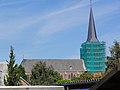 Horssen (Druten) Rijksmonument 22636 RK kerk Kerkpad 7.JPG 3,648 × 2,736; 3.77 MB
-
 Horssen (Druten) Rijksmonument 22637 2 klokken in 2 torens.JPG 3,648 × 2,736; 2.96 MB
-
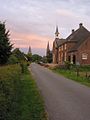
 Horssen - H Antonius abt kerk en S Bonifatiuskerk.jpg 3,200 × 2,133; 2.97 MB
-
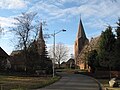
 Horssen NL 3 churches.jpg 852 × 1,136; 113 KB
-
 Horssen RM Antonius Abtkerk.jpg 2,835 × 4,566; 3.84 MB
-
 Horssen, de twee kerken foto2 2011-01-16 15.00.jpg 3,456 × 2,592; 1.24 MB
-
 Ingang zuidzijde koor - Horssen - 20117311 - RCE.jpg 1,197 × 1,200; 416 KB
-
 Ingang zuidzijde koor - Horssen - 20117312 - RCE.jpg 1,197 × 1,200; 430 KB
-
 Interieur - Horssen - 20117299 - RCE.jpg 1,200 × 869; 175 KB
-
 Interieur - Horssen - 20117300 - RCE.jpg 1,200 × 883; 181 KB
-
 Interieur naar het zuid-oosten - Horssen - 20117298 - RCE.jpg 1,200 × 883; 198 KB
-
 Kapconstructie koor - Horssen - 20117306 - RCE.jpg 1,200 × 1,195; 298 KB
-
 Kapconstructie koor - Horssen - 20117307 - RCE.jpg 1,200 × 1,195; 267 KB
-
 Kapconstructie koor - Horssen - 20117308 - RCE.jpg 1,200 × 1,188; 363 KB
-

-

-
 Overzicht van de kerk aan de noordzijde - Horssen - 20427202 - RCE.jpg 1,200 × 927; 193 KB
-
 Overzicht van de kerk, gezien vanuit het oosten - Horssen - 20427226 - RCE.jpg 927 × 1,200; 273 KB
-

,_Bestanddeelnr_170-2193.jpg)


_Rijksmonument_22637_2_klokken_in_2_torens.JPG)


