Category:Anti-tank coastal obstacles of World War II in the East Riding of Yorkshire
Jump to navigation
Jump to search
Media in category "Anti-tank coastal obstacles of World War II in the East Riding of Yorkshire"
The following 22 files are in this category, out of 22 total.
-
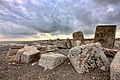
 Anti Tank blocks - geograph.org.uk - 101286.jpg 640 × 480; 57 KB
-
 Auburn Beach - geograph.org.uk - 1223896.jpg 640 × 481; 60 KB
-
 Barmston Sands - geograph.org.uk - 845084.jpg 640 × 458; 67 KB
-
 Barmston Sands - geograph.org.uk - 845087.jpg 640 × 464; 65 KB
-
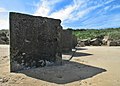
 Coastal Defences on Easington Beach - geograph.org.uk - 951810.jpg 640 × 427; 244 KB
-
 Coastal Defences on Easington Beach 2 - geograph.org.uk - 951812.jpg 640 × 427; 248 KB
-
 Coastal Defences, Double Gates - geograph.org.uk - 1326182.jpg 640 × 478; 73 KB
-
 Concrete Blocks at Kilnsea - geograph.org.uk - 785961.jpg 640 × 505; 99 KB
-
 Easington beach - panoramio.jpg 1,000 × 666; 359 KB
-
 Fraisthorpe Beach - geograph.org.uk - 1731133.jpg 3,488 × 2,616; 4.2 MB
-
 Fraisthorpe Beach - geograph.org.uk - 1731150.jpg 3,488 × 2,616; 4.38 MB
-
 Fraisthorpe Sands - geograph.org.uk - 1251589.jpg 640 × 480; 32 KB
-
 Fraisthorpe Sands - geograph.org.uk - 845108.jpg 640 × 459; 77 KB
-
 Fraisthorpe Sands - geograph.org.uk - 845116.jpg 640 × 478; 67 KB
-
 Fraisthorpe, Fraisthorpe beach, tank traps - panoramio.jpg 1,100 × 785; 372 KB
-
 Long Bank, Easington - geograph.org.uk - 304809.jpg 640 × 478; 62 KB
-
 Spurn Head - geograph.org.uk - 56.jpg 480 × 640; 30 KB
-
 Spurn Lighthouse - geograph.org.uk - 19784.jpg 640 × 480; 78 KB
-
 Wartime Coastal Defences - geograph.org.uk - 1223922.jpg 640 × 481; 63 KB
-
 Wilsthorpe Beach - geograph.org.uk - 53867.jpg 640 × 480; 88 KB
-
 Wilsthorpe Beach - geograph.org.uk - 621556.jpg 462 × 640; 76 KB
-
 Wilsthorpe Cliff - geograph.org.uk - 813164.jpg 640 × 417; 78 KB


