Category:Anti-tank barriers of World War II in the United Kingdom
Jump to navigation
Jump to search
Subcategories
This category has the following 6 subcategories, out of 6 total.
A
Media in category "Anti-tank barriers of World War II in the United Kingdom"
The following 56 files are in this category, out of 56 total.
-

-
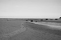
 Anti tank blocks Pefferside - geograph.org.uk - 5222876.jpg 1,024 × 683; 313 KB
-
 Anti Tank Pimples, Coast Road - geograph.org.uk - 1757907.jpg 768 × 1,024; 208 KB
-
 Anti-tank blocks Chesil Beach.jpg 2,848 × 2,136; 1.49 MB
-
 Anti-Tank Concrete Blocks, Findhorn - geograph.org.uk - 550321.jpg 640 × 427; 254 KB
-
 Anti-Tank Concrete Blocks, Findhorn Beach - geograph.org.uk - 550088.jpg 640 × 376; 212 KB
-

-
 Anti-Tank Cubes in Higham Creek - geograph.org.uk - 1087763.jpg 640 × 481; 67 KB
-
 Anti-tank cylinders - geograph.org.uk - 1441828.jpg 640 × 426; 97 KB
-
 Anti-tank defences at Cuckmere Haven (2248).jpg 4,288 × 2,848; 6.88 MB
-
 Anti-tank defences at Drurridge Bay - geograph.org.uk - 1125666.jpg 640 × 480; 60 KB
-
 Anti-tank defensive concrete blocks (geograph 3255892).jpg 1,600 × 1,113; 394 KB
-
 Anti-Tank Wall, Cuckmere Haven - geograph.org.uk - 883236.jpg 640 × 479; 105 KB
-
 Anti-tank Wall, Cuckmere Haven.JPG 1,280 × 960; 325 KB
-
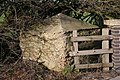
 Anti-vehicle post socket, Crookham Warf.JPG 1,600 × 1,200; 648 KB
-
 Anti-vehicle post, Crookham Warf.JPG 1,200 × 1,600; 650 KB
-
 Atlantic Wall Training, Hankley Common, Dragon's Teeth.JPG 1,600 × 1,200; 657 KB
-
 British anti tank barriers.jpg 800 × 599; 97 KB
-
 Buoy road block obstacle, surrey, uk.jpg 4,128 × 2,322; 6.47 MB
-
 Buoy, Birdham, Chichester.jpg 2,073 × 2,644; 2.51 MB
-
 Buoy, Coxbridge Farm, Farnham.jpg 2,848 × 2,136; 1.44 MB
-
 Buoy, Roadside, Sussex (cropped).JPG 1,494 × 1,974; 454 KB
-
 Chappel Viaduct 3.jpg 2,736 × 3,648; 4.13 MB
-
 Christchurch Anti-Tank Island.JPG 3,264 × 2,448; 2.64 MB
-
 Cuffley world War 2 Anti-tank Blocks - geograph.org.uk - 92099.jpg 640 × 480; 91 KB
-
 Dragons' Teeth - geograph.org.uk - 196083.jpg 638 × 383; 264 KB
-
 Dun Mill Lock World War II defences 02.jpg 4,128 × 3,096; 10.14 MB
-
 Dunstan Steads MMB 02.jpg 4,566 × 2,961; 4.77 MB
-
 East Lothian anti-tank cube.jpg 600 × 800; 183 KB
-
 Four in a row - geograph.org.uk - 1257167.jpg 400 × 600; 96 KB
-
 Hairpins in undergrowth, Narborough.jpg 2,848 × 2,136; 1.42 MB
-
 Hairpins, Narborough.jpg 2,848 × 2,136; 1.43 MB
-
 Hedgehog sockets, Nr. Crofton on Kennet and Avon Canal.JPG 1,600 × 1,200; 650 KB
-
 Home Guard memorial, River Ray, Blunsdon - geograph.org.uk - 504112.jpg 640 × 480; 356 KB
-
 Invasion Defences in the United Kingdom H1951.jpg 800 × 598; 58 KB
-
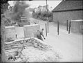
 IWM-H-7330-Road-Barrier-in-Scotland.jpg 800 × 584; 75 KB
-
 Lunan Bay - geograph.org.uk - 4830.jpg 640 × 344; 190 KB
-
 Lunan Bay Kyle Munro.JPG 3,008 × 2,000; 1.54 MB
-
 Another dragon's tooth - geograph.org.uk - 956049.jpg 640 × 426; 125 KB
-
 Dragons tooth - geograph.org.uk - 670108.jpg 640 × 427; 126 KB
-
 North from Bridge 98, near Crofton - geograph.org.uk - 1595449.jpg 640 × 480; 311 KB
-
 Obstacles on Taunton Stop Line.JPG 1,600 × 1,200; 653 KB
-
 Pillbox and Anti Tank Traps - geograph.org.uk - 595752.jpg 640 × 427; 98 KB
-
 River through the blocks - geograph.org.uk - 1228282.jpg 640 × 426; 85 KB
-
 Selly Point blocks - geograph.org.uk - 937572.jpg 640 × 426; 65 KB
-

-
 Tank Trap, Horden Dene Holme - geograph.org.uk - 1584412.jpg 640 × 480; 104 KB
-
 Tank traps next to Blacksmith's Bridge, Basingstoke Canal - geograph.org.uk - 1746711.jpg 2,592 × 1,944; 2.22 MB
-
 Tank traps, near Northam - geograph.org.uk - 1359514.jpg 640 × 480; 119 KB
-
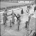
 The Home Guard 1939-45 H12852.jpg 800 × 605; 51 KB
-
 The Home Guard 1939-45 H15191.jpg 800 × 792; 81 KB
-
 The Home Guard during the Second World War H2722.jpg 800 × 607; 74 KB
-
 The tank traps at Dumbarnie Links - geograph.org.uk - 963366.jpg 640 × 480; 69 KB
-
 Three anti tank cubes - geograph.org.uk - 1034024.jpg 640 × 494; 102 KB
-
 Anti tank blocks - geograph.org.uk - 681447.jpg 640 × 480; 136 KB
-
 Dragons Teeth - Fairbourne Beach - geograph.org.uk - 1413179.jpg 640 × 480; 76 KB


.jpg)

.jpg)


.JPG)


