Category:Anthorn
Jump to navigation
Jump to search
village in Cumbria, United Kingdom  | |||||
| Upload media | |||||
| Instance of | |||||
|---|---|---|---|---|---|
| Location | Bowness, Allerdale, Cumbria, North West England, England | ||||
| Located in or next to body of water | |||||
 | |||||
English: Anthorn is a village in Cumbria, England. It is situated on the south side of the Solway Firth, on the Wampool estuary, about thirteen miles west of Carlisle. It is the location of the Anthorn transmitting station, broadcasting specialised low frequency signals for timekeeping and navigation.
Media in category "Anthorn"
The following 42 files are in this category, out of 42 total.
-
 "Who was Charlie Nugent" - geograph.org.uk - 601804.jpg 640 × 480; 212 KB
-
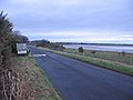 Anthorn - geograph.org.uk - 125084.jpg 640 × 480; 71 KB
-
 Anthorn, Bowness - geograph.org.uk - 40481.jpg 640 × 480; 89 KB
-
 Approaching Anthorn village - geograph.org.uk - 5344153.jpg 640 × 480; 230 KB
-
 Bungalow at Anthorn - geograph.org.uk - 5343671.jpg 640 × 480; 289 KB
-
 Buttercup meadow, Anthorn - geograph.org.uk - 4974225.jpg 640 × 480; 73 KB
-
 Close up, Elizabeth II postbox, Anthorn - geograph.org.uk - 4976083.jpg 1,233 × 2,374; 589 KB
-
 Elizabeth II postbox, Anthorn - geograph.org.uk - 4974467.jpg 1,559 × 2,878; 918 KB
-
 Elizabeth II postbox, Anthorn - geograph.org.uk - 4976078.jpg 640 × 480; 67 KB
-
 Entering Anthorn - geograph.org.uk - 3122186.jpg 800 × 600; 238 KB
-
 Entering Anthorn - geograph.org.uk - 4974200.jpg 640 × 480; 67 KB
-
 House in Anthorn - geograph.org.uk - 4974206.jpg 640 × 480; 71 KB
-
 House on Waver Road, Anthorn - geograph.org.uk - 4974220.jpg 640 × 480; 53 KB
-
 Houses in Anthorn - geograph.org.uk - 3122254.jpg 800 × 600; 213 KB
-
 Houses on The Island - Anthorn - geograph.org.uk - 4116093.jpg 4,283 × 2,303; 3.77 MB
-
 Large house, Anthorn - geograph.org.uk - 4974218.jpg 640 × 480; 77 KB
-
 Low tide at Anthorn - geograph.org.uk - 5344139.jpg 640 × 480; 250 KB
-
 Memorial Seat for Charlie Nugent - geograph.org.uk - 601811.jpg 640 × 480; 195 KB
-
 National Cycle Route 72, Anthorn - geograph.org.uk - 4974208.jpg 640 × 480; 64 KB
-
 National Cycle Route 72, Anthorn - geograph.org.uk - 4974215.jpg 640 × 480; 50 KB
-
 National Cycle Route 72, Anthorn - geograph.org.uk - 4974226.jpg 640 × 480; 64 KB
-
 National Cycle Route 72, Anthorn - geograph.org.uk - 4974473.jpg 640 × 472; 65 KB
-
 National Cycle Route 72, Anthorn - geograph.org.uk - 4976086.jpg 640 × 480; 44 KB
-
 Old building on Bowness Common - geograph.org.uk - 726774.jpg 640 × 426; 123 KB
-
 River crossing - geograph.org.uk - 125050.jpg 640 × 480; 52 KB
-
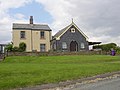
 The Chapel at Anthorn - geograph.org.uk - 3590963.jpg 2,592 × 1,944; 1.73 MB
-

-

-
 The former chapel at Anthorn - geograph.org.uk - 3122246.jpg 800 × 600; 244 KB
-
 The former chapel, Anthorn - geograph.org.uk - 4974214.jpg 640 × 480; 57 KB
-
 The River Wampool at Anthorn - geograph.org.uk - 3590954.jpg 2,592 × 1,944; 1.66 MB
-
 View towards Anthorn from Bowness Common - geograph.org.uk - 726800.jpg 640 × 426; 129 KB
-
 Wartime airfield building near Anthorn - geograph.org.uk - 5343548.jpg 640 × 480; 286 KB
-
 Waterfront at Anthorn - geograph.org.uk - 5344136.jpg 640 × 480; 231 KB
-
 Waver Road - Anthorn - geograph.org.uk - 4116090.jpg 3,878 × 3,055; 5.15 MB
-
 Anthorn Social Club - geograph.org.uk - 164268.jpg 640 × 480; 79 KB
-

-

-
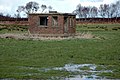 Disused brick building on Bowness Common - geograph.org.uk - 726782.jpg 640 × 426; 152 KB
-
 Flocking Barnacle Geese - geograph.org.uk - 126322.jpg 640 × 480; 62 KB
-
 Sewage Outfall - geograph.org.uk - 410000.jpg 640 × 480; 121 KB
-
 Wartime relic - geograph.org.uk - 125116.jpg 640 × 480; 72 KB


