Category:Ansty, Warwickshire
Jump to navigation
Jump to search
village and civil parish in Warwickshire, England, UK  | |||||
| Upload media | |||||
| Instance of | |||||
|---|---|---|---|---|---|
| Location | Rugby, Warwickshire, West Midlands, England | ||||
| Population |
| ||||
| Area |
| ||||
| official website | |||||
 | |||||

Subcategories
This category has the following 4 subcategories, out of 4 total.
Media in category "Ansty, Warwickshire"
The following 200 files are in this category, out of 257 total.
(previous page) (next page)-
 A minor traffic jam - geograph.org.uk - 5554620.jpg 2,000 × 1,333; 1.95 MB
-

-
 Alphabet Lodge Ansty - geograph.org.uk - 768427.jpg 640 × 421; 97 KB
-
 Ansty - geograph.org.uk - 135530.jpg 640 × 480; 151 KB
-
 Ansty - geograph.org.uk - 4337148.jpg 4,627 × 3,469; 2.21 MB
-
 Ansty -Warwickshire -main road -6j08.jpg 2,592 × 1,944; 2.43 MB
-
 Ansty Club - geograph.org.uk - 1965651.jpg 640 × 480; 55 KB
-
 Ansty Club, Ansty - geograph.org.uk - 6291097.jpg 5,456 × 3,632; 1.59 MB
-
 Ansty Golf Centre - geograph.org.uk - 5282159.jpg 4,128 × 2,322; 4.33 MB
-
 Ansty Golf Club - geograph.org.uk - 4178671.jpg 1,600 × 1,296; 561 KB
-
 Ansty Golf Course - geograph.org.uk - 4848982.jpg 640 × 426; 52 KB
-
 Ansty Golf Course - geograph.org.uk - 5177623.jpg 640 × 427; 74 KB
-
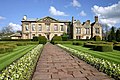
 Ansty Hall - geograph.org.uk - 3847479.jpg 1,024 × 627; 228 KB
-
 Ansty Hall Hotel - geograph.org.uk - 3976823.jpg 1,024 × 768; 162 KB
-
 Ansty Hall Hotel - geograph.org.uk - 568715.jpg 640 × 480; 141 KB
-
 Ansty Hall hotel entrance barrier - geograph.org.uk - 568713.jpg 640 × 625; 165 KB
-
 Ansty Village bridge - geograph.org.uk - 5177632.jpg 4,981 × 3,181; 7.37 MB
-
 Ansty, Coventry CV7, UK - panoramio (1).jpg 5,472 × 3,648; 5.08 MB
-
 Ansty, Coventry CV7, UK - panoramio (2).jpg 5,472 × 3,648; 5.02 MB
-
 Ansty, Coventry CV7, UK - panoramio.jpg 5,472 × 3,648; 6.3 MB
-
 Ansty, on the Northern Oxford Canal - geograph.org.uk - 30515.jpg 427 × 640; 57 KB
-
 Ansty, UK - panoramio (1).jpg 5,472 × 3,648; 11.36 MB
-
 Ansty, UK - panoramio (10).jpg 5,472 × 3,648; 4.37 MB
-
 Ansty, UK - panoramio (11).jpg 5,472 × 3,648; 9.4 MB
-
 Ansty, UK - panoramio (12).jpg 5,472 × 3,648; 7.02 MB
-
 Ansty, UK - panoramio (2).jpg 5,472 × 3,648; 10.48 MB
-
 Ansty, UK - panoramio (3).jpg 5,472 × 3,648; 9.75 MB
-
 Ansty, UK - panoramio (4).jpg 5,472 × 3,648; 5.4 MB
-
 Ansty, UK - panoramio (5).jpg 5,472 × 3,648; 5.66 MB
-
 Ansty, UK - panoramio (6) (cropped).jpg 2,917 × 2,918; 2.84 MB
-
 Ansty, UK - panoramio (6).jpg 5,472 × 3,648; 5.81 MB
-
 Ansty, UK - panoramio (7).jpg 5,472 × 3,648; 9.13 MB
-
 Ansty, UK - panoramio (8).jpg 5,472 × 3,648; 8.26 MB
-
 Ansty, UK - panoramio (9).jpg 5,472 × 3,648; 7.1 MB
-
 Ansty, UK - panoramio.jpg 5,472 × 3,648; 8.54 MB
-
 Ansty-Derelict Farm - geograph.org.uk - 1965655.jpg 640 × 480; 94 KB
-
 Ansty-Main Road - geograph.org.uk - 1965659.jpg 640 × 418; 49 KB
-
 Ansty-Oxford Canal - geograph.org.uk - 1965259.jpg 640 × 480; 75 KB
-
 Approaching M6 junction 2 southbound - geograph.org.uk - 2071227.jpg 640 × 480; 60 KB
-
 Arable farmland west of Ansty in Warwickshire - geograph.org.uk - 5723073.jpg 1,600 × 893; 1.56 MB
-
 B4029 near Ansty - geograph.org.uk - 5282162.jpg 2,322 × 4,128; 4.24 MB
-
 B4029 towards Shilton - geograph.org.uk - 5219248.jpg 640 × 480; 55 KB
-
 B4065 Main Road in Ansty - geograph.org.uk - 4179655.jpg 1,600 × 1,334; 511 KB
-
 Binley Woods, near Coventry - geograph.org.uk - 29351.jpg 640 × 480; 75 KB
-

-
 Bridge 11, Carter's Bridge - geograph.org.uk - 4468877.jpg 1,024 × 802; 308 KB
-
 Bridge 13, Noonhill Bridge - geograph.org.uk - 4468929.jpg 1,024 × 795; 290 KB
-
 Bridge 13A, M69 Motorway Bridge - geograph.org.uk - 4468940.jpg 1,024 × 724; 163 KB
-
 Bridge 16 crossing the Oxford Canal in Ansty - geograph.org.uk - 4179606.jpg 1,600 × 1,264; 524 KB
-

-

-

-
 Bridge ^11 Carter's Bridge, Oxford Canal - geograph.org.uk - 6250804.jpg 1,600 × 1,065; 727 KB
-
 Bridge ^13, Oxford Canal - geograph.org.uk - 6250808.jpg 1,600 × 1,065; 765 KB
-
 Bridge ^13a M69, Oxford Canal - geograph.org.uk - 6250809.jpg 1,600 × 1,065; 648 KB
-
 Bridge ^14 Main Road, Oxford Canal - geograph.org.uk - 6250810.jpg 1,600 × 1,065; 723 KB
-
 Bridge ^16, Oxford Canal - geograph.org.uk - 6250814.jpg 1,600 × 1,065; 728 KB
-
 Bridge ^17 B4029, Oxford Canal - geograph.org.uk - 6251373.jpg 1,600 × 1,065; 762 KB
-
 Bridge ^19 Hollyhill Bridge, Oxford Canal - geograph.org.uk - 6251375.jpg 1,600 × 1,065; 895 KB
-
 Brookfield Farm - geograph.org.uk - 6289285.jpg 5,456 × 3,632; 1.29 MB
-
 Brookfield Farm along the Oxford Canal - geograph.org.uk - 4468862.jpg 1,024 × 751; 219 KB
-
 Canal boat Benson, Oxford canal - geograph.org.uk - 6289380.jpg 5,456 × 3,632; 1.15 MB
-
 Canal boat Boaty McBoatface, Oxford canal - geograph.org.uk - 6289384.jpg 5,456 × 3,632; 1.52 MB
-
 Canal boat Damsefly, Oxford canal - geograph.org.uk - 6287593.jpg 5,456 × 3,632; 2.26 MB
-
 Canal boat Invincible, Oxford canal - geograph.org.uk - 6291020.jpg 5,456 × 3,632; 1.6 MB
-
 Canal boat Pegasus, Oxford canal - geograph.org.uk - 6291110.jpg 5,456 × 3,632; 1.64 MB
-
 Canal boat Rowdyke, Oxford canal - geograph.org.uk - 6289378.jpg 5,456 × 3,632; 1.45 MB
-
 Canal boat Trafalgar, Oxford canal - geograph.org.uk - 6289388.jpg 5,456 × 3,632; 1.81 MB
-
 Canal overbridge at Ansty - geograph.org.uk - 4384867.jpg 4,256 × 2,832; 4.52 MB
-
 Canalside beer garden in Ansty, Warwickshire - geograph.org.uk - 5723087.jpg 1,280 × 817; 1.33 MB
-
 Canalside gardens in Ansty, Warwickshire - geograph.org.uk - 5723081.jpg 1,280 × 960; 1.62 MB
-
 Canalside gardens in Ansty, Warwickshire - geograph.org.uk - 5723084.jpg 1,280 × 960; 1.81 MB
-
 Car park at Ansty Hall hotel - geograph.org.uk - 3141336.jpg 1,024 × 768; 157 KB
-
 Coombe Abbey hotel - geograph.org.uk - 290218.jpg 640 × 427; 115 KB
-
 Cottages in Ansty - geograph.org.uk - 4337133.jpg 4,449 × 3,337; 2.76 MB
-
 Countryside by the WCML - geograph.org.uk - 4902602.jpg 640 × 426; 35 KB
-
 Coventry Way joins the Oxford Canal - geograph.org.uk - 6291301.jpg 5,456 × 3,632; 2.56 MB
-
 Crop field near Ansty - geograph.org.uk - 5219249.jpg 640 × 480; 68 KB
-

-
 Cross Point Tesco Extra - geograph.org.uk - 172376.jpg 640 × 480; 78 KB
-
 Crowner Fields - geograph.org.uk - 1965248.jpg 640 × 480; 84 KB
-
 Entrance to Ansty Hall Hotel - geograph.org.uk - 4180825.jpg 1,600 × 1,200; 625 KB
-

-
 Farm buildings at Ansty, 1981 - geograph.org.uk - 4789202.jpg 500 × 800; 89 KB
-
 Farmland and bales - geograph.org.uk - 4468806.jpg 1,024 × 789; 253 KB
-
 Farmland and bales near the Oxford Canal - geograph.org.uk - 4468833.jpg 1,024 × 720; 146 KB
-
 Farmland by the West Coast Main Line - geograph.org.uk - 2842075.jpg 640 × 430; 26 KB
-
 Fields to the south of Oxford canal - geograph.org.uk - 6287611.jpg 5,456 × 3,632; 1.29 MB
-
 Former bridge on the Oxford Canal - geograph.org.uk - 6291295.jpg 5,456 × 3,632; 2.06 MB
-
 Former bridge site east of Ansty, Warwickshire - geograph.org.uk - 5723177.jpg 1,280 × 839; 1.42 MB
-
 Former bridge site east of Ansty, Warwickshire - geograph.org.uk - 5723206.jpg 1,280 × 881; 1.39 MB
-
 Frozen canal at Ansty, 1981 - geograph.org.uk - 4789182.jpg 800 × 498; 67 KB
-
 Frozen canal at Ansty, 1981 - geograph.org.uk - 4789229.jpg 800 × 510; 130 KB
-
 Gas installation, Coventry - geograph.org.uk - 1748226.jpg 2,000 × 1,422; 211 KB
-
 Graffiti underneath Squires Bridge - geograph.org.uk - 4179573.jpg 1,600 × 1,200; 393 KB
-
 Grazing land by the West Coast Main Line - geograph.org.uk - 2228611.jpg 640 × 430; 120 KB
-
 Grove Road, Ansty - geograph.org.uk - 6291015.jpg 5,456 × 3,632; 1.05 MB
-
 Grove Road, Ansty - geograph.org.uk - 6291017.jpg 5,456 × 3,632; 1.48 MB
-
 Heading north west on the B4029 - geograph.org.uk - 5219251.jpg 640 × 480; 43 KB
-
 Helicopter in front of Ansty Hall Hotel - geograph.org.uk - 4180845.jpg 1,600 × 1,207; 572 KB
-
 Hinckley Road crossing the M69 motorway - geograph.org.uk - 4179677.jpg 1,600 × 1,165; 584 KB
-
 Hollyhill Bridge - geograph.org.uk - 5177619.jpg 5,184 × 3,456; 7.21 MB
-
 Hollyhill Bridge crossing the Oxford Canal - geograph.org.uk - 4178613.jpg 1,600 × 1,200; 647 KB
-
 Hollyhill Bridge crossing the Oxford Canal - geograph.org.uk - 4178630.jpg 1,600 × 1,266; 733 KB
-
 Hollyhill Bridge east of Ansty in Warwickshire - geograph.org.uk - 5723155.jpg 1,280 × 920; 1.43 MB
-
 Home Farm - geograph.org.uk - 1963376.jpg 640 × 480; 79 KB
-
 Hopsford Hall Farm - geograph.org.uk - 3856550.jpg 640 × 430; 56 KB
-
 Hopsford Hall Farm - geograph.org.uk - 6489239.jpg 1,024 × 590; 110 KB
-
 Hopsford Viaduct - geograph.org.uk - 3976813.jpg 1,024 × 768; 271 KB
-
 Hopsford Viaduct and the Oxford Canal - geograph.org.uk - 4178496.jpg 1,600 × 1,205; 468 KB
-
 Horses next to Noonhill Farm - geograph.org.uk - 4468921.jpg 1,024 × 849; 217 KB
-
 Houses on Main Road, Ansty - geograph.org.uk - 5219257.jpg 640 × 456; 46 KB
-
 Junction 2, Southbound M6 - geograph.org.uk - 3677758.jpg 640 × 480; 239 KB
-
 Kenilworth from the air - geograph.org.uk - 5835517.jpg 3,264 × 2,448; 3.93 MB
-
 Looking north along the M69 motorway - geograph.org.uk - 4179735.jpg 1,600 × 1,280; 539 KB
-
 M6 approaching junction 2 - geograph.org.uk - 554756.jpg 640 × 480; 111 KB
-
 M6 Motorway - geograph.org.uk - 3677775.jpg 640 × 480; 238 KB
-
 M6 motorway - geograph.org.uk - 554758.jpg 640 × 480; 139 KB
-
 M6 Motorway - Junction 2 bridges - geograph.org.uk - 1818380.jpg 640 × 480; 135 KB
-

-
 M6 Motorway at junction 2 - geograph.org.uk - 1818383.jpg 640 × 480; 147 KB
-
 M6 motorway at junction 2 - geograph.org.uk - 2071238.jpg 640 × 466; 67 KB
-
 M6 motorway at junction 2 - geograph.org.uk - 4455912.jpg 1,024 × 656; 172 KB
-
 M6 motorway beyond junction 2 - geograph.org.uk - 1818386.jpg 640 × 480; 144 KB
-
 M6 motorway bridge - geograph.org.uk - 661520.jpg 640 × 338; 55 KB
-
 M6 Motorway near Crowner Fields Farm - geograph.org.uk - 1818391.jpg 640 × 480; 78 KB
-
 M6 northbound at Junction 2 - geograph.org.uk - 4599720.jpg 1,200 × 852; 299 KB
-
 M6 roadsign - geograph.org.uk - 554749.jpg 640 × 480; 107 KB
-
 M6 west of Junction 2 westbound - geograph.org.uk - 4593104.jpg 2,256 × 1,496; 732 KB
-
 M6, Exit Sliproad at Junction 2 - geograph.org.uk - 3665058.jpg 640 × 480; 252 KB
-
 M6-M69 Interchange - geograph.org.uk - 3677773.jpg 640 × 480; 250 KB
-
 M69 crossing the Oxford Canal - geograph.org.uk - 3588143.jpg 640 × 480; 65 KB
-
 M69 half mile to M6 junction - geograph.org.uk - 4592816.jpg 2,256 × 1,496; 870 KB
-
 M69 joins the A46 - geograph.org.uk - 5156892.jpg 2,847 × 1,893; 2.1 MB
-
 M69 motorway - geograph.org.uk - 5302983.jpg 4,128 × 2,322; 4.95 MB
-
 M69 motorway near Ansty - geograph.org.uk - 3588145.jpg 640 × 480; 73 KB
-

-
 M69 slip road to M6 westbound - geograph.org.uk - 4593099.jpg 2,256 × 1,496; 793 KB
-
 Main Road Bridge - geograph.org.uk - 1963389.jpg 640 × 480; 79 KB
-

-

-

-
 Moorings east of Bedworth in Warwickshire - geograph.org.uk - 5723369.jpg 1,280 × 960; 1.53 MB
-
 Narrowboat approaching Hollyhill Bridge - geograph.org.uk - 4178542.jpg 1,600 × 1,138; 823 KB
-
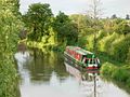
 Narrowboat on the Oxford Canal - geograph.org.uk - 4178530.jpg 1,600 × 1,318; 588 KB
-
 Narrowboats along the Oxford Canal - geograph.org.uk - 4468779.jpg 1,024 × 752; 256 KB
-

-
 No. 14 Ansty Village Bridge crossing the Oxford Canal - geograph.org.uk - 4179635.jpg 1,200 × 1,600; 555 KB
-
 Noonhill Farm - geograph.org.uk - 5177660.jpg 5,184 × 3,456; 5.61 MB
-
 North along the B4065 towards Shilton - geograph.org.uk - 4180871.jpg 1,600 × 1,171; 439 KB
-
 Northern Oxford Canal, Ansty - geograph.org.uk - 768424.jpg 640 × 503; 79 KB
-
 Outside the Ansty Club - geograph.org.uk - 6381692.jpg 1,280 × 851; 361 KB
-
 Overgrown towpath of the Oxford Canal - geograph.org.uk - 4178652.jpg 1,600 × 1,200; 667 KB
-
 Oxford Canal -Ansty bridge 19j08.jpg 2,592 × 1,944; 2.76 MB
-
 Oxford Canal -eastward from Ansty bridge 19j08.jpg 2,592 × 1,944; 2.91 MB
-
 Oxford Canal and towpath - geograph.org.uk - 4468903.jpg 1,024 × 761; 225 KB
-
 Oxford Canal and towpath near Noonhill Farm - geograph.org.uk - 4468913.jpg 1,024 × 738; 253 KB
-
 Oxford canal at Ansty - geograph.org.uk - 4384743.jpg 4,256 × 2,832; 4.54 MB
-
 Oxford Canal at Ansty - geograph.org.uk - 4667992.jpg 640 × 427; 83 KB
-
 Oxford canal at former Bridge ^15 - geograph.org.uk - 6291140.jpg 5,456 × 3,632; 2.13 MB
-
 Oxford Canal at Hopsford Aqueduct - geograph.org.uk - 4668009.jpg 640 × 427; 83 KB
-
 Oxford Canal east of Ansty - geograph.org.uk - 4668004.jpg 640 × 427; 84 KB
-
 Oxford Canal east of Ansty in Warwickshire - geograph.org.uk - 5723165.jpg 1,280 × 852; 1.56 MB
-
 Oxford Canal east of Ansty in Warwickshire - geograph.org.uk - 5723171.jpg 1,280 × 870; 1.6 MB
-
 Oxford Canal near Ansty - geograph.org.uk - 5219253.jpg 640 × 480; 58 KB
-
 Oxford Canal near Brookfield Farm - geograph.org.uk - 4468893.jpg 1,024 × 768; 206 KB
-
 Oxford Canal near Potters Green - geograph.org.uk - 5045997.jpg 640 × 427; 95 KB
-
 Oxford canal towards Bridge ^11 - geograph.org.uk - 6287599.jpg 5,456 × 3,632; 1.76 MB
-
 Oxford canal towards Bridge ^11 - geograph.org.uk - 6287606.jpg 5,456 × 3,632; 1.37 MB
-
 Oxford canal towards Bridge ^11 - geograph.org.uk - 6289283.jpg 5,456 × 3,632; 1.54 MB
-
 Oxford canal towards Bridge ^12 - geograph.org.uk - 6289288.jpg 5,456 × 3,632; 1.17 MB
-
 Oxford canal towards Bridge ^12 - geograph.org.uk - 6289291.jpg 5,456 × 3,632; 1.45 MB
-
 Oxford canal towards Bridge ^14 - geograph.org.uk - 6291009.jpg 5,456 × 3,632; 844 KB
-
 Oxford canal towards Bridge ^14 - geograph.org.uk - 6291104.jpg 5,456 × 3,632; 1.28 MB
-
 Oxford canal towards Bridge ^15 - geograph.org.uk - 6291119.jpg 5,456 × 3,632; 1.65 MB
-
 Oxford canal towards Bridge ^17 - geograph.org.uk - 6291144.jpg 5,456 × 3,632; 1.48 MB
-
 Oxford canal towards Bridge ^19 - geograph.org.uk - 6291162.jpg 5,456 × 3,632; 2.13 MB
-
 Oxford canal towards Bridge ^20 - geograph.org.uk - 6291170.jpg 5,456 × 3,632; 1.92 MB
-
 Oxford canal towards Bridge ^24 - geograph.org.uk - 6291300.jpg 5,456 × 3,632; 1.95 MB
-
 Oxford Canal Walk - geograph.org.uk - 5207845.jpg 640 × 480; 85 KB
-
 Oxford Canal Walk - geograph.org.uk - 5207851.jpg 640 × 480; 102 KB
-
 Oxford Canal Walk - geograph.org.uk - 5207860.jpg 640 × 480; 78 KB
-
 Oxford Canal Walk - geograph.org.uk - 5207862.jpg 640 × 480; 75 KB
-
 Oxford Canal Walk - geograph.org.uk - 5214165.jpg 640 × 480; 89 KB
-
 Oxford Canal west of Ansty - geograph.org.uk - 4667996.jpg 640 × 427; 92 KB
-
 Oxford Canal, Ansty - geograph.org.uk - 190244.jpg 640 × 480; 89 KB
-
 Oxford Canal, Ansty - geograph.org.uk - 190256.jpg 640 × 480; 100 KB
-
 Oxford Canal, Ansty - geograph.org.uk - 6381679.jpg 1,280 × 851; 446 KB
-

-

-

-

-
 Oxford Canal, Bridge Number 16 - geograph.org.uk - 3151761.jpg 640 × 480; 68 KB
-

-

-
 Oxford Canal, Hopsford Aqueduct - geograph.org.uk - 3153000.jpg 640 × 480; 73 KB
-

-
 Oxford Canal, Reach west of Ansty - geograph.org.uk - 3151531.jpg 640 × 480; 49 KB
-
 Oxford Canal-Centenary Way - geograph.org.uk - 6325581.jpg 1,600 × 1,200; 716 KB
-
 Paynes Cottage near bridge 14, Oxford Canal - geograph.org.uk - 6291113.jpg 5,456 × 3,632; 1.22 MB


.jpg)
.jpg)


.jpg)
.jpg)
.jpg)
.jpg)
.jpg)
.jpg)
.jpg)
.jpg)
_(cropped).jpg)
.jpg)
.jpg)
.jpg)
.jpg)


_junction_2_-_geograph.org.uk_-_3588146.jpg)


_-_geograph.org.uk_-_3151728.jpg)


