Category:Ansley, Warwickshire
Jump to navigation
Jump to search
village and civil parish in Warwickshire, England, UK  | |||||
| Upload media | |||||
| Instance of | |||||
|---|---|---|---|---|---|
| Location | North Warwickshire, Warwickshire, West Midlands, England | ||||
| Population |
| ||||
| Area |
| ||||
 | |||||
English: Ansley is a village and civil parish in the North Warwickshire district of Warwickshire, England. The parish includes Ansley Common, Ansley Hall, and formerly Ansley Hall Colliery. The village is just to the west of Nuneaton, and near Arley, Astley and Church End.
Subcategories
This category has the following 2 subcategories, out of 2 total.
A
- Ansley War Memorial (1 F)
L
Media in category "Ansley, Warwickshire"
The following 123 files are in this category, out of 123 total.
-

-
 49-53 Birmingham Road, Ansley - geograph.org.uk - 1888773.jpg 640 × 480; 80 KB
-

-
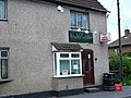
 Ansley (wet) Fish Bar - geograph.org.uk - 73045.jpg 480 × 640; 119 KB
-
 Ansley Church Hall - geograph.org.uk - 72144.jpg 480 × 640; 103 KB
-

-
 Ansley Common - geograph.org.uk - 5584443.jpg 1,600 × 900; 346 KB
-
 Ansley Common seen from Bret's Hall Wood - geograph.org.uk - 1873186.jpg 640 × 480; 132 KB
-
 Ansley Fish Bar, Birmingham Road, Ansley - geograph.org.uk - 1888703.jpg 640 × 480; 114 KB
-
 Ansley Lane junction - geograph.org.uk - 5286226.jpg 1,600 × 901; 693 KB
-
 Ansley Post Office - geograph.org.uk - 5584356.jpg 1,600 × 900; 354 KB
-
 Autumnal tree by the road - geograph.org.uk - 5577366.jpg 900 × 1,600; 376 KB
-
 B4114 Coleshill Road at Chapel End - geograph.org.uk - 4826662.jpg 800 × 552; 101 KB
-
 B4114 Coleshill Road in Ansley Common - geograph.org.uk - 4826648.jpg 800 × 541; 103 KB
-
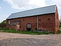 Barn at Slack's Farm - geograph.org.uk - 1868533.jpg 640 × 480; 87 KB
-
 Birchley Heath Road - geograph.org.uk - 5253911.jpg 1,469 × 1,102; 756 KB
-

-
 Birmingham Road, Ansley - geograph.org.uk - 5286222.jpg 1,600 × 901; 609 KB
-
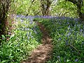 Bluebell walk - geograph.org.uk - 1861719.jpg 2,048 × 1,536; 1.43 MB
-
 Bluebells and mature trees - geograph.org.uk - 1872684.jpg 640 × 480; 163 KB
-
 Bluebells in Birchley Wood - geograph.org.uk - 1866730.jpg 640 × 480; 161 KB
-
 Bluebells in The Birchleys - geograph.org.uk - 1865441.jpg 640 × 480; 167 KB
-

-
 Bret's Hall Farm, Ansley Common - geograph.org.uk - 1873159.jpg 640 × 480; 41 KB
-
 Bret's Hall Wood - geograph.org.uk - 1876914.jpg 640 × 480; 122 KB
-
 Bridge leading to Ansley - geograph.org.uk - 1883726.jpg 480 × 640; 134 KB
-
 Brook House Farm - geograph.org.uk - 1864357.jpg 640 × 480; 56 KB
-
 Brook House Farm, Ansley - geograph.org.uk - 1890778.jpg 640 × 480; 65 KB
-
 Buildings at Slack's Farm - geograph.org.uk - 1868521.jpg 640 × 480; 80 KB
-
 Buildings at Slacks Farm - geograph.org.uk - 1868494.jpg 640 × 480; 82 KB
-
 Bungalows, Nursery Road, Ansley Common - geograph.org.uk - 1873061.jpg 640 × 480; 112 KB
-
 Bus and chip shop, Ansley - geograph.org.uk - 1888631.jpg 640 × 480; 72 KB
-
-

-
 Church End - geograph.org.uk - 5584367.jpg 1,600 × 900; 362 KB
-
 Cottage Farm on Birchley Heath Road - geograph.org.uk - 2882124.jpg 640 × 425; 63 KB
-

-
 Course of old railway - geograph.org.uk - 1864279.jpg 640 × 480; 176 KB
-
 Croft Mead, Ansley village - geograph.org.uk - 3355186.jpg 1,024 × 768; 162 KB
-
-

-
 Distant view of The Rookery - geograph.org.uk - 1866777.jpg 640 × 480; 108 KB
-
 Diverted footpath at Slack's Farm - geograph.org.uk - 1872665.jpg 640 × 480; 101 KB
-
 East end of Ridge Lane, west of Nuneaton - geograph.org.uk - 3355022.jpg 1,024 × 768; 274 KB
-
-
 Every Which Way - geograph.org.uk - 6193977.jpg 3,096 × 4,128; 3.15 MB
-

-
 Field near Birchley Heath - geograph.org.uk - 1860395.jpg 480 × 640; 144 KB
-
 Field near Ox Hayes Farm - geograph.org.uk - 1868324.jpg 640 × 480; 116 KB
-
 Footpath diversion notice - geograph.org.uk - 1872678.jpg 640 × 480; 110 KB
-

-

-

-
 Footpath near Village Farm, Ansley - geograph.org.uk - 1890700.jpg 640 × 480; 87 KB
-
-
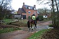 Ford and Rider at Ansley Mill Ford - geograph.org.uk - 3238635.jpg 3,872 × 2,592; 2.34 MB
-
 Former pithead baths, Ansley Hall Colliery - geograph.org.uk - 4034691.jpg 1,280 × 960; 252 KB
-
-
 Furnace End Car Boot Sale site - geograph.org.uk - 1864372.jpg 640 × 480; 84 KB
-
 HGV storage at Village Farm, Ansley - geograph.org.uk - 1890691.jpg 640 × 480; 87 KB
-
 HGV storage at Village Farm, Ansley - geograph.org.uk - 1890706.jpg 640 × 480; 74 KB
-

-
 Housing on Pipers Lane, west of Nuneaton - geograph.org.uk - 3355007.jpg 1,024 × 768; 317 KB
-

-
 Lady Wood Farm, Ridge Lane - geograph.org.uk - 1864263.jpg 640 × 480; 65 KB
-
 Lady Wood Farm, Ridge Lane - geograph.org.uk - 1868336.jpg 640 × 480; 96 KB
-
 Lane to Ansley Mill - geograph.org.uk - 1864353.jpg 640 × 480; 97 KB
-
 Leafy Walk - geograph.org.uk - 1861715.jpg 1,536 × 2,048; 1.43 MB
-
 Line of old railway, off Oldbury Road - geograph.org.uk - 1868463.jpg 640 × 480; 112 KB
-
 Little Brook Farm, Ansley - geograph.org.uk - 1890714.jpg 640 × 480; 95 KB
-

-
 Ludford Close - geograph.org.uk - 5584361.jpg 1,600 × 900; 336 KB
-
 Ludford Close, Ansley - geograph.org.uk - 1883747.jpg 640 × 480; 126 KB
-
 Mill Lane - geograph.org.uk - 5286230.jpg 1,600 × 901; 706 KB
-
 New pond on Oldbury Road - geograph.org.uk - 1868403.jpg 640 × 480; 165 KB
-
 Newly dug pond - geograph.org.uk - 1872783.jpg 640 × 480; 140 KB
-
 North end of Pipers Lane, west of Nuneaton - geograph.org.uk - 3355014.jpg 1,024 × 768; 170 KB
-
 Nursery Hill Primary School - geograph.org.uk - 1864290.jpg 640 × 480; 78 KB
-
 Nursery Hill Primary School - geograph.org.uk - 1872788.jpg 640 × 480; 112 KB
-
 Nursery Hill Primary School - geograph.org.uk - 1872796.jpg 640 × 480; 140 KB
-
 Nuthurst Crescent, Ansley village - geograph.org.uk - 3355175.jpg 1,024 × 768; 129 KB
-
 Old railway bridge abutments, Ridge Lane - geograph.org.uk - 1864269.jpg 640 × 480; 133 KB
-
 Old railway embankment - geograph.org.uk - 1872751.jpg 640 × 480; 139 KB
-
 On the very edge - geograph.org.uk - 5584437.jpg 1,600 × 900; 516 KB
-
 Open countryside - geograph.org.uk - 5584427.jpg 1,600 × 900; 239 KB
-
 Open farmland - geograph.org.uk - 5577359.jpg 1,600 × 900; 220 KB
-
 Path to Brook House Farm - geograph.org.uk - 1864348.jpg 640 × 480; 82 KB
-
 Pipers Lane at Ansley Common - geograph.org.uk - 4826401.jpg 800 × 511; 169 KB
-
 Playing field at Birchley Heath - geograph.org.uk - 2882111.jpg 640 × 425; 71 KB
-
 Pond near Church End - geograph.org.uk - 6193969.jpg 4,128 × 3,096; 3.05 MB
-
 Pond to the east of Lady Wood Farm - geograph.org.uk - 1868352.jpg 640 × 480; 173 KB
-
 Railway cutting, Ansley - geograph.org.uk - 6193966.jpg 3,096 × 4,128; 2.79 MB
-
 Rear of houses in Ridge Lane - geograph.org.uk - 1868383.jpg 640 × 480; 108 KB
-

-
 Rye Hills Farm - geograph.org.uk - 5577371.jpg 1,600 × 900; 243 KB
-
 Small playground - geograph.org.uk - 4144457.jpg 1,280 × 853; 250 KB
-
 South end of Birmingham Road, Ansley - geograph.org.uk - 3355169.jpg 1,024 × 768; 169 KB
-
 Stockpile of chippings, Oldbury Road - geograph.org.uk - 1868438.jpg 640 × 480; 94 KB
-
 Sunbathing calf - geograph.org.uk - 1861726.jpg 2,048 × 1,536; 1.4 MB
-

-
 The Boot Inn, Ansley - geograph.org.uk - 1864330.jpg 640 × 480; 71 KB
-

-

-

-

-

-
 The rear of Ox Hayes Farm - geograph.org.uk - 1865465.jpg 640 × 480; 50 KB
-
 The Rookery and The Birchleys - geograph.org.uk - 1866642.jpg 640 × 480; 103 KB
-
 The Rookery, Birchley Heath - geograph.org.uk - 1864258.jpg 640 × 480; 78 KB
-
 The Rookery, Birchley Heath - geograph.org.uk - 1866574.jpg 640 × 480; 101 KB
-
 Thomas William Hextall (48994599098).jpg 1,803 × 1,906; 3.5 MB
-
 Towards Birchley Heath - geograph.org.uk - 1861711.jpg 640 × 480; 148 KB
-
 Trees form a canopy in Oldbury Road - geograph.org.uk - 1868419.jpg 640 × 480; 154 KB
-
 Unusual raised manholes - geograph.org.uk - 1883734.jpg 640 × 480; 108 KB
-
 Very wide bridleway or 'green lane' - geograph.org.uk - 1865530.jpg 640 × 480; 132 KB
-
 View across Nuneaton - geograph.org.uk - 4826639.jpg 800 × 490; 136 KB
-
 West View, Ansley Common - geograph.org.uk - 1873127.jpg 640 × 480; 93 KB
-
 Where's my mummy^ - geograph.org.uk - 1861725.jpg 2,048 × 1,536; 1.35 MB
-
 Wood Lane - geograph.org.uk - 5577405.jpg 900 × 1,600; 371 KB
-
 Woodland at Wood Lane - geograph.org.uk - 1864381.jpg 640 × 480; 92 KB
-

-
 Ansley Mill and Ford. - geograph.org.uk - 70532.jpg 640 × 480; 109 KB
-
 Ansley Social Club - geograph.org.uk - 72142.jpg 640 × 480; 136 KB


_Fish_Bar_-_geograph.org.uk_-_73045.jpg)


.jpg)


