Category:Annaclone
Jump to navigation
Jump to search
English: Annaclone is a small village and civil parish in County Down, Northern Ireland, between Rathfriland and Banbridge.
village in United Kingdom  | |||||
| Upload media | |||||
| Instance of | |||||
|---|---|---|---|---|---|
| Location | County Down, Northern Ireland | ||||
 | |||||
Media in category "Annaclone"
The following 59 files are in this category, out of 59 total.
-

-
 Agricultural traffic jam on Fernhill Road - geograph.org.uk - 2874894.jpg 1,024 × 767; 150 KB
-
 Agricultural traffic on Ballynafern Road - geograph.org.uk - 2893038.jpg 1,024 × 623; 124 KB
-
 Annaclone Catholic Chapel and Presbytery - geograph.org.uk - 2875876.jpg 896 × 1,024; 197 KB
-
 Annaclone Chapel and Graveyard - geograph.org.uk - 2874848.jpg 1,024 × 768; 213 KB
-
 Annaclone Chapel from Fernhill - geograph.org.uk - 2893079.jpg 1,024 × 753; 246 KB
-
 Annaclone Presbyterian Church - geograph.org.uk - 551504.jpg 640 × 480; 112 KB
-
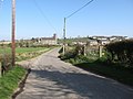
 Annaclone village from Sentry Box Road - geograph.org.uk - 2874906.jpg 1,024 × 669; 75 KB
-
-
 Approaching Annaclone along the Fernhill Road - geograph.org.uk - 2874850.jpg 1,024 × 768; 164 KB
-
 Christ Church, Annaclone. - geograph.org.uk - 551507.jpg 640 × 480; 98 KB
-
 Christ Church, Annaclone. - geograph.org.uk - 981414.jpg 640 × 480; 68 KB
-
 Cottages on Sentry Box Road - geograph.org.uk - 2880224.jpg 1,024 × 673; 134 KB
-
 Daffodils on Fernhill Road - geograph.org.uk - 2893094.jpg 768 × 1,024; 286 KB
-
 Descending Fernhill Road - geograph.org.uk - 2893063.jpg 1,024 × 750; 146 KB
-
 Farm on the Ballyfern Road - geograph.org.uk - 2893031.jpg 640 × 479; 75 KB
-
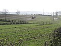
 Farmland west of Fernhill Road - geograph.org.uk - 2879811.jpg 1,024 × 590; 125 KB
-
 Farmstead on Sentry Box Road - geograph.org.uk - 2874902.jpg 1,024 × 768; 149 KB
-
 Fernhill Road - geograph.org.uk - 567226.jpg 640 × 480; 77 KB
-
 Fernhill Road at the junction with Millvale Road - geograph.org.uk - 2893065.jpg 1,024 × 768; 193 KB
-
 Housing estate at Tanvally, Annaclone - geograph.org.uk - 2879242.jpg 1,024 × 768; 291 KB
-
 Leaving Annaclone towards Rathfriland on the B10 - geograph.org.uk - 2876757.jpg 1,002 × 1,024; 145 KB
-
 Millvale Road, Annaclone - geograph.org.uk - 800021.jpg 640 × 480; 82 KB
-

-
-
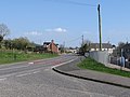
 Monteith Road, Annaclone - geograph.org.uk - 2876706.jpg 1,024 × 768; 203 KB
-

-
 Roofless farm building on the Millvale Road - geograph.org.uk - 2880119.jpg 1,024 × 766; 237 KB
-
 St Colman's Chapel and Graveyard - geograph.org.uk - 2879808.jpg 1,024 × 768; 190 KB
-
 St Colman's Primary School, Annaclone - geograph.org.uk - 2879531.jpg 1,024 × 768; 194 KB
-
 St. Colman's Church - geograph.org.uk - 567215.jpg 640 × 480; 97 KB
-
 Tanvally Road, Annaclone - geograph.org.uk - 2878858.jpg 1,024 × 768; 211 KB
-

-
-
 The Catholic Presbytery at Annaclone - geograph.org.uk - 2874358.jpg 1,024 × 657; 115 KB
-
 The former Monteith National School - geograph.org.uk - 2879537.jpg 1,024 × 710; 162 KB
-

-

-
 The interior of St Colman's Church, Annaclone - geograph.org.uk - 2875912.jpg 1,024 × 727; 152 KB
-
 The junction of Fernhill and Millvale Roads - geograph.org.uk - 2874864.jpg 1,024 × 767; 186 KB
-

-
 The junction of Millvale and Fernhill Roads - geograph.org.uk - 2874869.jpg 1,024 × 768; 164 KB
-

-
 The lower northern end of Fernhill Road - geograph.org.uk - 2893101.jpg 742 × 1,024; 122 KB
-
 The priests plot at Annaclone Chapel - geograph.org.uk - 2872630.jpg 1,024 × 768; 204 KB
-

-
 The steeply rising Fernhill Road - geograph.org.uk - 2880215.jpg 1,024 × 769; 166 KB
-
 The top of Fernhill Road - geograph.org.uk - 2893060.jpg 1,024 × 768; 165 KB
-
 The upper section of Fernhill Road - geograph.org.uk - 2880221.jpg 1,024 × 766; 183 KB
-
 The village of Annaclone - geograph.org.uk - 2893106.jpg 1,024 × 634; 109 KB
-
 The village of Annaclone from Fernhill Road - geograph.org.uk - 2893075.jpg 1,024 × 612; 145 KB
-
 The village of Annaclone from Millvale Road - geograph.org.uk - 2880206.jpg 1,024 × 766; 138 KB
-
 Tractor on Sentry Box Road - geograph.org.uk - 2880242.jpg 1,024 × 767; 233 KB
-
 Traditional farmstead on the Fernhill Road - geograph.org.uk - 2874853.jpg 1,024 × 767; 201 KB
-
 Ulsterbus Service 29 at Annaclone - geograph.org.uk - 2876720.jpg 1,024 × 702; 162 KB
-
 Undulating landscape north of Millvale Road - geograph.org.uk - 2874874.jpg 1,024 × 512; 138 KB
-
 View south along Sentry Box Road - geograph.org.uk - 2880235.jpg 1,024 × 751; 141 KB
-
 View west along Millvale Road - geograph.org.uk - 2880210.jpg 1,024 × 768; 251 KB
-
 Wetland between Millvale and Monteith Roads - geograph.org.uk - 2880213.jpg 1,024 × 768; 216 KB


_at_its_junction_with_Fernhill_Road_-_geograph.org.uk_-_2878869.jpg)


