Category:Animations from the National Oceanic and Atmospheric Administration
Jump to navigation
Jump to search
Media in category "Animations from the National Oceanic and Atmospheric Administration"
The following 200 files are in this category, out of 214 total.
(previous page) (next page)-
 02102009 1.radarloop Mineola tornado.gif 596 × 503; 1.1 MB
-
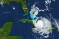
 0300+24 windvectors xynthia.gif 628 × 627; 67 KB
-
 160502 goes15 visible shortwaveIR CYMM Fire anim.gif 1,282 × 964; 12.03 MB
-
 17 June 09 17Z loop.gif 962 × 912; 13.95 MB
-
 1893 Sea Islands Hurricane.gif 640 × 480; 2.45 MB
-
 2004 Indonesia Tsunami 100px.gif 100 × 89; 39 KB
-
 2004 Indonesia Tsunami Complete.gif 300 × 276; 1.1 MB
-
 2004 Indonesia Tsunami edit.gif 300 × 276; 2.55 MB
-
 2004 Indonesia Tsunami.gif 300 × 311; 100 KB
-
 2007 Kongrey Guam radar.gif 781 × 466; 495 KB
-
 2016 Grand Rapids tornado outbreak radar loop.gif 1,051 × 939; 79.51 MB
-
 24OCT01IWXSRV01.gif 200 × 284; 633 KB
-
 3 29 98 loop.gif 354 × 322; 194 KB
-
 8 8 09 tornado loop.gif 640 × 625; 1.76 MB
-
 Adirondack Derecho image 1995.gif 505 × 428; 147 KB
-
 Albertoradar.gif 773 × 455; 5.08 MB
-
 Alice 1979 Animation.gif 301 × 301; 8.96 MB
-
 Andrea before Florida landfall VIS-IR animation.gif 720 × 480; 2.82 MB
-
 Andrea5m9a0015z-1815z.gif 400 × 420; 4.36 MB
-
 Andrew 1992 Animation.gif 301 × 301; 4.49 MB
-
 Animated hurricane.gif 100 × 100; 98 KB
-
 Animation bolt from the blue.gif 320 × 240; 82 KB
-
 April 23 2010 Severe Storm System Radar Loop.gif 3,400 × 1,600; 3.58 MB
-
 Aprilshowers.gif 720 × 480; 2.82 MB
-
 Arthur Jul 1 2014 1915-2307Z.gif 500 × 500; 5.67 MB
-
 Arthur Jul 3 2014 1115-2315Z.gif 640 × 640; 31.65 MB
-
 Arthur Jul 4 2014 1115–1815Z RGB.gif 720 × 480; 4.13 MB
-
 Avn-animated barbara.gif 720 × 480; 3.31 MB
-
 Avn-animated-Usagi.gif 720 × 480; 3.13 MB
-
 Avn-animated.gif 720 × 480; 3.6 MB
-
 Backcomp.gif 400 × 400; 13 KB
-
 Barbara May 29-30 2013 1945Z-0245Z.gif 720 × 480; 2.95 MB
-
 Bd-animated.gif 720 × 480; 2.71 MB
-
 Bering Sea cyclone 2014-11-08 animation.gif 1,020 × 720; 7.2 MB
-
 Beringia land bridge-noaagov.gif 700 × 458; 367 KB
-
 Bonnielandfall.gif 773 × 455; 4.73 MB
-
 Boucle GOES8-1998-01 07-09.gif 400 × 300; 1.01 MB
-
 Breaking waves.gif 690 × 423; 254 KB
-
 Charley Landfall.gif 360 × 270; 779 KB
-
 Chrissplitloop.gif 720 × 480; 4.49 MB
-
 Cimaron 2006-10-29 landfall.gif 720 × 480; 4.48 MB
-
 Coral atoll formation animation.gif 320 × 237; 38 KB
-
 Cpc-ncep-noaa CDAS 10-hPa Temp Anoms anim 06DEC2013-05JAN2014.gif 523 × 305; 2.07 MB
-
 Cpc-ncep-noaa z200anim 07JUN2012-06JUL2012.gif 538 × 305; 2.27 MB
-
 Cpc-ncep-noaa z500 nh 1d 30MAY2013.png 578 × 396; 65 KB
-
 Cpc-ncep-noaa z500 nh 30d anim 07JUN2012-06JUL2012.gif 578 × 396; 2.05 MB
-
 Cubanseabreezeconvergence.gif 290 × 200; 400 KB
-
 Cyclone Ita ir lalo-animated.gif 720 × 480; 3.09 MB
-
 Cyclone Pam animated NOAA 1801UTC March 14 2015.gif 720 × 480; 4.21 MB
-
 Danielpeak.gif 720 × 480; 3.68 MB
-
 Danielpeakrgb.gif 720 × 480; 4.67 MB
-
 Debbylife.gif 720 × 480; 2.67 MB
-
 December 23, 2009 Longview, TX tornado radar loop.gif 603 × 470; 2.65 MB
-
 Denning tornado animation.gif 1,919 × 955; 2.65 MB
-
 ErinFloridaLandfallRadar.gif 773 × 448; 385 KB
-
 Ernestolandfallflavn.gif 720 × 480; 5.46 MB
-
 Ernestolandfallhisavn.gif 720 × 480; 8.5 MB
-
 Ernestolandfallncavn.gif 720 × 480; 3.85 MB
-
 Evan Dec 16-17 IR Animation.gif 720 × 480; 2.24 MB
-
 Extratropical system over the Dakotas 2008-09-13.gif 600 × 571; 996 KB
-
 Fay Landfall FL up to 0045.gif 720 × 480; 3.78 MB
-
 Feb 29 2012 Tornado Outbreak Radar Loop.gif 1,588 × 1,354; 1.98 MB
-
 Feb242007 blizzard.gif 3,400 × 1,600; 2.89 MB
-
 Felicia2009Hawaiiradarloop.gif 778 × 514; 2.19 MB
-
 Floyd Rocky Mount flooding.gif 528 × 408; 754 KB
-
 Floyd1999NCLandfall.gif 773 × 455; 845 KB
-
 Floyd1999RadarPANYNJDMP.gif 773 × 455; 1,016 KB
-
 Fredricktownloop.gif 640 × 480; 1.6 MB
-
 Fukushima trajectory animation for days 10 to 21 after the accident.gif 500 × 622; 383 KB
-
 Fullloopnoreaster.gif 300 × 250; 15.5 MB
-
 Gablandfallsmall.gif 350 × 346; 3.34 MB
-
 Genevieve 2014-08-07 1101–1732Z (infrared).gif 720 × 480; 2.15 MB
-
 Georgiafires5m7a1032z-2255z.gif 390 × 286; 3.34 MB
-
 Georgiastorms-4m29a1132z-2302z.gif 479 × 310; 1.37 MB
-
 Georgiastorms4m30a1145z-2315z.gif 425 × 259; 2.15 MB
-
 Georgiastorms6m1a1402z-2203z.gif 463 × 280; 3.44 MB
-
 Georgiastorms6m2a1115z-6m3a0045z.gif 442 × 243; 2.42 MB
-
 Gustav 80.gif 586 × 551; 1.56 MB
-
 GustavCuba.gif 680 × 501; 12.89 MB
-
 Haiyan Avn-animated1.gif 720 × 480; 3.49 MB
-
 Haiyan Bd-animated.gif 720 × 480; 2.66 MB
-
 Haiyan Ir-animated.gif 720 × 480; 2.51 MB
-
 Haiyan Mangkhut Landfall Comparison.gif 1,440 × 480; 7.04 MB
-
 Haiyan Rb-animated.gif 720 × 480; 3.66 MB
-
 Hermine landfall radarloop sept 6 2010.gif 600 × 550; 444 KB
-
 Higos 2015 rapid deepening RBTOP.gif 720 × 480; 2.26 MB
-
 Higos 2015 rapid deepening VIS.gif 720 × 480; 4.68 MB
-
 Hudhud 11 Oct 2014 animated.gif 720 × 480; 3.23 MB
-
 Hudhud 12 Oct 2014 02.gif 720 × 480; 1.64 MB
-
 Hudhud 7-8 Oct 2014 Animated.gif 720 × 480; 2.83 MB
-
 Hurr-rita-irloop edit.gif 300 × 250; 2.87 MB
-
 Hurremilyloopavn.gif 720 × 480; 2.12 MB
-
 Hurricane Audrey 1957 Radar Animation.gif 450 × 450; 1.45 MB
-
 Hurricane Bret NEXRAD radar animation.gif 1,370 × 761; 4.42 MB
-
 Hurricane Celia 2010 Infrared satellite loop.gif 800 × 600; 3.51 MB
-
 Hurricane Floyd radar animation.gif 1,370 × 761; 5.59 MB
-
 Hurricane Floyd radar animation2.gif 1,370 × 761; 8.96 MB
-
 Hurricane Gert visible satellite loop.gif 266 × 270; 2.81 MB
-
 Hurricane Gonzalo approaching and passing Bermuda.gif 720 × 480; 1.28 MB
-
 Hurricane Ike NEXRAD radar animation.gif 1,370 × 761; 7.82 MB
-
 Hurricane Isabel NEXRAD radar animation.gif 764 × 495; 12.5 MB
-
 Hurricane Ivan NEXRAD radar animation.gif 1,370 × 761; 5.1 MB
-
 Hurricane Jeanne NEXRAD radar animation.gif 1,370 × 761; 3.18 MB
-
 Hurricane Joaquin IR loop Bermuda.gif 720 × 480; 1.46 MB
-
 Hurricane Katrina LA landfall radar.gif 772 × 455; 6.05 MB
-
 Hurricane Matthew 10-1 thru 10-9, 2016.gif 900 × 750; 132.98 MB
-
 Hurricane Matthew en route to Florida.gif 720 × 480; 3.75 MB
-
 Hurricane Odile 2014 making landfall.gif 720 × 480; 2.56 MB
-
 Hurricane Otto at landfall over Nicaragua.gif 720 × 480; 2.6 MB
-
 Hurricane Patricia Infrared Animation October 23.gif 720 × 480; 1.24 MB
-
 Hurricane Patricia October 23, 2015, GOES-15 visible animation.gif 950 × 711; 6.91 MB
-
 Hurricane Rita NEXRAD radar animation.gif 1,370 × 761; 6.8 MB
-
 Ice storm Wv loop.gif 602 × 400; 1.79 MB
-
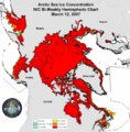 IICWG Arctic Chart 2007 H.gif 767 × 777; 489 KB
-
 Ir-animated.gif 720 × 480; 2.25 MB
-
 Iselle Aug 8 2014 0600–2000Z RBTOP IR.gif 720 × 480; 2.88 MB
-
 Joaquin boucle.gif 671 × 476; 5.86 MB
-
 July 12, 2006 Westchester Tornado.gif 764 × 495; 650 KB
-
 July 21 2003 Pennsylvania mesocyclone.gif 757 × 441; 2.42 MB
-
 Jun 1, 2011 Massachusetts tornado radar loop.gif 1,039 × 912; 6.89 MB
-
 Kansas 2003 tornado radar.gif 773 × 462; 903 KB
-
 Karina IR loop.gif 640 × 480; 4.55 MB
-
 Karl IR loop 21-to-24-09-2016.gif 1,342 × 952; 10.88 MB
-
 LakeEffectSnowBuffalo101206.gif 773 × 455; 332 KB
-
 Lehar landfall animated 28Nov13.gif 720 × 480; 3.66 MB
-
 Lightning animation - NOAA.gif 114 × 100; 34 KB
-
 Lightning connection with the ground.gif 320 × 240; 68 KB
-
 Lightning formation.gif 320 × 240; 45 KB
-
 Lightning slow motion.gif 141 × 247; 2.42 MB
-
 Loop isallobaric tendencies.gif 300 × 251; 62 KB
-
 Mangkhut Landfall over Luzon 2018-09-14 (cropped).gif 422 × 480; 1.45 MB
-
 Mangkhut Landfall over Luzon 2018-09-14.gif 720 × 480; 2.59 MB
-
 Mar 2 2012 Tornado Outbreak Radar Loop.gif 1,952 × 1,600; 1.66 MB
-
 Marcia 2015 landfall.gif 720 × 480; 1.89 MB
-
 Marcia 2015-02-20 VIS animation.gif 720 × 480; 4.79 MB
-
 Matthew from Hurricane to Post-Tropical 2016-10-06 to 11.gif 671 × 571; 4.01 MB
-
 May 1998 Derecho Radar Loop.gif 500 × 380; 779 KB
-
 May 29 1995 Connecticut supercell velocity.gif 773 × 455; 344 KB
-
 May 31, 2013 Oklahoma Phased Array Radar Reflectivity.gif 597 × 599; 9.72 MB
-
 Maylow5m7a0915z-2332z.gif 350 × 292; 5.65 MB
-
 Maysak passing north of Yap.gif 720 × 480; 2.37 MB
-
 Maysak rgb-animated at its peak intensity.gif 720 × 480; 4.04 MB
-
 Maysak VIS-IR animated at its peak intensity.gif 720 × 480; 4.46 MB
-
 Maystorms.gif 500 × 333; 3.7 MB
-
 Maystormsavn.gif 720 × 480; 3.56 MB
-
 Maystormvapor.gif 400 × 267; 4.57 MB
-
 Maytornadoes5m5a1132z-6a0115z.gif 424 × 299; 7.65 MB
-
 Maytstorms5m5a1132z-1715z.gif 500 × 382; 4.2 MB
-
 Mekkhala 2015 landfall.gif 720 × 480; 2.51 MB
-
 National Weather Service radar mosaic loop.gif 3,400 × 1,600; 2.95 MB
-
 NEFlooding2006.gif 1,055 × 558; 3.05 MB
-
 Nilofar Animated.gif 720 × 480; 3.06 MB
-
 Noreasterwv.gif 720 × 480; 4.75 MB
-
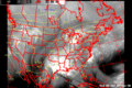
 Northeast blackout 2003.gif 1,000 × 750; 873 KB
-
 Northeast Snowfall Impact Scale.gif 640 × 480; 1.9 MB
-
 Noul 2015 landfall.gif 720 × 480; 2.13 MB
-
 NWS 2013 Moore radar loop.gif 800 × 564; 2.82 MB
-
 Oceanic Crust Africa Isochron Reduction.gif 600 × 600; 1.06 MB
-
 Omar IR loop.gif 640 × 480; 4.39 MB
-
 Opalradarpt.gif 773 × 455; 4.29 MB
-
 Pam hitting Vanuatu.gif 720 × 480; 2.68 MB
-
 Patricia 2015 landfall BD.gif 720 × 480; 1.6 MB
-
 Patricia 2015 landfall RBTOP.gif 720 × 480; 2.21 MB
-
 Phailin landfall RGB Animation 12 Oct 2013.gif 720 × 480; 3.31 MB
-
 Phanfone 2014 landfall.gif 720 × 480; 1.82 MB
-
 Radar animation with Wind Farm artefact.gif 600 × 800; 1.69 MB
-
 Radar loop of storms affecting Dallas-Fort Worth April 3, 2012.gif 700 × 403; 4.62 MB
-
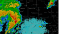
 Radar loop of the 2007 Central Florida tornadoes.gif 600 × 550; 5 MB
-
 Radar Loop of the Corn Belt Derecho over Central Illinois.gif 511 × 519; 3.1 MB
-
 Radar loop of TS Bill.gif 600 × 571; 798 KB
-
 Radar loop of WS Stella.gif 600 × 571; 664 KB
-
 Radar May 3, 1999 KTLX (small).gif 300 × 369; 2.62 MB
-
 Radar May 3, 1999 KTLX.gif 800 × 986; 6.12 MB
-
 Radarloopmarion.gif 450 × 402; 75 KB
-
 Radarops.gif 304 × 157; 15 KB
-
 Rgb-animated-Manuel.gif 720 × 480; 3.63 MB
-
 Rgb-animated-Usagi.gif 720 × 480; 3.88 MB
-
 Rgb-animated.gif 720 × 480; 3.39 MB
-
 Rice, Texas tornado radar loop.gif 600 × 472; 1.18 MB
-
 Rita-satellite loop.gif 720 × 480; 2.37 MB
-
 Roanu 2016-05-21 0830Z animated.gif 720 × 480; 4.19 MB
-
 Salt pannes and pools high and low tide.gif 400 × 386; 219 KB
-
 Sloshrun.gif 328 × 312; 124 KB
-
 Solar Eclipse animation captured by National Oceanic and Atmospheric Administration.gif 1,280 × 960; 10.06 MB
-
 SSN Predict SWPC.gif 720 × 550; 3.4 MB
-
 Sstaanim.gif 486 × 234; 113 KB
-
 Step leader lightning.gif 320 × 240; 62 KB
-
 Strongnoreaster.gif 720 × 480; 3.93 MB
-
 Super Outbreak 1974-04-03 loop.gif 640 × 382; 4.32 MB
-
 Supercell Tennessee.gif 681 × 847; 1.63 MB
-
 TD-15-E loop 2009-09-07.gif 320 × 320; 1.09 MB
-
 TPWEastCoastLow.gif 640 × 480; 1.66 MB
-
 Tropical cyclone Catarina.gif 640 × 480; 3.57 MB
-
 Tropical Cyclone Monica.gif 640 × 480; 3.93 MB
-
 Tropical Storm Hermine South Texas Radar.gif 640 × 480; 3.05 MB
-
 TS Amelia August 1-4.gif 200 × 200; 662 KB
-
 TS Ana landfall loop IR.gif 720 × 480; 1.46 MB
-
 TS Barry 2007 Tampa radar.gif 757 × 466; 1.65 MB
-
 TS18Wradarloop.gif 778 × 514; 6.41 MB
-
 Tstorm2.gif 404 × 396; 4.32 MB


.gif)


.gif)


.gif)


