Category:Animated maps of the Iberian Peninsula
Jump to navigation
Jump to search
Media in category "Animated maps of the Iberian Peninsula"
The following 9 files are in this category, out of 9 total.
-
 Crown of Castile - Map-ar.gif 330 × 365; 354 KB
-
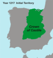 Crown of Castile - Map.gif 330 × 365; 287 KB
-
 Galiciamaptimes.gif 1,000 × 1,445; 235 KB
-
 Gobiernos autonómicos de España.gif 960 × 720; 1.31 MB
-
 Idioma navarro-aragonés.gif 670 × 502; 98 KB
-
 Linguistic map Southwestern Europe-ar.gif 600 × 544; 672 KB
-
 Linguistic map Southwestern Europe-en.gif 806 × 600; 1.08 MB
-
 Linguistic map Southwestern Europe-es.gif 650 × 596; 450 KB
-
 Pt(covid.gif 600 × 1,500; 93 KB


