Category:Anglo-French survey of 1784-1790
Jump to navigation
Jump to search
Survey of the distance between Greenwich and Paris | |||||
| Upload media | |||||
| Location |
| ||||
|---|---|---|---|---|---|
| |||||
Subcategories
This category has only the following subcategory.
G
Media in category "Anglo-French survey of 1784-1790"
The following 9 files are in this category, out of 9 total.
-
 Anglo-French start of survey.jpg 3,765 × 2,113; 5.3 MB
-
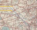
 Anglo-French survey of 1784-1790 Proposed mesh.jpg 3,104 × 1,643; 676 KB
-
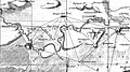
 Anglo-French survey of 1784-1790.jpg 6,729 × 3,457; 6.05 MB
-
 General Roys Baseline.jpg 909 × 742; 325 KB
-
 Portable scaffold for the great theodolite of Ramsden.png 199 × 364; 220 KB
-
 RamsdenRS theodolite of 1787 microscope detail.png 858 × 704; 341 KB
-
 RamsdenRS theodolite of 1787.jpg 572 × 962; 93 KB
-
 Roy 1790 Plate 09 Triangles for Distance between Greenwich and Paris.jpg 15,793 × 8,024; 40.92 MB
-
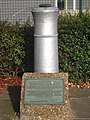 Where it all began! (geograph 2651652).jpg 480 × 640; 109 KB


.jpg)