Category:Anglesey, Staffordshire
Jump to navigation
Jump to search
English: Anglesey is a civil parish in the East Staffordshire district of Staffordshire, England. It covers an area in the south of Burton upon Trent, south of the town centre, around Anglesey Road. According to the 2001 census it had a population of 5,835.
village in Staffordshire, England, UK | |||||
| Upload media | |||||
| Instance of | |||||
|---|---|---|---|---|---|
| Location | East Staffordshire, Staffordshire, West Midlands, England | ||||
| Population |
| ||||
 | |||||
Subcategories
This category has only the following subcategory.
B
Media in category "Anglesey, Staffordshire"
The following 43 files are in this category, out of 43 total.
-
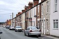 All Saints Road, Burton-on-Trent - geograph.org.uk - 3172995.jpg 4,288 × 2,848; 6.73 MB
-
 Allotments, Leicester Junction - geograph.org.uk - 3200857.jpg 640 × 506; 88 KB
-
-
-
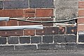
 Benchmark on ^10 Watson Street - geograph.org.uk - 3717721.jpg 683 × 1,024; 157 KB
-
 Benchmark on ^103 Anglesey Road - geograph.org.uk - 3717169.jpg 683 × 1,024; 201 KB
-
 Benchmark on ^110 Beech Street - geograph.org.uk - 3717358.jpg 1,024 × 683; 238 KB
-
 Benchmark on ^272 Anglesey Road - geograph.org.uk - 3702577.jpg 683 × 1,024; 269 KB
-

-
 Benchmark on ^50 Trent Street - geograph.org.uk - 3717554.jpg 683 × 1,024; 165 KB
-
 Benchmark on ^56 Branston Road - geograph.org.uk - 3702605.jpg 683 × 1,024; 225 KB
-
 Benchmark on ^59 All Saints Road - geograph.org.uk - 3717483.jpg 683 × 1,024; 248 KB
-
 Branston Road - geograph.org.uk - 5868159.jpg 2,000 × 1,333; 1.99 MB
-
 Broadway Street, Burton-on-Trent - geograph.org.uk - 3173019.jpg 4,288 × 2,848; 7.34 MB
-

-

-
 Circus in Burton upon Trent - geograph.org.uk - 4543605.jpg 1,024 × 799; 206 KB
-
 Coors Brewery from Shobnall Road - geograph.org.uk - 4832484.jpg 640 × 480; 73 KB
-

-

-

-
 Goat and cowl on a former brewery - geograph.org.uk - 4832155.jpg 640 × 480; 67 KB
-
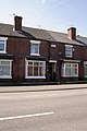 Houses of Whitcliffe Place, Anglesey Road - geograph.org.uk - 3702583.jpg 683 × 1,024; 175 KB
-
 Junction of Blackpool Street and Bailey Street - geograph.org.uk - 3717646.jpg 1,024 × 683; 149 KB
-
 Junction of Blackpool Street and Trent Street - geograph.org.uk - 3717565.jpg 1,024 × 683; 129 KB
-
 Junction of Branston Road and Trent Street - geograph.org.uk - 3702615.jpg 1,024 × 683; 154 KB
-
 Junction of Cambridge Street with Anglesey Road - geograph.org.uk - 3717341.jpg 1,024 × 683; 175 KB
-
 Junction of South Oak Street and All Saints Road - geograph.org.uk - 3717544.jpg 1,024 × 683; 147 KB
-

-
 King Street - Burton-on-Trent - geograph.org.uk - 3172377.jpg 4,288 × 2,848; 6.95 MB
-
 Looking towards Branston - geograph.org.uk - 5694122.jpg 2,000 × 1,333; 2.14 MB
-

-
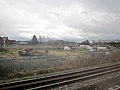
 Railway line to Birmingham - geograph.org.uk - 5694168.jpg 2,000 × 1,333; 2.94 MB
-

-
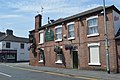
 The Branston Arms - geograph.org.uk - 6236537.jpg 1,280 × 960; 376 KB
-
 The Branston Cafe - geograph.org.uk - 6236539.jpg 1,280 × 960; 373 KB
-
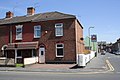
 The Coopers Arms - geograph.org.uk - 6201119.jpg 1,280 × 960; 308 KB
-
 The Derby to Birmingham railway - geograph.org.uk - 5110771.jpg 800 × 600; 150 KB
-
 The Kings Way Church - Queen Street - geograph.org.uk - 4067595.jpg 1,600 × 1,064; 465 KB
-

-
 Trent Brewery - geograph.org.uk - 702112.jpg 413 × 640; 90 KB
-
 Uxbridge Arms - Branston Road - geograph.org.uk - 4067584.jpg 1,600 × 1,064; 394 KB
-


_-_geograph.org.uk_-_3717600.jpg)


