Category:Angalacan River (San Jacinto and Mapandan)
Jump to navigation
Jump to search
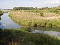
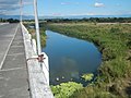
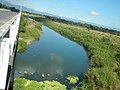
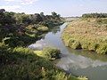
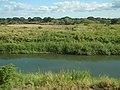
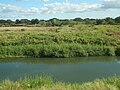
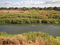
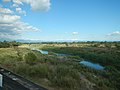
Angalacan River Flood Control System Inaugurated April 4, 2006 Angalacan River (San Jacinto and Mapandan) Bued-Angalacan River Watershed Angalacan River 16°2'48"N 120°28'9"E [https://mapcarta.com/15807214 Latitude: 16.0369° or 16° 2' 12.7" north Longitude: 120.4669° or 120° 28' 0.7" east Elevation: 14 meters (46 feet) GeoNames ID: 1730768 joins the Bued River
Media in category "Angalacan River (San Jacinto and Mapandan)"
The following 41 files are in this category, out of 41 total.
-
 9184Poblacion, Mapandan, Pangasinan 11.jpg 4,608 × 3,456; 6.69 MB
-
 9184Poblacion, Mapandan, Pangasinan 12.jpg 4,608 × 3,456; 6.76 MB
-
 9184Poblacion, Mapandan, Pangasinan 13.jpg 4,608 × 3,456; 6.39 MB
-
 9184Poblacion, Mapandan, Pangasinan 14.jpg 4,608 × 3,456; 6.75 MB
-
 9184Poblacion, Mapandan, Pangasinan 21.jpg 4,608 × 3,456; 6.4 MB
-
 9184Poblacion, Mapandan, Pangasinan 22.jpg 4,608 × 3,456; 5.83 MB
-
 9184Poblacion, Mapandan, Pangasinan 23.jpg 4,608 × 3,456; 5.94 MB
-
 9184Poblacion, Mapandan, Pangasinan 24.jpg 4,608 × 3,456; 6.65 MB
-
 9184Poblacion, Mapandan, Pangasinan 25.jpg 4,608 × 3,456; 6.43 MB
-
 9184Poblacion, Mapandan, Pangasinan 26.jpg 4,608 × 3,456; 6.15 MB
-
 9184Poblacion, Mapandan, Pangasinan 27.jpg 4,608 × 3,456; 6.1 MB
-
 9184Poblacion, Mapandan, Pangasinan 29.jpg 4,608 × 3,456; 5.83 MB
-
 9184Poblacion, Mapandan, Pangasinan 30.jpg 4,608 × 3,456; 6.15 MB
-
 9184Poblacion, Mapandan, Pangasinan 31.jpg 4,608 × 3,456; 6.55 MB
-
 9184Poblacion, Mapandan, Pangasinan 35.jpg 4,608 × 3,456; 6.71 MB
-
 9184Poblacion, Mapandan, Pangasinan 36.jpg 4,608 × 3,456; 6.55 MB
-
 9184Poblacion, Mapandan, Pangasinan 37.jpg 4,608 × 3,456; 6.55 MB
-
 9184Poblacion, Mapandan, Pangasinan 38.jpg 4,608 × 3,456; 6.97 MB
-
 9184Poblacion, Mapandan, Pangasinan 39.jpg 4,608 × 3,456; 6.05 MB
-
 9184Poblacion, Mapandan, Pangasinan 40.jpg 4,608 × 3,456; 6.64 MB
-
 9184Poblacion, Mapandan, Pangasinan 41.jpg 4,608 × 3,456; 6.63 MB
-
 9184Poblacion, Mapandan, Pangasinan 42.jpg 4,608 × 3,456; 6.37 MB
-
 9184Poblacion, Mapandan, Pangasinan 43.jpg 4,608 × 3,456; 6.46 MB
-
 9184Poblacion, Mapandan, Pangasinan 48.jpg 4,608 × 3,456; 6.82 MB
-
 9184Poblacion, Mapandan, Pangasinan 50.jpg 4,608 × 3,456; 6.89 MB
-
 9184Poblacion, Mapandan, Pangasinan 56.jpg 4,608 × 3,456; 5.93 MB
-
 9184Poblacion, Mapandan, Pangasinan 57.jpg 4,608 × 3,456; 6.29 MB
-
 9184Poblacion, Mapandan, Pangasinan 58.jpg 4,608 × 3,456; 6.79 MB
-
 9184Poblacion, Mapandan, Pangasinan 59.jpg 4,608 × 3,456; 6.09 MB
-
 9184Poblacion, Mapandan, Pangasinan 60.jpg 4,608 × 3,456; 6.27 MB
-
 9184Poblacion, Mapandan, Pangasinan 61.jpg 4,608 × 3,456; 6.32 MB
-
 9184Poblacion, Mapandan, Pangasinan 62.jpg 4,608 × 3,456; 6.42 MB
-
 9184Poblacion, Mapandan, Pangasinan 63.jpg 4,608 × 3,456; 6.44 MB
-
 9184Poblacion, Mapandan, Pangasinan 64.jpg 4,608 × 3,456; 6.38 MB
-
 9184Poblacion, Mapandan, Pangasinan 65.jpg 4,608 × 3,456; 6.11 MB
-
 9184Poblacion, Mapandan, Pangasinan 66.jpg 4,608 × 3,456; 6.48 MB
-
 9184Poblacion, Mapandan, Pangasinan 67.jpg 4,608 × 3,456; 6.24 MB
-
 9184Poblacion, Mapandan, Pangasinan 68.jpg 4,608 × 3,456; 6.24 MB
-
 9184Poblacion, Mapandan, Pangasinan 69.jpg 4,608 × 3,456; 5.9 MB
-
 9263Baloling Coral Poblacion Mapandan, Pangasinan 17.jpg 4,608 × 3,456; 6.51 MB
-
 9263Baloling Coral Poblacion Mapandan, Pangasinan 18.jpg 4,608 × 3,456; 6.05 MB


