Category:Andreafsky River
Jump to navigation
Jump to search
river in the United States of America  | |||||
| Upload media | |||||
| Instance of | |||||
|---|---|---|---|---|---|
| Location | Alaska | ||||
| Length |
| ||||
| Mouth of the watercourse | |||||
| Drainage basin | |||||
 | |||||
Media in category "Andreafsky River"
The following 6 files are in this category, out of 6 total.
-
 Aerial view of the east fork of the Andreafsky river.jpg 2,100 × 1,416; 131 KB
-
 Andreafsky River AK.jpg 325 × 208; 43 KB
-
 Andreafsky river with small town.jpg 2,100 × 1,414; 136 KB
-
 St Marys AK.JPG 2,592 × 1,944; 1.22 MB
-
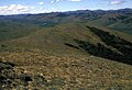 Upper Andreafsky river area.jpg 2,100 × 1,430; 180 KB
-
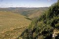 Upper Andreafsky River Yukon Delta NWR.jpg 1,050 × 702; 224 KB


