Category:An Exact Delineation of the Famous Citty of Bristoll and Suburbs
Jump to navigation
Jump to search
Media in category "An Exact Delineation of the Famous Citty of Bristoll and Suburbs"
The following 26 files are in this category, out of 26 total.
-
 1673 map of the Severn Estuary.jpg 1,830 × 1,086; 1.37 MB
-
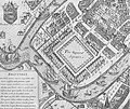
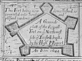 Ground Plan of the Royal Fort, Bristol, 1644.jpg 1,428 × 1,063; 1 MB
-
 Jewrie Lane.jpg 1,537 × 1,250; 1.49 MB
-
 Key Head of Bristol, 1728.jpg 1,219 × 947; 950 KB
-
 Map of Redcliffe in 1728.jpg 5,151 × 3,468; 12.31 MB
-
 Millerd map 1728 Queens Square.jpg 3,374 × 2,834; 6.59 MB
-
 Millerd1728cornmarket1684.jpg 1,638 × 1,407; 1.62 MB
-
 Millerd1728dallsaints.jpg 3,402 × 1,362; 3.24 MB
-
 Millerd1728dbridge.jpg 1,368 × 2,598; 2.58 MB
-
 Millerd1728dcastle.jpg 1,363 × 2,545; 2.37 MB
-
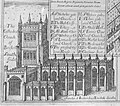 Millerd1728dcathedral.jpg 2,743 × 2,412; 4.52 MB
-
 Millerd1728dcornmarket.jpg 2,676 × 1,154; 2.07 MB
-
 Millerd1728dcustomhouse.jpg 1,391 × 2,534; 2.44 MB
-
 Millerd1728dgatehouse.jpg 1,381 × 2,862; 2.7 MB
-
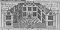 Millerd1728dgreathouseback.jpg 2,353 × 1,168; 1.97 MB
-
 Millerd1728dgreathouseredcliffe.jpg 1,429 × 2,892; 2.83 MB
-
 Millerd1728dguildhall.jpg 2,347 × 1,410; 2.36 MB
-
 Millerd1728dhighcross.jpg 1,363 × 2,833; 2.62 MB
-
 Millerd1728dhotwells.jpg 1,434 × 2,806; 2.79 MB
-
 Millerd1728full.jpg 4,867 × 4,579; 15.77 MB
-
 Prospect of Bath in 1673.jpg 2,039 × 1,315; 1.75 MB
-
 South Prospect of the Tollzey of Bristol 1673.jpg 1,781 × 1,407; 1.8 MB
-
 Southeast prospect of Bristol in 1673.jpg 2,107 × 1,045; 1.53 MB
-
 St Mary Redcliffe Church, Bristol from Millerd's Map (1728).jpg 3,409 × 2,893; 6.68 MB
-
 St Michaels Hill Bristol Millerd 1673.jpg 2,163 × 1,746; 1,011 KB
-
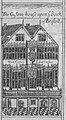
 The Merchants Hall, Bristol (1673).jpg 2,143 × 1,420; 2.09 MB


.jpg)

.jpg)