Category:Amstel 110, Amsterdam
Jump to navigation
Jump to search
| Object location | | View all coordinates using: OpenStreetMap |
|---|
 | |||||
| Upload media | |||||
| Instance of |
| ||||
|---|---|---|---|---|---|
| Location | Amsterdam, North Holland, Netherlands | ||||
| Street address |
| ||||
| Located on street | |||||
| Heritage designation |
| ||||
 | |||||
|
This is a category about rijksmonument number 204
|
| Address |
|
Media in category "Amstel 110, Amsterdam"
The following 6 files are in this category, out of 6 total.
-
 Amsterdam - Amstel 108.JPG 2,736 × 3,648; 4.28 MB
-
 Amsterdam - Amstel 110.JPG 2,736 × 3,648; 4.36 MB
-
 Buildings in Amsterdam IMG 5153.jpg 5,658 × 3,766; 16.42 MB
-
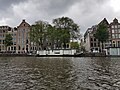 Houseboat 2.jpg 4,032 × 3,024; 4.98 MB
-
 Overzicht - Amsterdam - 20015656 - RCE.jpg 1,200 × 952; 256 KB
-


