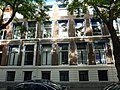
Category:Amaliastraat 7, The Hague
Jump to navigation
Jump to search
| Object location | | View all coordinates using: OpenStreetMap |
|---|
house in The Hague, Netherlands  | |||||
| Upload media | |||||
| Instance of | |||||
|---|---|---|---|---|---|
| Location | The Hague, South Holland, Netherlands | ||||
| Located on street |
| ||||
| Heritage designation |
| ||||
 | |||||
|
This is a category about rijksmonument number 17439
|
| Address |
|
Media in category "Amaliastraat 7, The Hague"
The following 4 files are in this category, out of 4 total.
-
 Achterzijde - 's-Gravenhage - 20088082 - RCE.jpg 1,200 × 974; 306 KB
-
 Amaliastr., straatbeeld - 's-Gravenhage - 20088057 - RCE.jpg 1,200 × 804; 163 KB
-
 Den Haag - Amaliastraat 7.JPG 3,648 × 2,736; 5.59 MB
-
 Voorgevel - 's-Gravenhage - 20088080 - RCE.jpg 1,200 × 965; 246 KB


