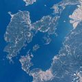
Category:Amakusa Islands
Jump to navigation
Jump to search
日本語: 天草諸島
island group in Kumamoto prefecture, Japan | |||||
| Upload media | |||||
| Instance of |
| ||||
|---|---|---|---|---|---|
| Part of | |||||
| Located in protected area | |||||
| Location | |||||
| Located in or next to body of water |
| ||||
| Has part(s) |
| ||||
| Population |
| ||||
| Area |
| ||||
 | |||||
Subcategories
This category has the following 18 subcategories, out of 18 total.
A
- Amakusa Matsushima (8 F)
F
G
- Gesujima (14 F)
H
M
- Maejima (Amakusa) (4 F)
N
- Nakagamijima (14 F)
O
S
- Shishijima (30 F)
- Shourajima (5 F)
T
- Tobasejima (29 F)
- Tsūjishima (6 F)
Y
- Yushima (Kumamoto) (11 F)
Media in category "Amakusa Islands"
The following 39 files are in this category, out of 39 total.
-
Admiralty Chart No 3692 Shimabara Kaiwan, Published 1908.jpg 10,638 × 15,929; 78.32 MB
-
Admiralty Chart No 836 Amakusa Islands and Yatsushiro Sea, Published 1892.jpg 11,067 × 15,999; 72.03 MB
-
Amakusa Islands.jpg 1,000 × 1,000; 140 KB
-
Amakusa kamishima.JPG 3,264 × 2,448; 1.35 MB
-
Ferryamakusa Shimabararailway.jpg 3,872 × 2,592; 3.94 MB
-
Ferryamakusa2 Shimabararailway.jpg 4,928 × 3,264; 4.81 MB
-
Hiaijima Island, Kamiamakusa Kumamoto Aerial photograph.2016.jpg 2,702 × 2,027; 1.18 MB
-
Iwajima Island from Misumi Port Ferry Terminal.jpg 4,028 × 3,021; 2.72 MB
-
Kamiamakusa kojima.jpg 3,648 × 2,736; 6.84 MB
-
KazusaDolphinWatching01.jpg 1,200 × 900; 110 KB
-
Kizuna2 ReihokuKankoKisen Tomioka 20160320.jpg 4,256 × 2,832; 4.25 MB
-
Nakajima Island, Kamiamakusa Kumamoto Aerial photograph.2016.jpg 1,856 × 1,237; 606 KB
-
Ninaijima Islands and Iwajima Island from Temmonkyo Bridge 1.jpg 4,032 × 3,024; 1.62 MB
-
Ninaijima Islands and Iwajima Island from Temmonkyo Bridge 2.jpg 4,032 × 3,024; 1.64 MB
-
Ninaijima Islands and Iwajima Island from Temmonkyo Bridge 3.jpg 4,017 × 3,013; 2.31 MB
-
Ninaijima Islands, Oyanojima Island and Iwajima Island from Temmonkyo Bridge 1.jpg 4,032 × 3,024; 1.93 MB
-
Ninaijima Islands, Oyanojima Island and Iwajima Island from Temmonkyo Bridge 2.jpg 4,032 × 3,024; 2.27 MB
-
Ninaijima Islands, Oyanojima Island and Iwajima Island from Temmonkyo Bridge 3.jpg 4,032 × 3,024; 1.78 MB
-
Nogamajima Island, Kamiamakusa Kumamoto Aerial photograph.2016.jpg 3,030 × 2,273; 1.54 MB
-
Oyanojima Island and Iwajima Island from Temmonkyo Bridge.jpg 4,032 × 3,024; 1.99 MB
-
Oyanojima Island and Ninaijima Islands from Temmonkyo Bridge 1.jpg 4,032 × 3,024; 2.18 MB
-
Oyanojima Island and Ninaijima Islands from Temmonkyo Bridge 2.jpg 4,032 × 3,024; 2.95 MB
-
Oyanojima Island from Misumi Port Ferry Terminal.jpg 4,032 × 3,024; 2.1 MB
-
Oyanojima Island from Temmonkyo Bridge.jpg 4,032 × 3,024; 2.19 MB
-
Seshima Island, Kamiamakusa Kumamoto Aerial photograph.2016.jpg 2,680 × 2,011; 1.4 MB
-
Takamokujima Island, Kamiamakusa Kumamoto Aerial photograph.2016.jpg 1,981 × 1,486; 616 KB
-
Topographic Map of Amakusa and Nagashima.png 1,012 × 888; 1.36 MB
-
Ubushima Island, Amakusa Kumamoto Aerial photograph.2014.jpg 2,445 × 1,833; 825 KB
-
View from Misumi East Port at dusk (Iwajima Island).jpg 4,018 × 3,014; 1.84 MB
-
View from Misumi East Port at dusk (south).jpg 4,032 × 3,024; 1.24 MB
-
Yagyujima Island, Kamiamakusa Kumamoto Aerial photograph.2016.jpg 2,448 × 1,836; 948 KB
-
Yatsushiro Sea.png 628 × 599; 175 KB
-
Yatsushiro See.png 695 × 663; 56 KB
-
Yokoshima Island, Amakusa Kumamoto Aerial photograph.2014.jpg 1,079 × 1,714; 495 KB
-
Yokourajima Island, Amakusa Kumamoto Aerial photograph.2014.jpg 1,914 × 1,436; 887 KB
-
Zozo Strait and Iwajima Island from Misumi Port Ferry Terminal.jpg 4,032 × 3,024; 1.81 MB
-
Zozo Strait from Misumi Port Ferry Terminal 2.jpg 4,032 × 3,024; 1.74 MB
-
Zozo Strait from Misumi Port Ferry Terminal.jpg 3,936 × 2,952; 2.48 MB
-
倉岳山頂からの景色.jpg 5,472 × 3,648; 2.53 MB


