Category:Am Weg nach Arnsdorf (Süd) (FN Ruhland)
Jump to navigation
Jump to search
| Object location | | View all coordinates using: OpenStreetMap |
|---|
Diese Kategorie umfasst den Flurnamen Am Weg nach Arnsdorf (Süd) in Ruhland
Media in category "Am Weg nach Arnsdorf (Süd) (FN Ruhland)"
The following 72 files are in this category, out of 72 total.
-
 Geschwister-Scholl-Weg Ruhland, Birkenweg westwärts 2.jpg 1,704 × 2,272; 739 KB
-

-
 Ruhland, am Radweg nach Arnsdorf südlich der Bahnlinie 01.jpg 2,272 × 1,704; 657 KB
-
 Ruhland, am verlängerten Neugrabenweg, Blick nach Westsüdwest, Winter.jpg 2,272 × 1,704; 829 KB
-
 Ruhland, Bahnbrücke über den Sieggraben an der Bahnlinie nach Ortrand, Nordansicht, 02.jpg 4,000 × 3,000; 5.19 MB
-
-
 Ruhland, Bahnbrücke über den Sieggraben an der Bahnlinie nach Ortrand, Südansicht.jpg 2,272 × 1,704; 540 KB
-
 Ruhland, beim Radweg nach Arnsdorf südlich der Bahnlinie 02.jpg 2,272 × 1,704; 647 KB
-

-

-

-

-

-

-
 Ruhland, Birkenweg - Wasserwerk (Straße), Hauptwaldweg nach Südwest, Winter.jpg 2,272 × 1,704; 744 KB
-
 Ruhland, Birkenweg, von der Fichtestr. zum Wasserwerk.jpg 2,272 × 1,704; 797 KB
-

-

-

-

-

-

-

-

-

-
 Ruhland, Radweg nach Arnsdorf südlich der Bahnlinie 01.jpg 2,272 × 1,704; 795 KB
-

-

-
 Ruhland, Radweg nach Arnsdorf südlich der Bahnlinie, Weidefläche östlich des Wegs 01.jpg 2,272 × 1,704; 385 KB
-
 Ruhland, Radweg nach Arnsdorf südlich der Bahnlinie, Weidefläche östlich des Wegs 02.jpg 2,272 × 1,704; 445 KB
-

-

-

-
 Ruhland, Radweg zwischen Ortrander Bahnlinie und Autobahn, Nordnordwestansicht.jpg 2,272 × 1,704; 514 KB
-

-

-
 Ruhland, Radweg zwischen Ortrander Bahnlinie und Autobahn, Südsüdostansicht 01.jpg 2,272 × 1,704; 585 KB
-
 Ruhland, Radweg zwischen Ortrander Bahnlinie und Autobahn, Südsüdostansicht 02.jpg 2,272 × 1,704; 533 KB
-
 Ruhland, Radweg zwischen Ortrander Bahnlinie und Autobahn, Südsüdostansicht.jpg 2,272 × 1,704; 662 KB
-

-
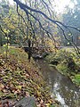
 Ruhland, Sieggraben zwischen Ortrander Bahnlinie und Arnsdorf; Nordwestansicht 01.jpg 2,272 × 1,704; 754 KB
-
 Ruhland, Sieggraben zwischen Ortrander Bahnlinie und Arnsdorf; Ostansicht 03.jpg 1,704 × 2,272; 761 KB
-

-
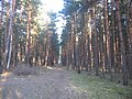
 Ruhland, Waldstück südlich des Birkenwegs, Hauptweg nordwärts, Winter, 01.jpg 2,272 × 1,704; 844 KB
-
 Ruhland, Waldstück südlich des Birkenwegs, Hauptweg nordwärts, Winter, 02.jpg 2,272 × 1,704; 737 KB
-
 Ruhland, Waldstück südlich des Birkenwegs, Hauptweg nordwärts, Winter, 03.jpg 2,272 × 1,704; 703 KB
-
 Ruhland, Waldstück südlich des Birkenwegs, Hauptweg nordwärts, Winter, 04.jpg 2,272 × 1,704; 853 KB
-
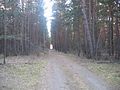
 Ruhland, Waldstück südlich des Birkenwegs, Hauptweg südwärts, Winter, 01.jpg 2,272 × 1,704; 767 KB
-
 Ruhland, Waldstück südlich des Birkenwegs, Hauptweg südwärts, Winter, 02.jpg 2,272 × 1,704; 617 KB
-

-
 Ruhland, Waldstück südlich des Birkenwegs, Winter 01.jpg 2,272 × 1,704; 792 KB
-
 Ruhland, Waldstück südlich des Birkenwegs, Winter 03.jpg 2,272 × 1,704; 588 KB
-
 Ruhland, Waldstück südlich des Birkenwegs, Winter 04.jpg 2,272 × 1,704; 636 KB
-
 Ruhland, Waldstück südlich des Birkenwegs, Winter 05.jpg 2,272 × 1,704; 658 KB
-
 Ruhland, Waldstück südlich des Birkenwegs, Winter 07.jpg 2,272 × 1,704; 856 KB
-
 Ruhland, Waldstück südlich des Birkenwegs, Winter 11.jpg 2,272 × 1,704; 732 KB
-
 Ruhland, Waldstück südlich des Birkenwegs, Winter 12.jpg 2,272 × 1,704; 797 KB
-

-
 Ruhland, Waldweg vom Wasserwerk zum verlängerten Neugrabenweg, Winter, 01.jpg 2,272 × 1,704; 753 KB
-
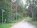
 Ruhland, Wasserwerk (Straße), Blick nach Ostnordost Einmündung in den Birkenweg.jpg 2,272 × 1,704; 618 KB
-
 Ruhland, Wasserwerk (Straße), verlängerter Birkenweg Blick nach Ostnordost; Winter.jpg 2,272 × 1,704; 793 KB
-
 Ruhland, Wasserwerk (Straße), verlängerter Birkenweg Blick nach Westsüdwest; Winter.jpg 2,272 × 1,704; 637 KB
-
 Ruhland, Wasserwerk (Straße, verlängerter Birkenweg), Blick nach Nordnordost, Winter.jpg 2,272 × 1,704; 653 KB
-

-

-

-

-

-

-

-

-


,_Hauptwaldweg_nach_S%C3%BCdwest,_Winter.jpg)


,_Blick_nach_Ostnordost_Einm%C3%BCndung_in_den_Birkenweg.jpg)
,_verl%C3%A4ngerter_Birkenweg_Blick_nach_Ostnordost;_Winter.jpg)
,_verl%C3%A4ngerter_Birkenweg_Blick_nach_Wests%C3%BCdwest;_Winter.jpg)
,_Blick_nach_Nordnordost,_Winter.jpg)


