Category:Am Buschgraben (FN Ruhland)
Jump to navigation
Jump to search
| Object location | | View all coordinates using: OpenStreetMap |
|---|
Diese Kategorie umfasst den Flurnamen Am Buschgraben in der Gemarkung Ruhland.
Subcategories
This category has only the following subcategory.
Media in category "Am Buschgraben (FN Ruhland)"
The following 28 files are in this category, out of 28 total.
-

-

-

-
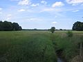 Ruhland, Am Buschgraben (FN Ruhland), Blick von der Waldstraße nach Nordnordost.jpg 1,600 × 1,200; 940 KB
-
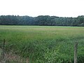 Ruhland, Am Buschgraben (FN Ruhland), Blick von der Waldstraße nach Nordost.jpg 1,600 × 1,200; 984 KB
-
 Ruhland, Am Buschgraben (FN Ruhland), Blick von der Waldstraße nach Nordwest.jpg 1,600 × 1,200; 996 KB
-
 Ruhland, Am Buschgraben, Blick nach Nordnordost, Winter.jpg 2,272 × 1,704; 573 KB
-
 Ruhland, Am Buschgraben, Blick nach Nordost, Winter.jpg 2,272 × 1,704; 558 KB
-
 Ruhland, Am Buschgraben, Blick nach Osten, Winter.jpg 2,272 × 1,704; 452 KB
-
 Ruhland, Am Buschgraben, Blick nach Ostsüdost, Winter.jpg 2,272 × 1,704; 552 KB
-
 Ruhland, Am Buschgraben, Blick nach Westnordwest, Winter.jpg 2,272 × 1,704; 563 KB
-
 Ruhland, Forstweg hinter der Autobahnbrücke, Blick nach Nord, Winter.jpg 2,272 × 1,704; 425 KB
-
 Ruhland, Forstweg hinter der Autobahnbrücke, Blick nach Nordwest, Winter 02.jpg 2,272 × 1,704; 320 KB
-
 Ruhland, Forstweg hinter der Autobahnbrücke, Blick nach Südwest, Winter.jpg 2,272 × 1,704; 412 KB
-
 Ruhland, Forstweg hinter der Autobahnbrücke, Blick nach Westen, Winter.jpg 2,272 × 1,704; 346 KB
-
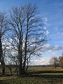 Ruhland, mehrstämmige Esche Am Buschgraben, Winter 01.jpg 1,704 × 2,272; 812 KB
-
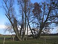 Ruhland, mehrstämmige Grauweiden Am Buschgraben, Winter.jpg 2,272 × 1,704; 932 KB
-
 Ruhland, mehrstämmige Silber-Weide Am Buschgraben, Winter 01.jpg 1,704 × 2,272; 857 KB
-
 Ruhland, mehrstämmige Silber-Weide Am Buschgraben, Winter 02.jpg 1,704 × 2,272; 957 KB
-

-

-

-

-

-

-

-

-


,_Blick_von_der_Waldstra%C3%9Fe_nach_Nordnordost.jpg)
,_Blick_von_der_Waldstra%C3%9Fe_nach_Nordost.jpg)
,_Blick_von_der_Waldstra%C3%9Fe_nach_Nordwest.jpg)


