Category:Altitude signs in Austria
Jump to navigation
Jump to search
Subcategories
This category has the following 3 subcategories, out of 3 total.
Media in category "Altitude signs in Austria"
The following 29 files are in this category, out of 29 total.
-
1773-Flexenpass-N.jpg 6,016 × 3,384; 6.88 MB
-
BG-BORG HIB Graz Liebenau - Main building 1854 detail 20090928 404.jpg 3,264 × 2,448; 637 KB
-
Exkursion zur Amberger Hütte 09.jpg 5,472 × 3,080; 6.03 MB
-
Freistadt - Hauptplatz - Rathaus - Höhenmarke.jpg 4,000 × 3,000; 3.32 MB
-
Furkajoch 01.JPG 2,726 × 1,888; 1.53 MB
-
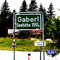
Gaberl 01.jpg 2,418 × 2,406; 5.15 MB
-
Großglockner Hochalpenstraße 21082018 324.jpg 6,000 × 4,000; 8.16 MB
-
Guttenberg-Haus-Tafel.jpg 3,072 × 2,304; 406 KB
-
Göskarspeicher signboard.jpg 2,816 × 2,112; 1.56 MB
-
Höhenmarkierung in A-2020 Hollabrunn.jpg 4,832 × 3,221; 4.59 MB
-
Judenburg Turm 5319.JPG 3,844 × 2,563; 6.41 MB
-
Kappl - Bergstation Diasbahn 02.jpg 3,702 × 2,352; 5.51 MB
-
Katschberghoehe passhoehe schild.jpg 1,944 × 1,296; 1.15 MB
-
Krefelder Hütte Schild.jpg 3,872 × 2,592; 2.75 MB
-
Litschau Pfarrkirche Seehöhe 531 m.jpg 3,536 × 2,652; 10.45 MB
-
Murzzuschlag szlak na Grosse Scheibe 11.jpg 6,000 × 4,000; 10.1 MB
-
Pass Lueg.jpg 640 × 480; 163 KB
-
St-Planaibahn-1.jpg 3,538 × 2,359; 1.62 MB
-
Puchberg am Schneeberg Willkommenstafel.jpg 2,967 × 1,900; 4.67 MB
-
RettenbachfernerObererParkplatz 2018.jpg 1,332 × 1,828; 869 KB
-
Ruine der Thüringer Hütte Hinweisschilder.jpg 3,000 × 4,000; 4.78 MB
-
St-KleinerHochwurzen.jpg 3,648 × 2,052; 1.29 MB
-
Stojerhöhe Wegweiser.jpg 3,096 × 4,128; 8.1 MB
-
Stubaier Gletscher - panoramio.jpg 4,912 × 2,760; 2.5 MB
-
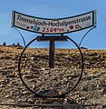
Timmelsjoch IMG 7468.jpg 3,585 × 3,666; 4.53 MB
-
Tübinger Hütte Schild.JPG 2,034 × 1,916; 639 KB
-
Žába on the top of Hintertuxer glacier - panoramio.jpg 2,592 × 1,944; 1,014 KB


