Category:Alteglofsheim
Jump to navigation
Jump to search
municipality of Germany    | |||||
| Upload media | |||||
| Instance of |
| ||||
|---|---|---|---|---|---|
| Part of |
| ||||
| Location | Regensburg, Upper Palatinate, Bavaria, Germany | ||||
| Head of government |
| ||||
| Population |
| ||||
| Area |
| ||||
| Elevation above sea level |
| ||||
| official website | |||||
 | |||||
Subcategories
This category has the following 3 subcategories, out of 3 total.
B
C
E
Media in category "Alteglofsheim"
The following 5 files are in this category, out of 5 total.
-
 Wappen von Alteglofsheim.svg 710 × 773; 110 KB
-
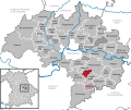 Alteglofsheim in R.svg 829 × 691; 689 KB
-
 Holzstich - Alteglofsheim vom Schlossturm - Link - um 1880.jpg 800 × 610; 420 KB
-
 Vilsmeier-Furthmeir-Familie um 1885.jpg 1,920 × 1,498; 221 KB
-
 Wappen Alteglofsheim.png 1,005 × 1,112; 51 KB


