Category:Alston Moor
Jump to navigation
Jump to search
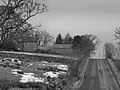
English: Alston Moor is an area of moorland and civil parish in Cumbria, England, based around the small town of Alston. The parish has a population of 2,156 (2001 census). Apart from the town of Alston, the parish also includes the villages of Garrigill and Nenthead, along with the hamlets of Nenthall, Nentsberry, Galligill, Blagill, Ashgill, Leadgate, Bayles and Raise. Alston Moor is part of the North Pennines Area of Outstanding Natural Beauty (AONB) - the second largest of the 40 AONBs in England and Wales.
civil parish, ward and former rural district in Eden, Cumbria, England, based around the small town of Alston  | |||||
| Upload media | |||||
| Instance of |
| ||||
|---|---|---|---|---|---|
| Location | Eden, Cumbria, North West England, England | ||||
| Population |
| ||||
| official website | |||||
 | |||||
Subcategories
This category has the following 20 subcategories, out of 20 total.
A
- Alston railway bridge (3 F)
- Ash Gill (36 F)
B
- Bayles, Cumbria (10 F)
- Black Fell, Pennines (2 F)
- Blagill (6 F)
- Blagill Mine (5 F)
- Burnhope Seat (13 F)
L
- Leadgate, Cumbria (11 F)
M
- Moor House Bridge (2 F)
N
- Nentsberry Haggs Mine (7 F)
P
- Priorsdale Ford (4 F)
R
- Randalholme Hall (3 F)
Y
- Yad Moss (5 F)
Media in category "Alston Moor"
The following 200 files are in this category, out of 2,739 total.
(previous page) (next page)-
 "Steam's up" - geograph.org.uk - 4095941.jpg 640 × 480; 445 KB
-
 'Poaching is a crime' - geograph.org.uk - 6488787.jpg 2,000 × 1,333; 2.02 MB
-
 'Public way' - geograph.org.uk - 5262491.jpg 1,500 × 1,125; 1.65 MB
-
 (Close to) the source of Whitewalls Burn - geograph.org.uk - 2076968.jpg 480 × 640; 108 KB
-

-

-

-
 (Part of) Alston east of Station Road - geograph.org.uk - 3369805.jpg 640 × 480; 102 KB
-
 (Part of) Garrigill - geograph.org.uk - 3176788.jpg 640 × 480; 80 KB
-
 (Part of) Nenthead mines (2) - geograph.org.uk - 4538796.jpg 640 × 480; 94 KB
-
 (Part of) Nenthead mines - geograph.org.uk - 4538718.jpg 640 × 480; 95 KB
-
 (Part of) the village green at Garrigill - geograph.org.uk - 3629969.jpg 640 × 480; 104 KB
-

-

-
 (Some of) Parkin's Stones - geograph.org.uk - 6275595.jpg 1,024 × 768; 308 KB
-

-
 A 686 road - geograph.org.uk - 5588928.jpg 6,000 × 4,000; 3.27 MB
-
 A hush on Middle Fell, Alston - geograph.org.uk - 4296808.jpg 640 × 480; 236 KB
-

-
 A prospect of Alston - geograph.org.uk - 4095935.jpg 640 × 480; 425 KB
-
 A quiet corner of Alston. - geograph.org.uk - 4029373.jpg 480 × 640; 73 KB
-
 A scruffy part of South Tynedale - geograph.org.uk - 3888730.jpg 3,872 × 2,592; 4.96 MB
-
 A stile with a view - geograph.org.uk - 2351728.jpg 3,648 × 2,736; 3.94 MB
-
 A Stoat trap near Pikeman Hill - geograph.org.uk - 4692881.jpg 1,600 × 1,065; 966 KB
-
 A Stoat trap near Pikeman Hill - geograph.org.uk - 4692890.jpg 1,600 × 1,065; 1.03 MB
-
 A stony part of the South Tyne - geograph.org.uk - 3888737.jpg 3,872 × 2,592; 3.64 MB
-
 A Welcome in the Hillsides^ - geograph.org.uk - 3930421.jpg 2,560 × 1,920; 2.12 MB
-
 A welcoming sign - geograph.org.uk - 2351772.jpg 2,736 × 3,648; 3.81 MB
-
 A686 above Alston - geograph.org.uk - 3356123.jpg 640 × 480; 455 KB
-
 A686 at Alston boundary - geograph.org.uk - 4745455.jpg 640 × 480; 104 KB
-
 A686 at lane to The Pennine Pottery - geograph.org.uk - 4745443.jpg 640 × 480; 41 KB
-
 A686 below Brownside Moss - geograph.org.uk - 4746299.jpg 640 × 480; 30 KB
-
 A686 bend, north of Newshield Farm - geograph.org.uk - 4745453.jpg 640 × 480; 40 KB
-
 A686 bend, north-east of Moscow - geograph.org.uk - 4745440.jpg 640 × 480; 39 KB
-
 A686 entering Alston - geograph.org.uk - 3479030.jpg 640 × 394; 71 KB
-
 A686 junction with B6294 - geograph.org.uk - 3479010.jpg 640 × 387; 80 KB
-
 A686 near Alston - geograph.org.uk - 3356125.jpg 640 × 480; 389 KB
-
 A686 near Bayles - geograph.org.uk - 2190925.jpg 640 × 480; 97 KB
-
 A686 near Bridge End House - geograph.org.uk - 4745457.jpg 640 × 479; 76 KB
-
 A686 near Newshield - geograph.org.uk - 3356126.jpg 640 × 427; 372 KB
-
 A686 nears county boundary - geograph.org.uk - 4745422.jpg 640 × 481; 26 KB
-
 A686 nears the B6294 junction - geograph.org.uk - 4745451.jpg 640 × 481; 98 KB
-
 A686 north of Newshield - geograph.org.uk - 3479015.jpg 640 × 401; 43 KB
-

-

-

-
 A686 towards Alston - geograph.org.uk - 5511293.jpg 640 × 480; 55 KB
-
 A686 towards Alston - geograph.org.uk - 5511303.jpg 640 × 480; 63 KB
-
 A686 towards Alston - geograph.org.uk - 5511315.jpg 640 × 480; 56 KB
-
 A686 towards Alston - geograph.org.uk - 5511329.jpg 640 × 480; 64 KB
-
 A686 westbound near Bayles - geograph.org.uk - 4746291.jpg 640 × 481; 79 KB
-
 A686 westbound near Meathaw Hill - geograph.org.uk - 4746405.jpg 640 × 480; 38 KB
-
 A686, Alston Bridge - geograph.org.uk - 5511343.jpg 640 × 480; 87 KB
-
 A686, Alston Moor - geograph.org.uk - 3353038.jpg 640 × 480; 500 KB
-
 A686, Bayles - geograph.org.uk - 5511322.jpg 640 × 480; 70 KB
-
 A686, Brewery Plantation - geograph.org.uk - 3356121.jpg 640 × 480; 233 KB
-
 A689 at Harbut Law - geograph.org.uk - 4002314.jpg 640 × 383; 70 KB
-
 A689 at Killhope Cross - geograph.org.uk - 2461130.jpg 1,500 × 873; 1.17 MB
-
 A689 junction and war memorial - geograph.org.uk - 3479046.jpg 640 × 412; 69 KB
-
 A689 near Watergreens - geograph.org.uk - 5511398.jpg 640 × 480; 47 KB
-
 A689 near Woodbrae Farm - geograph.org.uk - 5511664.jpg 640 × 480; 64 KB
-
 A689 towards Alston - geograph.org.uk - 2643497.jpg 640 × 427; 47 KB
-
 A689 towards Nenthead - geograph.org.uk - 5511382.jpg 640 × 480; 52 KB
-
 A689 towards Nenthead - geograph.org.uk - 5511408.jpg 640 × 480; 50 KB
-
 A689 towards Stanhope - geograph.org.uk - 5511660.jpg 640 × 480; 42 KB
-
 A689 towards Stanhope - geograph.org.uk - 5511786.jpg 640 × 480; 48 KB
-
 A689, Clitheroe - geograph.org.uk - 5511378.jpg 640 × 480; 47 KB
-
 A689, Fairhill - geograph.org.uk - 5511755.jpg 640 × 480; 67 KB
-
 A689, Low Wanwood - geograph.org.uk - 3353039.jpg 640 × 480; 240 KB
-
 A689, Nenthead - geograph.org.uk - 5511669.jpg 640 × 480; 87 KB
-
 A689, Nentsberry - geograph.org.uk - 5511421.jpg 640 × 480; 44 KB
-
 A689, Nentsberry Bridge - geograph.org.uk - 5511424.jpg 640 × 480; 75 KB
-
 Above Crossgill Pants - geograph.org.uk - 4426861.jpg 4,608 × 3,456; 3.57 MB
-
 Across valley of Black Burn - geograph.org.uk - 5717061.jpg 1,500 × 1,125; 1.36 MB
-

-
 AFC scrapyard on Station Road, Alston - geograph.org.uk - 4707505.jpg 1,600 × 1,065; 792 KB
-
 Age UK shop on Front Street, Alston - geograph.org.uk - 4704029.jpg 1,600 × 1,065; 533 KB
-
 Allen's Cleugh (2) - geograph.org.uk - 2364577.jpg 640 × 480; 78 KB
-
 Allen's Cleugh (2) - geograph.org.uk - 5772742.jpg 640 × 480; 97 KB
-
 Allen's Cleugh - geograph.org.uk - 2364574.jpg 640 × 480; 95 KB
-
 Allen's Cleugh - geograph.org.uk - 3276475.jpg 1,500 × 1,125; 2.16 MB
-
 Allen's Cleugh - geograph.org.uk - 5767448.jpg 640 × 480; 132 KB
-
 Allen's Cleugh, Tynehead Fell - geograph.org.uk - 4722860.jpg 1,200 × 799; 480 KB
-
 Alston - geograph.org.uk - 3337811.jpg 640 × 480; 474 KB
-
 Alston - geograph.org.uk - 6198160.jpg 2,908 × 1,709; 1.62 MB
-
 Alston 2 Miles - geograph.org.uk - 5511309.jpg 640 × 480; 67 KB
-
 Alston 2 Miles ^ Penrith 17 Miles - geograph.org.uk - 6198102.jpg 4,128 × 2,006; 3.74 MB
-
 Alston below the Town Hall - geograph.org.uk - 3884696.jpg 3,872 × 2,592; 3.54 MB
-
 Alston Bridge over River South Tyne - geograph.org.uk - 4499286.jpg 1,024 × 768; 273 KB
-
 Alston Bridge over River South Tyne - geograph.org.uk - 4499294.jpg 1,024 × 768; 409 KB
-
 Alston Depot - geograph.org.uk - 3884795.jpg 3,872 × 2,592; 4.54 MB
-
 Alston fire station - geograph.org.uk - 4513524.jpg 1,250 × 832; 949 KB
-
 Alston Fire Station, Front Street - geograph.org.uk - 4501593.jpg 1,024 × 770; 242 KB
-
 Alston Fire Station, Front Street, Alston - geograph.org.uk - 4704056.jpg 1,600 × 1,065; 564 KB
-
 Alston Freeserve Transmission Mast - geograph.org.uk - 6292122.jpg 4,308 × 2,872; 7.04 MB
-
 Alston House Hotel - geograph.org.uk - 5511352.jpg 640 × 480; 76 KB
-
 Alston House Hotel, Alston - geograph.org.uk - 4709967.jpg 1,600 × 1,065; 513 KB
-
 Alston Market Square - geograph.org.uk - 4335297.jpg 1,600 × 1,200; 480 KB
-
 Alston Market Square - geograph.org.uk - 4501614.jpg 1,024 × 768; 203 KB
-
 Alston Moor - geograph.org.uk - 5921635.jpg 640 × 480; 244 KB
-
 Alston Moor above Garrigill - geograph.org.uk - 3177343.jpg 640 × 480; 63 KB
-
 Alston Moor east of Black Band - geograph.org.uk - 3176838.jpg 640 × 480; 71 KB
-
 Alston Moor Golf Club near Low Flat - geograph.org.uk - 4501324.jpg 1,024 × 766; 247 KB
-
 Alston Moor Golf Club near Low Flat - geograph.org.uk - 4501344.jpg 1,024 × 768; 304 KB
-
 Alston Moor north of Black Band - geograph.org.uk - 3177318.jpg 640 × 480; 86 KB
-
 Alston Police Station - geograph.org.uk - 3337785.jpg 640 × 482; 407 KB
-
 Alston Post Office - geograph.org.uk - 4513515.jpg 780 × 1,250; 726 KB
-
 Alston Post Office - geograph.org.uk - 5513611.jpg 2,136 × 2,848; 1.17 MB
-
 Alston Post Office on Front Street - geograph.org.uk - 4704845.jpg 1,600 × 1,065; 447 KB
-

-
 Alston sewage works, from the north-east - geograph.org.uk - 6195369.jpg 1,600 × 1,200; 396 KB
-
 Alston Signage - geograph.org.uk - 4596212.jpg 1,600 × 1,200; 920 KB
-
 Alston signal box - geograph.org.uk - 3951667.jpg 3,000 × 2,000; 5.74 MB
-
 Alston Signpost - geograph.org.uk - 3338263.jpg 481 × 640; 534 KB
-
 Alston station (geograph 6505552).jpg 1,024 × 768; 260 KB
-
 Alston Station - geograph.org.uk - 4855116.jpg 1,800 × 1,013; 2.04 MB
-
 Alston Station - geograph.org.uk - 4863423.jpg 1,143 × 1,600; 548 KB
-

-
 Alston station, back end 1954 - geograph.org.uk - 5037147.jpg 2,384 × 1,387; 2.17 MB
-
 Alston Station, from the south - geograph.org.uk - 6194365.jpg 1,946 × 1,460; 790 KB
-
 Alston station, with train 1951 - geograph.org.uk - 5037128.jpg 2,362 × 1,351; 2.22 MB
-
 Alston Train Station - geograph.org.uk - 4708700.jpg 1,600 × 1,065; 729 KB
-
 Alston Train Station, Alston - geograph.org.uk - 4708616.jpg 1,600 × 1,065; 720 KB
-
 Alston Train Station, Alston - geograph.org.uk - 4708634.jpg 1,600 × 1,065; 899 KB
-
 Alston Training and Adventure Centre - geograph.org.uk - 3886261.jpg 3,872 × 2,592; 3.42 MB
-
 Alston Wholefoods, Front Street, Alston - geograph.org.uk - 4703961.jpg 1,600 × 1,065; 513 KB
-
 Alston Youth Hostel - geograph.org.uk - 4292529.jpg 1,024 × 769; 298 KB
-
 Alston, Church Gaytes Cottage - geograph.org.uk - 3338159.jpg 640 × 480; 518 KB
-

-
 Alston, Former Grammar School - geograph.org.uk - 3337784.jpg 640 × 480; 408 KB
-
 Alston, Front Street - geograph.org.uk - 3337788.jpg 640 × 480; 464 KB
-

-
 Alston, Station Road - geograph.org.uk - 3338257.jpg 640 × 481; 503 KB
-
 Alston, The Angel Inn - geograph.org.uk - 3338167.jpg 640 × 480; 479 KB
-
 Alston, Townfoot - geograph.org.uk - 3338240.jpg 640 × 481; 476 KB
-
 An assembly of Aylesburys - geograph.org.uk - 4095919.jpg 640 × 480; 513 KB
-
 And there are no diamonds in the mine - geograph.org.uk - 6275371.jpg 1,024 × 768; 318 KB
-
 Angled rock plates in River Tees - geograph.org.uk - 6221181.jpg 1,600 × 1,200; 541 KB
-
 Annat Walls - geograph.org.uk - 3884867.jpg 3,872 × 2,592; 4.36 MB
-
 Annat Walls - geograph.org.uk - 4501464.jpg 1,024 × 768; 230 KB
-
 Annat Walls from north-west - geograph.org.uk - 4499408.jpg 1,024 × 768; 196 KB
-
 Approaching Hardedge - geograph.org.uk - 2359771.jpg 3,648 × 2,736; 3.71 MB
-
 Approaching Hartside Cottages - geograph.org.uk - 4002369.jpg 640 × 380; 39 KB
-
 Arch at Rotherhope Tower - geograph.org.uk - 5719907.jpg 1,500 × 1,125; 1.75 MB
-
 Area of disused mines above Blagill Burn - geograph.org.uk - 5129132.jpg 640 × 480; 107 KB
-

-
 Area of disused mines west of Blagill - geograph.org.uk - 5144262.jpg 640 × 480; 109 KB
-

-

-

-

-

-

-

-

-
 Area of shake holes west of Seldom Seen - geograph.org.uk - 5159913.jpg 640 × 480; 104 KB
-
 As I was going to Scarberry Hill - geograph.org.uk - 6274822.jpg 1,024 × 768; 269 KB
-
 Ascending Black Fell - geograph.org.uk - 1892423.jpg 640 × 480; 65 KB
-
 Ascending Burnhope Seat - geograph.org.uk - 4586108.jpg 4,608 × 3,456; 3.6 MB
-
 Ascending Round Hill - geograph.org.uk - 3937971.jpg 2,560 × 1,920; 2.07 MB
-
 Ash Gill - geograph.org.uk - 2552875.jpg 3,371 × 2,447; 1.13 MB
-
 Ash Gill - geograph.org.uk - 4538191.jpg 640 × 480; 99 KB
-
 Ashgill - geograph.org.uk - 6195152.jpg 2,992 × 4,269; 4.89 MB
-
 Ashgill Beck - geograph.org.uk - 2503493.jpg 1,024 × 677; 276 KB
-
 Ashgill Bridge - geograph.org.uk - 2364057.jpg 640 × 480; 118 KB
-
 Ashgill Force (10) - geograph.org.uk - 4702410.jpg 480 × 640; 124 KB
-
 Ashgill Force (2) - geograph.org.uk - 3629908.jpg 640 × 480; 135 KB
-
 Ashgill Force (3) - geograph.org.uk - 3629914.jpg 480 × 640; 111 KB
-
 Ashgill Force (4) - geograph.org.uk - 3629917.jpg 640 × 480; 109 KB
-
 Ashgill Force (5) - geograph.org.uk - 3629922.jpg 480 × 640; 93 KB
-
 Ashgill Force (6) - geograph.org.uk - 3629925.jpg 480 × 640; 105 KB
-
 Ashgill Force (7) - geograph.org.uk - 4702395.jpg 480 × 640; 119 KB
-
 Ashgill Force (8) - geograph.org.uk - 4702398.jpg 480 × 640; 94 KB
-
 Ashgill Force (9) - geograph.org.uk - 4702400.jpg 640 × 480; 132 KB
-
 Ashgill Force - geograph.org.uk - 2363921.jpg 480 × 640; 86 KB
-
 Ashgill Force - geograph.org.uk - 4699551.jpg 3,625 × 2,495; 2.25 MB
-
 Ashgill plantation - geograph.org.uk - 1249349.jpg 640 × 426; 52 KB
-
 Ashgill Road, Garrigill - geograph.org.uk - 4500713.jpg 1,024 × 768; 292 KB
-
 Ashgill Wood - geograph.org.uk - 4537464.jpg 640 × 480; 96 KB
-
 Ayle Common (2) - geograph.org.uk - 2088823.jpg 640 × 480; 67 KB
-
 Ayle Common - geograph.org.uk - 2088813.jpg 640 × 480; 64 KB
-
 Ayle Common - geograph.org.uk - 3353034.jpg 640 × 427; 387 KB
-
 B6277 - geograph.org.uk - 2553048.jpg 3,568 × 2,326; 1.2 MB
-
 B6277 - geograph.org.uk - 2553054.jpg 2,692 × 2,288; 780 KB
-
 B6277 - geograph.org.uk - 2554807.jpg 3,824 × 2,592; 1.42 MB
-
 B6277 at Slack's Rigg - geograph.org.uk - 3689592.jpg 640 × 480; 69 KB
-
 B6294 below Newshield Moss - geograph.org.uk - 5712545.jpg 1,500 × 1,001; 1.02 MB
-
 B6294 junction ahead - geograph.org.uk - 3479008.jpg 640 × 466; 77 KB
-

-
 Bale Hill farm - geograph.org.uk - 6269123.jpg 4,000 × 3,000; 2.52 MB
-
 Balloon by the Tees - geograph.org.uk - 4425550.jpg 4,608 × 3,456; 3.46 MB
-
 Barn and bridge by the River South Tyne - geograph.org.uk - 6154754.jpg 640 × 480; 335 KB
-
 Barn and old railway goods van above Nenthead - geograph.org.uk - 5982574.jpg 1,024 × 768; 311 KB
-
 Barn and sheep pens at Blagillhead - geograph.org.uk - 5140189.jpg 640 × 480; 101 KB
-
 Barn by the gateway to Low Skydes Farm - geograph.org.uk - 5921599.jpg 640 × 480; 286 KB
-
 Barn near Blackburn Bank - geograph.org.uk - 4711310.jpg 1,600 × 1,065; 810 KB
-
 Barn near Dorthgill - geograph.org.uk - 4723252.jpg 1,200 × 812; 425 KB
-
 Barn near Garrigill - geograph.org.uk - 4703559.jpg 1,600 × 1,065; 790 KB
-
 Barns at Bleagate - geograph.org.uk - 6488182.jpg 2,000 × 1,084; 1.72 MB
-
 Barns at Lee Houses - geograph.org.uk - 4415717.jpg 1,500 × 1,061; 1.5 MB


_the_source_of_Whitewalls_Burn_-_geograph.org.uk_-_2076968.jpg)
_mine_shop_above_Gilderdale_Burn_-_geograph.org.uk_-_2704647.jpg)
_mine_shop_and_sheepfold_by_Gilderdale_Burn_-_geograph.org.uk_-_2704637.jpg)
_mine_shop_in_upper_Gilderdale_-_geograph.org.uk_-_2704650.jpg)
_Alston_east_of_Station_Road_-_geograph.org.uk_-_3369805.jpg)
_Garrigill_-_geograph.org.uk_-_3176788.jpg)
_Nenthead_mines_(2)_-_geograph.org.uk_-_4538796.jpg)
_Nenthead_mines_-_geograph.org.uk_-_4538718.jpg)
_the_village_green_at_Garrigill_-_geograph.org.uk_-_3629969.jpg)
_an_old_railway_goods_van_at_Fairhill,_Nenthead_(2)_-_geograph.org.uk_-_4535860.jpg)
_an_old_railway_goods_van_at_Fairhill,_Nenthead_-_geograph.org.uk_-_4535854.jpg)
_Parkin%27s_Stones_-_geograph.org.uk_-_6275595.jpg)
%27_(11203012713).jpg)


_Haggs_Mine,_Nentsberry_-_geograph.org.uk_-_3423063.jpg)


_-_geograph.org.uk_-_2364577.jpg)
_-_geograph.org.uk_-_5772742.jpg)


.jpg)


_-_geograph.org.uk_-_5159923.jpg)
_-_geograph.org.uk_-_5159926.jpg)
_-_geograph.org.uk_-_5159931.jpg)
_-_geograph.org.uk_-_5159933.jpg)
_-_geograph.org.uk_-_5159935.jpg)


_-_geograph.org.uk_-_4702410.jpg)
_-_geograph.org.uk_-_3629908.jpg)
_-_geograph.org.uk_-_3629914.jpg)
_-_geograph.org.uk_-_3629917.jpg)
_-_geograph.org.uk_-_3629922.jpg)
_-_geograph.org.uk_-_3629925.jpg)
_-_geograph.org.uk_-_4702395.jpg)
_-_geograph.org.uk_-_4702398.jpg)
_-_geograph.org.uk_-_4702400.jpg)


_-_geograph.org.uk_-_2088823.jpg)


