Category:Alsagers Bank
Jump to navigation
Jump to search
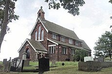
English: Alsagers Bank is a village in the Borough of Newcastle-under-Lyme in Staffordshire. Has a pub,The Gresley Arms, and a Post Office/village shop. Other facilities are St John's Church(Church of England), a Primary School, and a football club.
village in United Kingdom | |||||
| Upload media | |||||
| Instance of | |||||
|---|---|---|---|---|---|
| Location | Audley Rural, Newcastle-under-Lyme, Staffordshire, West Midlands, England | ||||
 | |||||
Media in category "Alsagers Bank"
The following 19 files are in this category, out of 19 total.
-
Alsagers Bank, field north of High Lane - geograph.org.uk - 4530421.jpg 3,264 × 2,448; 1.99 MB
-
Alsagers Bank, footpath between houses - geograph.org.uk - 4530375.jpg 3,264 × 2,448; 2.5 MB
-
Alsagers Bank, footpath north of High Lane - geograph.org.uk - 4530439.jpg 3,008 × 2,000; 1.71 MB
-
Alsagers Bank, footpath north of High Lane - geograph.org.uk - 4531429.jpg 3,008 × 2,000; 1.24 MB
-
Alsagers Bank, footpath off High Street - geograph.org.uk - 4532713.jpg 3,023 × 2,122; 1.89 MB
-
Alsagers Bank, Gresley Arms - geograph.org.uk - 4489552.jpg 3,008 × 2,000; 1.09 MB
-
Alsagers Bank, High Lane - geograph.org.uk - 4520532.jpg 3,246 × 2,243; 2.84 MB
-
Alsagers Bank, High Lane - geograph.org.uk - 4520535.jpg 3,238 × 2,282; 2.8 MB
-
Alsagers Bank, High Lane - geograph.org.uk - 4526959.jpg 3,231 × 2,112; 2.09 MB
-
Alsagers Bank, junction of High Lane and Scot Hay Road - geograph.org.uk - 4520537.jpg 3,194 × 2,256; 1.86 MB
-
Alsagers Bank, mast north of High Lane - geograph.org.uk - 4531469.jpg 3,008 × 2,000; 1,019 KB
-
Alsagers Bank, new houses on High Street - geograph.org.uk - 4526971.jpg 3,162 × 2,219; 1.95 MB
-
Alsagers Bank, path junction near High Lane - geograph.org.uk - 4530321.jpg 3,264 × 2,448; 2.47 MB
-
Alsagers Bank, route of old mineral line - geograph.org.uk - 4489547.jpg 3,005 × 1,790; 2.01 MB
-
Alsagers Bank, Shetland pony paddock behind High Lane - geograph.org.uk - 4530410.jpg 3,264 × 2,448; 1.93 MB
-
Alsagers Bank, St John's Church - geograph.org.uk - 4489578.jpg 3,008 × 2,000; 1.48 MB
-
Alsagers Bank, track to Watermills Farm - geograph.org.uk - 4531461.jpg 3,264 × 2,448; 2.11 MB
-
Pond near Halmer End - geograph.org.uk - 129578.jpg 640 × 480; 73 KB
-
St. John, Alsagers Bank - geograph.org.uk - 121012.jpg 640 × 427; 71 KB


