Category:Alrewas
Jump to navigation
Jump to search
English: Alrewas (awl-ree-wuss, al-) is a large village and civil parish within Lichfield District, in Staffordshire, England. It lies on the A38 road, approximately 5 miles north of the City of Lichfield. According to the English Place-Name Society the name means Alluvial land growing with alder-trees .
閩南語 / Bân-lâm-gú:Alrewas sī Liân-ha̍p Ông-kok ê England Staffordshire Kūn Lichfield pak-pêng 8 km hn̄g ê 1 ê chhân-chng. It tiàm tī Trend Mersey Ūn-hô chham Trent Khe kap-laû ê só͘-chāi. Chá-chêng Lichfield Chú-kaù mā tī chia khiā-khí. It mā sī Alrewas Fradley ê 1 ê chhoan-lí (parish).
village and civil parish in Staffordshire, United Kingdom  | |||||
| Upload media | |||||
| Instance of | |||||
|---|---|---|---|---|---|
| Location | Lichfield, Staffordshire, West Midlands, England | ||||
| Population |
| ||||
| Replaces |
| ||||
| Said to be the same as | Alrewas (Wikimedia duplicated page, civil parish) | ||||
| official website | |||||
 | |||||
Subcategories
This category has the following 16 subcategories, out of 16 total.
A
- 3 Post Office Road, Alrewas (2 F)
- All Saints, Alrewas (31 F)
- Alrewas Methodist Church (4 F)
- Alrewas Post Office (8 F)
- Alrewas River Trent footbridge (10 F)
- Alrewas War Memorial (7 F)
- Alrewas Weir (7 F)
B
C
- Catholme Lane (25 F)
- Chetwynd Bridge (3 F)
G
- Gaskell's Bridge, Alrewas (8 F)
- George and Dragon, Alrewas (8 F)
N
O
T
W
- Wychnor Junction (7 F)
Media in category "Alrewas"
The following 200 files are in this category, out of 1,387 total.
(previous page) (next page)-

-
 110 Main Street, Alrewas.jpg 2,774 × 2,081; 1.29 MB
-
 112 Main Street, Alrewas.jpg 2,774 × 2,081; 1.32 MB
-
 138 & 140 Main Street, Alrewas - geograph.org.uk - 5617736.jpg 2,448 × 1,836; 1.12 MB
-
 138 and 140 Main Street, Alrewas - geograph.org.uk - 3992202.jpg 1,964 × 1,324; 682 KB
-
 2020 vision, Day 228 - geograph.org.uk - 6571973.jpg 640 × 480; 116 KB
-
 25 Dark Lane, Alrewas - geograph.org.uk - 5615809.jpg 2,448 × 1,836; 1.38 MB
-
 60mph railway speed limit sign, Alrewas - geograph.org.uk - 6182804.jpg 1,600 × 1,160; 376 KB
-
 69 Main Street, Alrewas.jpg 2,774 × 2,081; 1.3 MB
-
 71 Main Street, Alrewas.jpg 2,774 × 2,081; 1.32 MB
-
 88 Main Street, Alrewas - geograph.org.uk - 3992337.jpg 2,008 × 1,300; 637 KB
-
 88 Main Street, Alrewas.jpg 2,774 × 2,081; 1.3 MB
-
 A bend in the Trent, west of Wychnor - geograph.org.uk - 3804278.jpg 1,024 × 768; 186 KB
-
 A38 near Alrewas - geograph.org.uk - 2400299.jpg 640 × 363; 39 KB
-
 A38 northbound, early morning - geograph.org.uk - 5615808.jpg 1,306 × 979; 390 KB
-
 A38 Rykneld Street at Alrewas - geograph.org.uk - 4542833.jpg 1,024 × 772; 177 KB
-

-
 A513 crossing Trent and Mersey Canal - geograph.org.uk - 3013659.jpg 640 × 441; 54 KB
-
-

-

-

-
 A513 towards King's Bromley - geograph.org.uk - 4542827.jpg 1,024 × 692; 196 KB
-
 A513 towards King's Bromley - geograph.org.uk - 5332809.jpg 640 × 480; 64 KB
-
 A513 towards Tamworth - geograph.org.uk - 5335497.jpg 640 × 480; 87 KB
-
 A513 turning, A38 - geograph.org.uk - 2400289.jpg 640 × 401; 53 KB
-

-
 Canal milepost and horse, Alrewas - geograph.org.uk - 1595430.jpg 462 × 640; 141 KB
-
 Church Road, Alrewas - geograph.org.uk - 445804.jpg 640 × 480; 84 KB
-

-
 Cottages, Mill End Lane, Alrewas - geograph.org.uk - 445990.jpg 640 × 480; 98 KB
-
 Former Cotton Mill - geograph.org.uk - 1521797.jpg 640 × 480; 228 KB
-
 Former school, Mill End Lane, Alrewas - geograph.org.uk - 1595144.jpg 640 × 480; 131 KB
-
 Main Street, Alrewas - geograph.org.uk - 1595263.jpg 640 × 480; 89 KB
-
 Mill End Lane, Alrewas - geograph.org.uk - 1595139.jpg 640 × 476; 107 KB
-
 Old Mill beside the River Trent, Alrewas - geograph.org.uk - 316601.jpg 640 × 480; 130 KB
-

-

-
 The Crown Inn - geograph.org.uk - 850461.jpg 640 × 480; 91 KB
-

-
 Tudor House, Alrewas - geograph.org.uk - 321304.jpg 640 × 380; 58 KB
-
 Alrewas , Burton Road A38 - geograph.org.uk - 6691924.jpg 6,000 × 4,000; 7.7 MB
-
 Alrewas , Rykneld Street A38 - geograph.org.uk - 6691927.jpg 6,000 × 4,000; 7.49 MB
-
 Alrewas , Rynkneld Street A38 - geograph.org.uk - 6691925.jpg 5,847 × 3,899; 4.57 MB
-
 Alrewas - geograph.org.uk - 4197658.jpg 640 × 480; 240 KB
-
 Alrewas - Level Crossing - geograph.org.uk - 845840.jpg 640 × 480; 75 KB
-
 Alrewas - River Tame - geograph.org.uk - 2428243.jpg 1,600 × 1,200; 508 KB
-
 Alrewas - Victoria House - geograph.org.uk - 2428228.jpg 1,600 × 1,233; 642 KB
-
 Alrewas boundary sign - geograph.org.uk - 6181276.jpg 1,600 × 1,187; 327 KB
-
 Alrewas Gas Compressor Station - geograph.org.uk - 2921414.jpg 1,024 × 768; 116 KB
-
 Alrewas Gas Compressor Station - geograph.org.uk - 2921427.jpg 1,024 × 510; 94 KB
-
 Alrewas Gravel Pit - 1 - geograph.org.uk - 1568075.jpg 640 × 480; 97 KB
-
 Alrewas Gravel Pit - 2 - geograph.org.uk - 1568080.jpg 640 × 480; 90 KB
-
 Alrewas Gravel Pit - geograph.org.uk - 2983493.jpg 640 × 390; 50 KB
-
 Alrewas House, Main Street, Alrewas - geograph.org.uk - 1595191.jpg 640 × 482; 151 KB
-
 Alrewas level crossing - geograph.org.uk - 6182779.jpg 1,600 × 1,538; 453 KB
-
 Alrewas Level Crossing and Signal Box - geograph.org.uk - 4197661.jpg 640 × 480; 274 KB
-
 Alrewas Motors, Alrewas - geograph.org.uk - 6181225.jpg 1,600 × 1,176; 348 KB
-
 Alrewas Signal box - geograph.org.uk - 4197663.jpg 640 × 480; 312 KB
-
 Alrewas Signal Box - geograph.org.uk - 845846.jpg 640 × 480; 102 KB
-
 Alrewas Signalbox - geograph.org.uk - 6182793.jpg 1,600 × 1,243; 384 KB
-
 Alrewas station (site) geograph-3229844-by-Ben-Brooksbank.jpg 2,348 × 1,447; 3.21 MB
-
 Alrewas Station Signal Box - geograph.org.uk - 1965608.jpg 2,740 × 1,947; 699 KB
-
 Alrewas Thatched.jpg 3,888 × 2,605; 3.86 MB
-
 Alrewas, Staffordshire - geograph.org.uk - 3843.jpg 640 × 390; 39 KB
-
-
 Armed Forces Memorial. National Memorial Arboretum - geograph.org.uk - 6600986.jpg 4,000 × 3,000; 2.49 MB
-
 Bagnall Lock - geograph.org.uk - 6306345.jpg 1,600 × 1,200; 351 KB
-
 Bailey Bridge at Alrewas, Staffordshire - geograph.org.uk - 1579624.jpg 640 × 442; 146 KB
-
 Bailey Bridge at Alrewas, Staffordshire - geograph.org.uk - 1579634.jpg 640 × 480; 138 KB
-
 Bailey Bridge over the mill stream - geograph.org.uk - 1521693.jpg 640 × 480; 338 KB
-
 Bailey Bridge over the Mill Stream - geograph.org.uk - 850262.jpg 640 × 480; 127 KB
-

-
 Bailey Bridge over the River Trent - geograph.org.uk - 1521703.jpg 640 × 480; 293 KB
-
 Bailey Bridge over the River Trent - geograph.org.uk - 848899.jpg 640 × 480; 94 KB
-
 Barley Green Lane (1) - geograph.org.uk - 2426046.jpg 3,072 × 2,048; 2.89 MB
-
 Barley Green Lane - geograph.org.uk - 1870391.jpg 640 × 480; 63 KB
-
 Barley Gren Lane, Alrewas - geograph.org.uk - 3180526.jpg 3,264 × 2,448; 3.84 MB
-
 Beech trees in the National Memorial Arboretum - geograph.org.uk - 6301719.jpg 1,024 × 768; 245 KB
-
 Bend in the A513 near Orgeave Lodge - geograph.org.uk - 5332837.jpg 640 × 480; 84 KB
-
 Blown Away - geograph.org.uk - 6301871.jpg 768 × 1,024; 300 KB
-

-

-
 Bridge in Croxall Road - geograph.org.uk - 6573029.jpg 640 × 360; 33 KB
-
 Bridge over millstream at Alrewas, Staffordshire - geograph.org.uk - 5645908.jpg 1,280 × 960; 1.58 MB
-

-
 Burton Road - geograph.org.uk - 1563739.jpg 640 × 441; 81 KB
-
 Bus stop on Main Street, Alrewas - geograph.org.uk - 5332784.jpg 640 × 480; 109 KB
-
 Capable Canines name sign, Alrewas - geograph.org.uk - 6181661.jpg 1,600 × 1,307; 583 KB
-

-
 Car sales on the A513, Alrewas - geograph.org.uk - 5332806.jpg 640 × 480; 54 KB
-
 Cattle grazing north of Alrewas in Staffordshire - geograph.org.uk - 5647568.jpg 1,280 × 889; 1.05 MB
-
 Cattle grazing north of Alrewas in Staffordshire - geograph.org.uk - 5647573.jpg 1,440 × 949; 1.3 MB
-
 Chetwynd or Salter's Bridge - geograph.org.uk - 4563374.jpg 800 × 600; 176 KB
-
 Church lane - geograph.org.uk - 436647.jpg 640 × 480; 101 KB
-
 Church Road, Alrewas - geograph.org.uk - 446013.jpg 640 × 480; 93 KB
-
 Church Road, Alrewas, Staffordshire - geograph.org.uk - 1563910.jpg 640 × 449; 142 KB
-
 Clematis Cottage, Alrewas.jpg 2,081 × 2,774; 1.24 MB
-
 Close up, Elizabeth II postbox on Main Street, Alrewas - geograph.org.uk - 5333448.jpg 1,097 × 2,025; 460 KB
-
 Clouds over the National Memorial Arboretum - geograph.org.uk - 5504480.jpg 3,648 × 2,432; 2.71 MB
-
 Coates ^ Sons, Alrewas - geograph.org.uk - 5168810.jpg 1,280 × 851; 438 KB
-
 Confluence of the Trent and the Tame - geograph.org.uk - 5638828.jpg 6,000 × 4,000; 5.68 MB
-
 Contrasting carriageways of the A38, Alrewas - geograph.org.uk - 6181632.jpg 1,600 × 1,224; 428 KB
-
 Conveyor bridge over Croxall Road, Alrewas - geograph.org.uk - 6182573.jpg 1,600 × 872; 248 KB
-
 Corner of an oilseed rape field - geograph.org.uk - 2921442.jpg 1,024 × 768; 158 KB
-

-
 Cottage by the canal - geograph.org.uk - 3111252.jpg 2,592 × 1,936; 1.56 MB
-
 Cottage by the Trent and Mersey Canal - geograph.org.uk - 3111203.jpg 2,592 × 1,936; 2.7 MB
-
 Cottage on Main Street. Alrewas - geograph.org.uk - 6592610.jpg 3,932 × 2,949; 2.01 MB
-
 Cottages in Alrewas - geograph.org.uk - 5168819.jpg 1,280 × 851; 282 KB
-
 Cottages off Fox Lane, Alrewas - geograph.org.uk - 5332798.jpg 640 × 480; 63 KB
-
 Crawley Brook, just before it enters the Trent - geograph.org.uk - 3598358.jpg 3,776 × 2,520; 3.93 MB
-

-
 Crop field, Overley - geograph.org.uk - 5332818.jpg 640 × 480; 95 KB
-
 Crop fields west of Alrewas, Staffordshire - geograph.org.uk - 2663864.jpg 1,056 × 1,440; 1.68 MB
-
 Cross Country train near Alrewas - geograph.org.uk - 4981843.jpg 1,024 × 768; 212 KB
-

-
 Crossroads on the A513 - geograph.org.uk - 2504141.jpg 640 × 428; 50 KB
-
 Croxall Road (1) - geograph.org.uk - 2426025.jpg 3,072 × 2,048; 2.97 MB
-
 Croxall Road southeast of Alrewas - geograph.org.uk - 6182520.jpg 1,600 × 1,200; 468 KB
-
 Croxall Road, Alrewas - geograph.org.uk - 6181650.jpg 1,259 × 1,600; 423 KB
-

-
 Daisy Lane, near Alrewas - geograph.org.uk - 690151.jpg 640 × 454; 68 KB
-
 Dark Lane Brightening Up - geograph.org.uk - 3848081.jpg 1,024 × 626; 166 KB
-

-
 Dead-end part of Croxall Road, Alrewas - geograph.org.uk - 6181659.jpg 1,600 × 1,374; 552 KB
-

-
 Detail of house, Park Road, Alrewas - geograph.org.uk - 1595522.jpg 608 × 626; 95 KB
-

-

-

-
 Disused conveyor bridge over Croxall Road - geograph.org.uk - 4981165.jpg 1,024 × 768; 151 KB
-
 DMG Autos, and Van Sales, Alrewas - geograph.org.uk - 2506341.jpg 640 × 428; 45 KB
-
 Double gate into oilseed rape field - geograph.org.uk - 2921433.jpg 640 × 480; 60 KB
-
 Driveway to Broadfields House - geograph.org.uk - 155606.jpg 640 × 480; 103 KB
-
 Edge of an oilseed rape field - geograph.org.uk - 2921387.jpg 1,024 × 768; 143 KB
-
 Elizabeth II postbox on Main Street, Alrewas - geograph.org.uk - 5333445.jpg 2,848 × 2,136; 1.26 MB
-
 Entrance All Saints' Church, Alrewas Village - geograph.org.uk - 6761409.jpg 2,448 × 3,264; 2.96 MB
-
 Entrance to Alrewas Quarry - geograph.org.uk - 5640218.jpg 6,000 × 4,000; 4.14 MB
-

-

-

-
 Essington House, Alrewas - geograph.org.uk - 5617725.jpg 2,448 × 1,836; 1.3 MB
-

-
 Farm land west of Alrewas, Staffordshire - geograph.org.uk - 1566959.jpg 1,440 × 963; 1.64 MB
-
 Farmland North of Alrewas - geograph.org.uk - 3848064.jpg 1,024 × 761; 223 KB
-
 Field by the A38, Alrewas - geograph.org.uk - 2983898.jpg 640 × 360; 38 KB
-
 Fields of stubble near Alrewas - geograph.org.uk - 690153.jpg 640 × 429; 72 KB
-
 Flood channel of the River Trent - geograph.org.uk - 1527614.jpg 640 × 480; 292 KB
-

-
-
 Flooded Footpath - geograph.org.uk - 3848070.jpg 800 × 649; 138 KB
-

-
 Footpath alongside River Tame National Memorial Arboretum - geograph.org.uk - 6601031.jpg 4,608 × 3,456; 3.79 MB
-

-
 Footpath To Wychnor - geograph.org.uk - 445993.jpg 640 × 480; 138 KB
-
 Fox Lane, Alrewas - geograph.org.uk - 5332799.jpg 640 × 480; 69 KB
-
 Furrowed field near Alrewas - geograph.org.uk - 5332779.jpg 640 × 480; 76 KB
-
 Gap in the barrier between A38 carriageways, Alrewas - geograph.org.uk - 6181655.jpg 1,600 × 1,284; 369 KB
-
 Gate between road and railway, Alrewas - geograph.org.uk - 6182841.jpg 1,600 × 1,209; 414 KB
-
 Gated estate, Church Road, Alrewas - geograph.org.uk - 1595159.jpg 640 × 470; 122 KB
-
 Gravel pit by Alrewas quarry - geograph.org.uk - 5640186.jpg 6,000 × 4,000; 5.06 MB
-

-
 Grazing near Alrewas, Staffordshire - geograph.org.uk - 1564695.jpg 640 × 480; 131 KB
-
 Grazing near Alrewas, Staffordshire - geograph.org.uk - 1564703.jpg 640 × 418; 135 KB
-
 Grazing near the River Tane - geograph.org.uk - 5335499.jpg 640 × 480; 65 KB
-
 Gulf filling station, Alrewas - geograph.org.uk - 6181299.jpg 1,600 × 1,026; 354 KB
-
 Hedge and ditch, Alrewas - geograph.org.uk - 1595166.jpg 640 × 477; 158 KB
-
 Horse jump - geograph.org.uk - 3111197.jpg 2,592 × 1,936; 2.69 MB
-
 House on Main Street, Alrewas - geograph.org.uk - 5332800.jpg 640 × 480; 74 KB
-
 House on Main Street, Alrewas - geograph.org.uk - 5333451.jpg 2,848 × 2,136; 1.15 MB
-
 House on the corner, Alrewas - geograph.org.uk - 1595530.jpg 640 × 482; 100 KB
-

-
 Junction of Main Street and Rykneld Street left only - geograph.org.uk - 6592630.jpg 4,608 × 3,456; 3.43 MB
-
 Keep Out notice on a Croxall Road gate, Alrewas - geograph.org.uk - 6182612.jpg 1,600 × 1,226; 376 KB
-
 Kings Bromley Road, Alrewas - geograph.org.uk - 5332805.jpg 640 × 480; 64 KB
-
 Lafarge Aggregates - geograph.org.uk - 847826.jpg 640 × 480; 97 KB
-
 Lafarge Aggregates View - geograph.org.uk - 847846.jpg 640 × 480; 86 KB
-
 Lafarge Readymix - geograph.org.uk - 3180513.jpg 3,264 × 2,448; 3.59 MB
-
 Lake by the Coventry Canal - geograph.org.uk - 433585.jpg 640 × 480; 84 KB
-
 Lake by Willowbrook Farm - geograph.org.uk - 3111193.jpg 2,592 × 1,936; 2.42 MB
-
 Lane leading to Fradley Junction - geograph.org.uk - 4556447.jpg 1,024 × 768; 245 KB
-
 Level crossing warning sign, Croxall Road, Alrewas - geograph.org.uk - 6182859.jpg 1,477 × 1,600; 299 KB
-
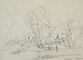 Lines family sketchbook - Disc1 056 - Alrewas, Staffordshire.jpg 2,292 × 1,664; 804 KB
-
 Looking back - geograph.org.uk - 358403.jpg 640 × 480; 92 KB
-
 Looking north towards Burton-upon-Trent - geograph.org.uk - 3111186.jpg 2,592 × 1,936; 3.25 MB
-
 Lorry park by the A38 at Alrewas - geograph.org.uk - 6195523.jpg 1,600 × 900; 493 KB
-
 Main Street in Alrewas - geograph.org.uk - 4648617.jpg 4,000 × 3,000; 2.93 MB
-
 Main Street in Alrewas, Staffordshire (geograph 7290139).jpg 1,440 × 960; 1.51 MB
-
 Memorial plaque for Christmas truce memorial - geograph.org.uk - 6601048.jpg 4,608 × 3,456; 6 MB
-
 Memorial to the Christmas truce 1914 - geograph.org.uk - 6601039.jpg 4,608 × 3,456; 4.24 MB
-
 Metal barrier at the edge of the A38, Alrewas - geograph.org.uk - 6181640.jpg 1,600 × 999; 514 KB
-
 Milepost at SK1802414595.jpg 492 × 701; 62 KB
-
 Mill stream bridge at Alrewas, Staffordshire - geograph.org.uk - 5645812.jpg 1,280 × 960; 1.66 MB
-
 Mill stream in Alrewas, Staffordshire - geograph.org.uk - 5645916.jpg 1,280 × 960; 1.32 MB
-
 Mill stream in Alrewas, Staffordshire - geograph.org.uk - 5645925.jpg 1,280 × 960; 1.4 MB
-
 Mill Stream, Alrewas - geograph.org.uk - 446002.jpg 640 × 480; 132 KB
-
 Mill Stream, Alrewas - geograph.org.uk - 446010.jpg 640 × 480; 131 KB
-
 Miscanthus gigantea at Alrewas - geograph.org.uk - 3180538.jpg 3,264 × 2,448; 3.31 MB
-
 My old school. Boy Dawes No 67. Aug 1957 to Jan 1959 - geograph.org.uk - 6601018.jpg 4,608 × 3,456; 5.27 MB


_-_geograph.org.uk_-_1583426.jpg)
_-_geograph.org.uk_-_1583437.jpg)


_geograph-3229844-by-Ben-Brooksbank.jpg)


_-_geograph.org.uk_-_2426046.jpg)


_-_geograph.org.uk_-_2426025.jpg)


.jpg)


