Category:Almondell and Calderwood Country Park
Jump to navigation
Jump to search
country park in West Lothian, Scotland, UK  | |||||
| Upload media | |||||
| Instance of |
| ||||
|---|---|---|---|---|---|
| Location | East Calder, West Lothian, Scotland | ||||
| Heritage designation |
| ||||
| Inception |
| ||||
| Area |
| ||||
 | |||||
Subcategories
This category has the following 9 subcategories, out of 9 total.
A
- Almondell aqueduct (10 F)
- Almondell Bridge (10 F)
- Almondell suspension bridge (3 F)
C
- Calder Wood (9 F)
- Camps Viaduct (14 F)
K
L
- Lower Weir, Almondell (3 F)
O
Media in category "Almondell and Calderwood Country Park"
The following 46 files are in this category, out of 46 total.
-
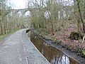
 Almondell & Calderwood Country Park, Scotland, viaduct.JPG 3,648 × 2,736; 4.76 MB
-

-

-
 Almondell Country Park - geograph.org.uk - 1396651.jpg 640 × 480; 108 KB
-
 Almondell Country Park near Mid Calder - geograph.org.uk - 318038.jpg 640 × 480; 196 KB
-
 Almondell Country Park. - geograph.org.uk - 61945.jpg 640 × 480; 145 KB
-
 Almondfrom naismith.jpg 800 × 572; 172 KB
-
 Almondrocks.jpg 800 × 533; 213 KB
-
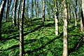
 Beech wood, Almondell - geograph.org.uk - 893083.jpg 640 × 480; 133 KB
-
 Camps Viaduct and Union Canal Feeder.jpg 4,000 × 3,000; 4.66 MB
-
-
 Deciduous woodland Almondell - geograph.org.uk - 1396667.jpg 640 × 480; 119 KB
-
 Dedication stone in Almondell - 1784 - geograph.org.uk - 1758893.jpg 1,024 × 768; 204 KB
-
 Drumshoreland Muir, West Lothian, Scotland. View from Roman Camp.jpg 4,896 × 2,752; 3.93 MB
-
 Drumshoreland Muir, West Lothian, Scotland.jpg 4,896 × 2,752; 2.8 MB
-
 Footbridge over the Almond - geograph.org.uk - 896983.jpg 640 × 480; 109 KB
-
 Footbridge over the lade - geograph.org.uk - 896987.jpg 640 × 480; 119 KB
-
 GreenhillAlmond.jpg 800 × 533; 153 KB
-
 Heronalmond.jpg 721 × 518; 145 KB
-
 Hutunderviaduct.jpg 800 × 639; 216 KB
-
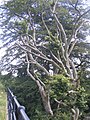 Just hanging on^ - geograph.org.uk - 503209.jpg 480 × 640; 155 KB
-
 Looking down the Almond from the Naysmith Bridge - geograph.org.uk - 1758059.jpg 1,024 × 768; 167 KB
-
 Map of the Almondell & Calderwood Country Park.jpg 915 × 608; 557 KB
-
 Nasmyth Bridge view of the River Almond, Almondell Country Park, West Lothian.jpg 4,896 × 2,752; 4.58 MB
-
 Old railway viaduct, Almondell River, West Lothian, Scotland.jpg 4,896 × 2,752; 4.3 MB
-
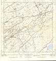 Ordnance Survey Sheet NT 06 The Calders, Published 1956.jpg 7,198 × 7,819; 7.68 MB
-
 OS Composite map from NT 06 07 16 17.jpg 6,233 × 3,800; 2.75 MB
-
 River Almond and willow bank stabilisation, Almondell Country Park, West Lothian.jpg 3,511 × 2,697; 3.09 MB
-
 River Almond Weir and Canal Feeder.jpg 4,000 × 3,000; 4.79 MB
-
 River from Almondell Bridge - geograph.org.uk - 788836.jpg 640 × 480; 100 KB
-
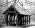
 Shelter beneath the old viaduct, canal feeder, Almondell, West Lothian.jpg 4,896 × 2,752; 4.29 MB
-
 Sir Simon Fraser Memorial Stone, Almondell and Calderwood Country Park, West Lothian.jpg 3,935 × 2,667; 2.81 MB
-
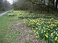
 Spring in Almondell and Calderwood Country Park.jpg 800 × 533; 185 KB
-
 The Almondell and Calderwood Country Park - geograph.org.uk - 761878.jpg 640 × 480; 104 KB
-
 The Nasmyth Bridge, River Almond, Almondell Country Park, West Lothian.jpg 4,733 × 2,661; 3.54 MB
-
 The Sir Simon Fraser Memorial Stone, Almondell and Calderwood Country Park, West Lothian.jpg 3,768 × 2,709; 2.29 MB
-
 The William Wallace Stone inscription, Drumshoreland Muir, West Lothian, Scotland.jpg 3,162 × 2,735; 2.23 MB
-
 Union Canal feeder and shelter, Almondell Country Park, West Lothian.jpg 4,896 × 2,752; 3.47 MB
-
 Union Canal Feeder enters tunnel.jpg 4,000 × 3,000; 4.92 MB
-
 Union Canal feeder to the left, Almondell, West Lothian, Scotland.jpg 4,896 × 2,752; 3.23 MB
-
 Uranus at Almondell - geograph.org.uk - 1596314.jpg 640 × 480; 116 KB
-
 Weir, River Almond.jpg 4,000 × 3,000; 4.79 MB
-
 William Wallace Stone inscription, Drumshoreland Muir, West Lothian.jpg 3,134 × 2,337; 1.38 MB
-
 William Wallace Stone, Drumshoreland Muir, West Lothian. Rear view.jpg 4,290 × 2,741; 3.26 MB
-
 WoodlandAlmond.jpg 533 × 800; 187 KB
-
 Woodlandwalk.jpg 800 × 436; 139 KB


