Category:Allotments in the Metropolitan Borough of Kirklees
Jump to navigation
Jump to search
Media in category "Allotments in the Metropolitan Borough of Kirklees"
The following 32 files are in this category, out of 32 total.
-
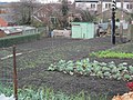
 Allotments - Bath Street - geograph.org.uk - 3622392.jpg 640 × 480; 132 KB
-
 Allotments - Deighton Lane - geograph.org.uk - 3248875.jpg 640 × 480; 122 KB
-
 Allotments - Ingham Avenue - geograph.org.uk - 1430342.jpg 640 × 480; 257 KB
-
 Allotments - Knowles Hill - geograph.org.uk - 3627670.jpg 640 × 477; 92 KB
-
 Allotments - Lees Hall Road - geograph.org.uk - 4242309.jpg 640 × 480; 124 KB
-
 Allotments - Longley Road - geograph.org.uk - 4955445.jpg 640 × 480; 108 KB
-
 Allotments - Low Hills Lane - geograph.org.uk - 4536849.jpg 640 × 480; 71 KB
-
 Allotments - Low Hills Lane - geograph.org.uk - 4536883.jpg 640 × 480; 70 KB
-
 Allotments - Meltham Road - geograph.org.uk - 2140517.jpg 640 × 480; 138 KB
-
 Allotments - Meltham Road - geograph.org.uk - 2141635.jpg 640 × 480; 91 KB
-
 Allotments - Moorlands Avenue - geograph.org.uk - 3622416.jpg 640 × 480; 118 KB
-
 Allotments - Moorlands Road - geograph.org.uk - 3768961.jpg 640 × 425; 56 KB
-
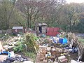
 Allotments - off Dean Brook Road - geograph.org.uk - 2153683.jpg 640 × 480; 84 KB
-
 Allotments - off Dewhurst Road - geograph.org.uk - 4409207.jpg 640 × 480; 100 KB
-
 Allotments - off New North Road - geograph.org.uk - 3236122.jpg 640 × 480; 96 KB
-
 Allotments - Somerset Road - geograph.org.uk - 4854565.jpg 640 × 480; 89 KB
-
 Allotments - Somerset Road - geograph.org.uk - 966248.jpg 640 × 422; 225 KB
-
 Allotments - Westfield Lane - geograph.org.uk - 774328.jpg 640 × 443; 74 KB
-
 Allotments - Whitechapel Road - geograph.org.uk - 774344.jpg 640 × 431; 88 KB
-
 Allotments - York Road - geograph.org.uk - 1418748.jpg 640 × 480; 240 KB
-

-

-
 Allotments off Moorlands Avenue - geograph.org.uk - 4309227.jpg 640 × 480; 94 KB
-
 Allotments off Prospect Road, Longwood - geograph.org.uk - 69771.jpg 640 × 480; 147 KB
-

-
 Allotments, Taylor Hill Road - geograph.org.uk - 1822673.jpg 2,048 × 1,536; 1.19 MB
-

-
 Allotments, Westfield Lane, Scholes - geograph.org.uk - 6550510.jpg 2,000 × 1,213; 2.89 MB
-
 Balks Allotments, Liversedge - geograph.org.uk - 6436229.jpg 2,000 × 1,331; 4.09 MB
-
 Clough Lane Allotments, Liversedge - geograph.org.uk - 6425984.jpg 2,000 × 1,331; 4.33 MB
-
 Clough Lane Allotments, Liversedge - geograph.org.uk - 6661940.jpg 2,000 × 1,024; 2.68 MB
-
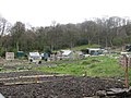
 Moorlands Ave allotments - geograph.org.uk - 412022.jpg 640 × 480; 150 KB


_-_geograph.org.uk_-_132871.jpg)


