Category:Allostock
Jump to navigation
Jump to search
English: Allostock is a village and civil parish in the unitary authority of Cheshire West and Chester and the ceremonial county of Cheshire, England, about five miles south of Knutsford. It has a population of 783 (2001 census).
village and civil parish in Chester West and Cheshire, UK   | |||||
| Upload media | |||||
| Instance of | |||||
|---|---|---|---|---|---|
| Location | Cheshire West and Chester, Cheshire, North West England, England | ||||
| Population |
| ||||
 | |||||
Subcategories
This category has the following 3 subcategories, out of 3 total.
Media in category "Allostock"
The following 144 files are in this category, out of 144 total.
-
 32 metre spot height, on Common Lane - geograph.org.uk - 2945184.jpg 1,024 × 768; 135 KB
-
 Allostock , M6 Motorway - geograph.org.uk - 6292584.jpg 6,000 × 4,000; 5.01 MB
-
 Allostock , M6 Motorway - geograph.org.uk - 6292585.jpg 6,000 × 4,000; 5.24 MB
-
 Allostock , M6 Motorway - geograph.org.uk - 6360395.jpg 6,000 × 4,000; 4.21 MB
-
 Allostock , M6 Motorway - geograph.org.uk - 6360399.jpg 6,000 × 4,000; 4.52 MB
-
 Allostock Population change 1881 to 2011.jpg 484 × 293; 35 KB
-
 Ashbrook Equine Hospital - geograph.org.uk - 5174700.jpg 640 × 480; 48 KB
-
 B5081 towards Swan Green - geograph.org.uk - 5174703.jpg 640 × 480; 45 KB
-
 B5082 towards Northwich - geograph.org.uk - 5174689.jpg 640 × 480; 70 KB
-
 B5082 towards the A50 - geograph.org.uk - 5174693.jpg 640 × 480; 99 KB
-
 Back Lane near Backlane Farm - geograph.org.uk - 5184827.jpg 640 × 480; 75 KB
-
 Baker's Lane - geograph.org.uk - 2720160.jpg 1,024 × 768; 140 KB
-
 Barbed wire fence alongside the B5082 - geograph.org.uk - 2945365.jpg 1,024 × 768; 193 KB
-
 Bend in the A50, Allostock - geograph.org.uk - 5174737.jpg 640 × 480; 74 KB
-
 Boggy land south of Townfield Lane - geograph.org.uk - 2720569.jpg 1,024 × 768; 265 KB
-
 Bradshaw Brook - geograph.org.uk - 2720585.jpg 1,024 × 768; 204 KB
-
 Bradshaw Brook - geograph.org.uk - 2720591.jpg 1,024 × 768; 219 KB
-
 Brick Bank Lane - geograph.org.uk - 2948117.jpg 1,024 × 768; 147 KB
-
 Bridge on Booth Bed Lane - geograph.org.uk - 2720581.jpg 1,024 × 768; 166 KB
-
 Brookside Farm - geograph.org.uk - 4163473.jpg 3,887 × 2,355; 1.88 MB
-
 Car dealership on London Road (A50) - geograph.org.uk - 5174751.jpg 640 × 480; 55 KB
-
 Cereal crop on the north bank of Crow Brook - geograph.org.uk - 2945188.jpg 1,024 × 768; 144 KB
-
 Cheshire West and Chester , Grassy Field - geograph.org.uk - 4934170.jpg 5,855 × 3,903; 7.25 MB
-

-
 Close up, Elizabeth II postbox on London Road (A50) - geograph.org.uk - 5175405.jpg 1,137 × 2,093; 525 KB
-
 Common Lane - geograph.org.uk - 5184830.jpg 640 × 480; 70 KB
-
 Conifer alongside a farm track - geograph.org.uk - 2720613.jpg 1,024 × 768; 137 KB
-

-
 Crow Brook - geograph.org.uk - 2945162.jpg 1,024 × 768; 181 KB
-
 Crow Brook - geograph.org.uk - 5184833.jpg 480 × 640; 137 KB
-
 Dairy cows grazing in front of Allostock Hall - geograph.org.uk - 2945390.jpg 1,024 × 768; 183 KB
-
 Direction Sign – Signpost - geograph.org.uk - 6560833.jpg 640 × 480; 67 KB
-
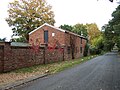
 Disused factory on Newplatt Lane - geograph.org.uk - 5798785.jpg 1,600 × 1,200; 553 KB
-
 Double bend at the 42 metre spot height - geograph.org.uk - 2945344.jpg 1,024 × 768; 154 KB
-
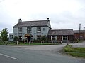
 Drovers Arms, Allostock - geograph.org.uk - 1202450.jpg 640 × 480; 55 KB
-
 Drovers Arms, Allostock - geograph.org.uk - 168448.jpg 640 × 425; 60 KB
-

-
 Elizabeth II postbox on London Road (A50) - geograph.org.uk - 5175402.jpg 2,848 × 2,136; 1.26 MB
-
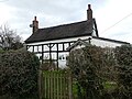
 Fallow Cottage near Swan Green 01.jpg 4,000 × 3,000; 1.28 MB
-
 Fallow Cottage near Swan Green 02.jpg 4,000 × 3,000; 6.14 MB
-
 Farm building on Wash Lane - geograph.org.uk - 5174731.jpg 640 × 480; 99 KB
-

-
 Farmland alongside the A50, Rudheath Woods - geograph.org.uk - 2948061.jpg 1,024 × 768; 147 KB
-
 Farmland near Washlane Farm - geograph.org.uk - 5174694.jpg 640 × 480; 38 KB
-
 Farmland off the B5082 - geograph.org.uk - 5174690.jpg 640 × 480; 86 KB
-
 Field boundary north of Baker's Lane - geograph.org.uk - 2720173.jpg 1,024 × 768; 139 KB
-
 Field gate and 'estate' fencing, Rudheath Woods - geograph.org.uk - 2948078.jpg 1,024 × 768; 189 KB
-
 Field gate on the north side of Baker's Lane - geograph.org.uk - 2720168.jpg 1,024 × 768; 166 KB
-
 Field gate south of Baker's Lane - geograph.org.uk - 2720181.jpg 1,024 × 768; 184 KB
-
 Field hedge reinforced with fencing - geograph.org.uk - 2720190.jpg 1,024 × 768; 163 KB
-

-
 Footpath stile, Townfield Lane - geograph.org.uk - 2720540.jpg 1,024 × 768; 127 KB
-
 Footpath towards Goostrey - geograph.org.uk - 327592.jpg 640 × 417; 96 KB
-

-
 Gated track off Wash Lane - geograph.org.uk - 5174733.jpg 640 × 480; 115 KB
-
 Grasscrete layby, New Platt Lane - geograph.org.uk - 2948034.jpg 1,024 × 768; 177 KB
-
 Grassland off London Road (A50) - geograph.org.uk - 5174740.jpg 640 × 480; 59 KB
-
 Grassland off Townfield Lane - geograph.org.uk - 5174754.jpg 640 × 480; 66 KB
-
 Grazing and hedgerow - geograph.org.uk - 5174757.jpg 640 × 480; 57 KB
-
 Grazing and hedgerow - geograph.org.uk - 5184829.jpg 640 × 480; 78 KB
-
 Grazing off London Road (A50) - geograph.org.uk - 5174759.jpg 640 × 480; 43 KB
-
 Grazing off the B5082 - geograph.org.uk - 5174686.jpg 640 × 480; 49 KB
-
 Grazing off Wash Lane - geograph.org.uk - 5174705.jpg 640 × 480; 73 KB
-
 Grazing off Wash Lane - geograph.org.uk - 5174734.jpg 640 × 480; 85 KB
-
 Hebden Green, Winsford - geograph.org.uk - 4677134.jpg 3,264 × 2,448; 4 MB
-
 Highfield House, Holmes Chapel Road - geograph.org.uk - 2945376.jpg 1,024 × 768; 125 KB
-

-

-
 Hills Garden Centre - Panorama - geograph.org.uk - 1202448.jpg 640 × 480; 71 KB
-
 Houses on Booth Bed Lane - geograph.org.uk - 2720588.jpg 1,024 × 768; 130 KB
-
 Houses on Knutsford Road, Rudheath Woods - geograph.org.uk - 2948046.jpg 1,024 × 768; 180 KB
-
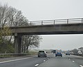 Hulme Hall Lane Bridge, M6 - geograph.org.uk - 4498045.jpg 640 × 519; 52 KB
-
 Ivy-covered tree alongside Booth Bed Lane - geograph.org.uk - 2720578.jpg 1,024 × 768; 144 KB
-
 Lake at New Platt Farm - geograph.org.uk - 1094124.jpg 480 × 640; 90 KB
-
 Large field north of Boothbed Farm - geograph.org.uk - 2722622.jpg 1,024 × 768; 142 KB
-
 Large field south of New Platt Lane - geograph.org.uk - 2948072.jpg 1,024 × 768; 184 KB
-
 Late Silage - geograph.org.uk - 4163472.jpg 3,888 × 2,592; 1.57 MB
-
 Leylandii hedge hiding Cherry Tree Farm - geograph.org.uk - 2722634.jpg 1,024 × 768; 157 KB
-
 Logs and eggs for sale, New Platt Lane - geograph.org.uk - 2948096.jpg 1,024 × 768; 179 KB
-
 London Road (A50) - geograph.org.uk - 5174741.jpg 640 × 480; 62 KB
-
 London Road (A50) - geograph.org.uk - 5174769.jpg 640 × 480; 95 KB
-
 Lumpy land south of Townfield Lane - geograph.org.uk - 2720550.jpg 1,024 × 768; 128 KB
-

-
 M6 Motorway - geograph.org.uk - 4163470.jpg 3,547 × 1,939; 1.75 MB
-

-
 M6 Motorway north of Hulme Hall Lane - geograph.org.uk - 2245347.jpg 640 × 480; 46 KB
-

-

-
 M6 Southbound - geograph.org.uk - 3504991.jpg 640 × 480; 384 KB
-

-
 Mangoletsi's BMW garage on the A50 - geograph.org.uk - 2720564.jpg 1,024 × 768; 105 KB
-

-
 Middlewich Road bridge, M6 - geograph.org.uk - 4498036.jpg 640 × 426; 36 KB
-
 Middlewich Road crosses the M6 - geograph.org.uk - 4616821.jpg 1,500 × 999; 108 KB
-
 Muddy entrance to stubble field - geograph.org.uk - 2720186.jpg 1,024 × 768; 192 KB
-
 Muddy yard, Old Mill Farm - geograph.org.uk - 2720554.jpg 1,024 × 768; 152 KB
-
 New Platt Lane - geograph.org.uk - 2948089.jpg 1,024 × 768; 217 KB
-
 New Platt Lane crossing the London Road (A50) - geograph.org.uk - 2948028.jpg 1,024 × 768; 178 KB
-
 Newplatt Farm, New Platt Lane - geograph.org.uk - 2948093.jpg 1,024 × 768; 167 KB
-
 North end of Shakerley Mere - geograph.org.uk - 6358446.jpg 1,024 × 768; 154 KB
-
 Northbound M6, Northwich Road Bridge - geograph.org.uk - 3505276.jpg 640 × 480; 376 KB
-
 Northwich Road bridge over M6 - geograph.org.uk - 4006140.jpg 640 × 342; 44 KB
-
 Northwich Road Bridge, M6 - geograph.org.uk - 4498028.jpg 640 × 373; 28 KB
-
 Old Mill Farm, Townfield Lane - geograph.org.uk - 2720197.jpg 1,024 × 768; 108 KB
-
 Open-fronted barn, off Baker's Lane - geograph.org.uk - 2720179.jpg 1,024 × 768; 165 KB
-
 Ploughed field, Goostrey - geograph.org.uk - 2358346.jpg 2,794 × 1,871; 1.29 MB
-
 Private drive to a hidden house - geograph.org.uk - 2948120.jpg 1,024 × 768; 179 KB
-
-
 Private track and public footpath, off the B5082 - geograph.org.uk - 2945336.jpg 1,024 × 768; 235 KB
-
 River scene - geograph.org.uk - 327632.jpg 640 × 497; 161 KB
-
 Roadworks on the M6 northbound - geograph.org.uk - 5174698.jpg 640 × 480; 55 KB
-
 Sheep grazing south of Townfield Lane - geograph.org.uk - 2720559.jpg 1,024 × 768; 150 KB
-
 Sign for Equiport - geograph.org.uk - 5174764.jpg 453 × 640; 37 KB
-
 Sign for the Three Greyhounds Inn - geograph.org.uk - 5174685.jpg 562 × 640; 41 KB
-
 Small tree alongside a small stream - geograph.org.uk - 2948070.jpg 1,024 × 768; 189 KB
-
 Southbound M6 near Swan Green - geograph.org.uk - 3504982.jpg 640 × 480; 313 KB
-
 Southbound M6, Middlewich Road Bridge - geograph.org.uk - 3504999.jpg 640 × 480; 322 KB
-
 Springbank Farm - geograph.org.uk - 2720161.jpg 1,024 × 768; 190 KB
-
 Sycamore Farm, Sandy Lane - geograph.org.uk - 2720542.jpg 1,024 × 768; 197 KB
-

-
 The Three Greyhounds Inn - geograph.org.uk - 5174683.jpg 640 × 480; 48 KB
-
 The Three Greyhounds Public House - geograph.org.uk - 83936.jpg 640 × 480; 77 KB
-
 Townfield Farm - geograph.org.uk - 293038.jpg 640 × 471; 96 KB
-
 Townfield Farm - geograph.org.uk - 4163471.jpg 3,888 × 1,918; 1.81 MB
-
 Townfield Lane - geograph.org.uk - 2720545.jpg 1,024 × 768; 125 KB
-
 Townfield Lane - geograph.org.uk - 2720557.jpg 1,024 × 768; 204 KB
-
 Townfield Lane - geograph.org.uk - 5174756.jpg 640 × 480; 106 KB
-
 Townfield Nurseries, Townfield Lane - geograph.org.uk - 2720566.jpg 1,024 × 768; 162 KB
-
 Track to Boothbed Farm - geograph.org.uk - 2720608.jpg 1,024 × 768; 189 KB
-
 Tree in a wind-blown meadow, south of B5082 - geograph.org.uk - 2945351.jpg 1,024 × 768; 129 KB
-
 View west along Townfield Lane - geograph.org.uk - 2720574.jpg 1,024 × 768; 216 KB
-

-
 Wash Lane - geograph.org.uk - 5174730.jpg 640 × 480; 133 KB
-
 Wash Lane - geograph.org.uk - 5174735.jpg 640 × 480; 126 KB
-
 Washlane Farm - geograph.org.uk - 2923862.jpg 2,770 × 1,496; 1.96 MB
-
 Waterlogged field, east of Brick Bank Lane - geograph.org.uk - 2948107.jpg 1,024 × 768; 114 KB
-
 Welcome to Hills - geograph.org.uk - 905236.jpg 640 × 480; 97 KB
-
 Where does the well used track lead? - geograph.org.uk - 5798737.jpg 1,600 × 1,200; 881 KB
-
 Why stand when you can lie down^ - geograph.org.uk - 2720595.jpg 1,024 × 768; 92 KB
-
 Wind-blown meadow under a bright but cloudy sky - geograph.org.uk - 2945360.jpg 1,024 × 768; 141 KB
-
 Winter trees along Booth Bed Lane - geograph.org.uk - 2722624.jpg 1,024 × 768; 231 KB
-
 Byway across Warrington Common - geograph.org.uk - 383086.jpg 640 × 480; 198 KB
-
 Hales Pasture - geograph.org.uk - 327572.jpg 640 × 475; 71 KB
-


_-_geograph.org.uk_-_5174751.jpg)


_-_geograph.org.uk_-_5175405.jpg)


_-_geograph.org.uk_-_5174699.jpg)


_-_geograph.org.uk_-_5175402.jpg)


_off_London_Road_(A50)_-_geograph.org.uk_-_5174738.jpg)


_-_geograph.org.uk_-_5174762.jpg)


_-_geograph.org.uk_-_5174740.jpg)


_-_geograph.org.uk_-_5174759.jpg)


_-_geograph.org.uk_-_5174741.jpg)
_-_geograph.org.uk_-_5174769.jpg)


_-_geograph.org.uk_-_2948028.jpg)


