Category:Allington, All Cannings
Jump to navigation
Jump to search
English: Allington is a village in north Wiltshire, England and is part of the civil parish of All Cannings. It should not be confused with Allington, also in Wiltshire.
hamlet and former civil parish in All Cannings, Wiltshire, England  | |||||
| Upload media | |||||
| Instance of |
| ||||
|---|---|---|---|---|---|
| Location | All Cannings, Wiltshire, South West England, England | ||||
 | |||||
Media in category "Allington, All Cannings"
The following 14 files are in this category, out of 14 total.
-
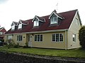 A bungalow in Allington, Wiltshire - geograph.org.uk - 83644.jpg 640 × 480; 58 KB
-
 Farm machinery passing Boldehyde Manor - geograph.org.uk - 1805558.jpg 640 × 540; 119 KB
-
 Farmland, Allington - geograph.org.uk - 928938.jpg 640 × 480; 125 KB
-
 Farmland, Allington - geograph.org.uk - 928943.jpg 640 × 480; 134 KB
-
 Minor road to Allington - geograph.org.uk - 1393306.jpg 640 × 469; 121 KB
-
 Minor road west of Allington - geograph.org.uk - 1417997.jpg 640 × 521; 115 KB
-
 North east near Allington - geograph.org.uk - 1418008.jpg 640 × 468; 95 KB
-
 Pond by Chippenham Lane - geograph.org.uk - 1179581.jpg 640 × 494; 128 KB
-
 Road near Allington - geograph.org.uk - 846319.jpg 640 × 480; 112 KB
-
 Rybury - panoramio.jpg 1,448 × 972; 387 KB
-
 Rybury Hill Fort - geograph.org.uk - 1286306.jpg 640 × 480; 42 KB
-
 Water Stop - geograph.org.uk - 1286342.jpg 640 × 480; 111 KB
-
 Weather vane, Allington - geograph.org.uk - 1429823.jpg 480 × 640; 83 KB
-
 Wheatfield and view north near Allington - geograph.org.uk - 1418018.jpg 640 × 427; 113 KB


