Category:Alleys in the London Borough of Enfield
Jump to navigation
Jump to search

Subcategories
This category has the following 3 subcategories, out of 3 total.
Media in category "Alleys in the London Borough of Enfield"
The following 17 files are in this category, out of 17 total.
-
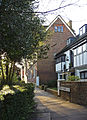 Church Walk, Enfield - geograph.org.uk - 1085937.jpg 465 × 640; 139 KB
-
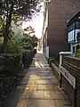 Church Walk, Enfield - geograph.org.uk - 1085940.jpg 480 × 640; 128 KB
-
 Crews Hill, Beech Avenue footpath - geograph.org.uk - 713019.jpg 640 × 480; 112 KB
-
 Footpath from The Green to Norman Way, Southgate.JPG 3,000 × 4,000; 4.39 MB
-
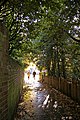
 Footpath to Oakwood Park, London N14 - geograph.org.uk - 301443.jpg 479 × 640; 111 KB
-
 Footpath to the High Road - geograph.org.uk - 1510180.jpg 414 × 640; 192 KB
-
 Footpath, Southgate Green, London N14 - geograph.org.uk - 789974.jpg 426 × 640; 131 KB
-
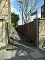
 Gentleman's Row, Enfield - geograph.org.uk - 1034202.jpg 426 × 640; 165 KB
-
 Gentleman's Row, Enfield - geograph.org.uk - 1034212.jpg 426 × 640; 144 KB
-
 Gentleman's Row, Enfield - geograph.org.uk - 1034231.jpg 640 × 430; 161 KB
-
 Holly Walk, Enfield - geograph.org.uk - 1033800.jpg 424 × 640; 100 KB
-
 Path to Cowlands Avenue - geograph.org.uk - 3250525.jpg 640 × 430; 89 KB
-
 Pennyfather Lane south end, Enfield EN2.JPG 4,000 × 3,000; 4.3 MB
-
 Pennyfather Lane, Enfield - geograph.org.uk - 1033391.jpg 640 × 426; 168 KB
-
 Road sign for Gentleman's Row, Enfield - geograph.org.uk - 1265091.jpg 640 × 479; 102 KB
-
 Urban footpath, Ponders End - geograph.org.uk - 3250515.jpg 640 × 430; 81 KB
-


