Category:Allander Water
Jump to navigation
Jump to search

river on the Glasgow and East Dunbartonshire border, and East Dunbartonshire and Stirling border, Scotland, UK, tributary of the River Kelvin  | |||||
| Upload media | |||||
| Instance of | |||||
|---|---|---|---|---|---|
| Location |
| ||||
| Origin of the watercourse |
| ||||
| Mouth of the watercourse |
| ||||
 | |||||
Subcategories
This category has only the following subcategory.
T
Media in category "Allander Water"
The following 14 files are in this category, out of 14 total.
-
 Allander Water - geograph.org.uk - 1127599.jpg 640 × 480; 142 KB
-
 Allander Water and walkway - geograph.org.uk - 1249371.jpg 640 × 480; 104 KB
-

-
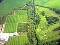
 Auchenhowie from the air (geograph 6262776).jpg 1,024 × 768; 314 KB
-
 Crossing Allander Water - geograph.org.uk - 620392.jpg 640 × 480; 119 KB
-
 Gavin's Mill Fish Pass, Milngavie - geograph.org.uk - 80181.jpg 640 × 479; 198 KB
-
 Murray Park (geograph 5869668).jpg 1,600 × 1,028; 545 KB
-
 Murray Park from the air (geograph 3197503).jpg 586 × 640; 188 KB
-
 Murray Park, Milngavie (geograph 4533327).jpg 3,264 × 2,448; 4.04 MB
-
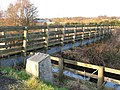
 Prescott Bridge over the Allander Water (geograph 4199553).jpg 800 × 600; 159 KB
-
 The Allander Walkway - geograph.org.uk - 947276.jpg 640 × 480; 108 KB
-
 The Prescott Bridge - geograph.org.uk - 948473.jpg 640 × 480; 96 KB
-
 Water Pipes - geograph.org.uk - 1249333.jpg 640 × 480; 69 KB
-
 Water Pipes - geograph.org.uk - 1249449.jpg 640 × 480; 81 KB


.jpg)


.jpg)
.jpg)
.jpg)
.jpg)


