Category:Allée couverte de la Petite Roche
Jump to navigation
Jump to search
| Object location | | View all coordinates using: OpenStreetMap |
|---|
|
This building is classé au titre des monuments historiques de la France. It is indexed in the base Mérimée, a database of architectural heritage maintained by the French Ministry of Culture, under the reference PA00110560
|
.JPG) | |||||
| Upload media | |||||
| Instance of | |||||
|---|---|---|---|---|---|
| Location | Rocheville, Manche, Normandy, Metropolitan France, France | ||||
| Heritage designation |
| ||||
 | |||||
Media in category "Allée couverte de la Petite Roche"
The following 11 files are in this category, out of 11 total.
-
 Allée couverte de la petite Roche (10).JPG 3,000 × 4,000; 3.92 MB
-
 Allée couverte de la petite Roche (2).JPG 4,000 × 3,000; 3.83 MB
-
 Allée couverte de la petite Roche (3).JPG 3,000 × 4,000; 4.22 MB
-
 Allée couverte de la petite Roche (4).JPG 4,000 × 3,000; 2.76 MB
-
 Allée couverte de la petite Roche (5).JPG 4,000 × 3,000; 3.77 MB
-
 Allée couverte de la petite Roche (6).JPG 4,000 × 3,000; 3.69 MB
-
 Allée couverte de la petite Roche (7).JPG 3,000 × 4,000; 3.47 MB
-
 Allée couverte de la petite Roche (8).JPG 4,000 × 3,000; 3.55 MB
-
 Allée couverte de la petite Roche (9).JPG 4,000 × 3,000; 3.33 MB
-
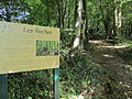 Allée couverte de la petite Roche - Paneau informatif.JPG 4,000 × 3,000; 3.73 MB
-
 Allée couverte de la petite Roche.jpg 4,584 × 2,934; 2.15 MB
.JPG)
.JPG)
.JPG)
.JPG)
.JPG)
.JPG)
.JPG)
.JPG)

