Category:Alkrington Garden Village
Jump to navigation
Jump to search
English: Alkrington Garden Village is a surburban area in the unparished area of Middleton, in the Rochdale district, in the county of Greater Manchester, England.
suburb of Middleton, Greater Manchester, England, United Kingdom  | |||||
| Upload media | |||||
| Instance of | |||||
|---|---|---|---|---|---|
| Location | Middleton, Rochdale, Greater Manchester, North West England, England | ||||
 | |||||
Subcategories
This category has the following 2 subcategories, out of 2 total.
A
- Alkrington Hall (20 F)
Media in category "Alkrington Garden Village"
The following 39 files are in this category, out of 39 total.
-
 Alkrington - Brookside Close - geograph.org.uk - 2239221.jpg 640 × 480; 42 KB
-
 Alkrington - local shops at Mount Road roundabout - geograph.org.uk - 2239195.jpg 2,592 × 1,944; 2.18 MB
-
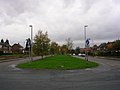
 Alkrington - Mount Road roundabout - geograph.org.uk - 2239185.jpg 640 × 480; 62 KB
-
 Alkrington - Old David's pub - geograph.org.uk - 2239212.jpg 640 × 480; 48 KB
-
 Alkrington Community Centre - geograph.org.uk - 2239204.jpg 2,592 × 1,944; 1.52 MB
-
 Alkrington Garden Village - geograph.org.uk - 78440.jpg 640 × 480; 222 KB
-
 Alkrington Garden Village - geograph.org.uk - 78472.jpg 640 × 480; 248 KB
-
 Alkrington Health Centre - geograph.org.uk - 1950222.jpg 800 × 600; 94 KB
-
 Alkrington Shopping Precinct - geograph.org.uk - 1950224.jpg 800 × 600; 123 KB
-
 Alkrington Shopping Precinct - geograph.org.uk - 1950229.jpg 800 × 600; 119 KB
-
 Alkrington Wood - geograph.org.uk - 6516056.jpg 4,032 × 3,024; 1.84 MB
-
 Apple and Pear - geograph.org.uk - 1950249.jpg 900 × 600; 130 KB
-
 Brookside Crescent - geograph.org.uk - 4208880.jpg 3,722 × 2,025; 1.53 MB
-

-
 Evesham Road, Alkrington - geograph.org.uk - 3566306.jpg 3,872 × 2,592; 4.81 MB
-
 Grassland on the edge of Alkrington - geograph.org.uk - 3566313.jpg 3,872 × 2,592; 4.55 MB
-
 Green grass by Brookside Crescent - geograph.org.uk - 3566287.jpg 3,872 × 2,592; 3.97 MB
-
 Home Farm, Alkrington Hall - geograph.org.uk - 63030.jpg 640 × 480; 123 KB
-
 House in Alkrington Woods - geograph.org.uk - 5119442.jpg 1,600 × 1,200; 321 KB
-

-
 Kirkway, Alkrington Garden Village - geograph.org.uk - 1950235.jpg 800 × 600; 85 KB
-
 Lever Bridge in Alkrington Wood - geograph.org.uk - 5119440.jpg 1,600 × 1,200; 317 KB
-
 Mainway, Alkrington - geograph.org.uk - 5496280.jpg 3,840 × 2,160; 2.99 MB
-
 Mainway, Alkrington Garden Village - geograph.org.uk - 1950208.jpg 800 × 600; 139 KB
-
 Manchester New Road - geograph.org.uk - 63104.jpg 640 × 480; 116 KB
-
 Manchester New Road, Alkrington - geograph.org.uk - 2329255.jpg 640 × 448; 141 KB
-
 Meadow Road, Alkrington - geograph.org.uk - 63044.jpg 640 × 480; 88 KB
-
 Old David's - geograph.org.uk - 1950240.jpg 800 × 600; 100 KB
-
 Old David's - geograph.org.uk - 4208868.jpg 3,006 × 1,631; 1.43 MB
-
 Old David's Bar and Restaurant - Closed and Boarded - geograph.org.uk - 4022235.jpg 4,608 × 3,456; 7.55 MB
-
 Parade of shops, Kirkway - geograph.org.uk - 2329248.jpg 640 × 456; 99 KB
-
 Path behind the houses - geograph.org.uk - 3566357.jpg 3,872 × 2,592; 5.46 MB
-
 Paths round the back of the houses - geograph.org.uk - 3566341.jpg 3,872 × 2,592; 5.47 MB
-
 Roundabout at the end of Kingsway - geograph.org.uk - 4022238.jpg 4,356 × 2,554; 3.92 MB
-
 Shopping Centre, Alkrington Garden Village - geograph.org.uk - 78487.jpg 640 × 480; 252 KB
-
 St Thomas More Roman Catholic Church, Alkrington - geograph.org.uk - 1950218.jpg 1,600 × 1,200; 307 KB
-
 The Apple ^ Pear, Alkrington - geograph.org.uk - 3566297.jpg 3,872 × 2,592; 3.57 MB
-
 The Heath, Alkrington Garden Village - geograph.org.uk - 78554.jpg 640 × 480; 229 KB
-
 Thornberries - geograph.org.uk - 1950213.jpg 800 × 600; 97 KB


