Category:Alewife triangle
Jump to navigation
Jump to search
English: The Alewife triangle is bordered by Alewife Brook Parkway, the Fitchburg Line, and the Fitchburg Cutoff Path. Formerly industrial, it was developed beginning in the 1980s as transit-oriented development around Alewife station.
Subcategories
This category has the following 3 subcategories, out of 3 total.
A
- Alewife Yard (6 F)
F
- Fitchburg Cutoff Path (15 F)
Media in category "Alewife triangle"
The following 13 files are in this category, out of 13 total.
-
 Aerial view of Alewife garage and developments, November 2015.jpg 4,800 × 3,206; 7.24 MB
-
 Alewife Brook Reservation and buildings, May 2019.jpg 4,032 × 3,024; 6.23 MB
-
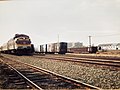
 B&M 1223 on 685.agr.jpg 4,032 × 3,024; 6.49 MB
-
 Cambridge Highlands aerial, November 2015.jpg 6,000 × 4,000; 10.91 MB
-
 Fresh Pond Aerial.JPG 6,000 × 4,000; 10.21 MB
-
 MBTA 1150 from 685.agr.jpg 4,032 × 3,024; 6.35 MB
-
 New buildings behind Alewife Brook Reservation, April 2020.jpg 4,032 × 3,024; 5.17 MB
-
 North and West Cambridge and North Allston aerial.JPG 4,320 × 3,240; 4.44 MB
-
 TOD near Alewife station (1), July 2005.jpg 2,002 × 1,286; 650 KB
-
 Wetland in Alewife Brook Reservation (1), April 2020.jpg 4,032 × 3,024; 4.87 MB
-
 Wetland in Alewife Brook Reservation (2), April 2020.jpg 4,032 × 3,024; 5.4 MB
-
 Wetlands in the Alewife Brook Reservation, March 2019.jpg 4,032 × 3,024; 7.33 MB
-
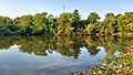 Yates Pond in Alewife Brook Reservation, September 2022.jpg 2,873 × 1,635; 2.03 MB


,_July_2005.jpg)
,_April_2020.jpg)
,_April_2020.jpg)

