Category:Aldershot Road, Fleet
Jump to navigation
Jump to search
road in Fleet leading to Aldershot  | |||||
| Upload media | |||||
| Instance of | |||||
|---|---|---|---|---|---|
| Location | Fleet, Hart, Hampshire, South East England, England | ||||
 | |||||
Subcategories
This category has the following 4 subcategories, out of 4 total.
5
Media in category "Aldershot Road, Fleet"
The following 12 files are in this category, out of 12 total.
-
 A323 Aldershot Road, Fleet - geograph.org.uk - 6235665.jpg 1,024 × 684; 302 KB
-
 Aldershot Road at the junction of Kings Road - geograph.org.uk - 4517316.jpg 2,560 × 1,920; 1.25 MB
-
 Aldershot Road Bridge - geograph.org.uk - 2902313.jpg 640 × 430; 133 KB
-
 Aldershot Road, Fleet - geograph.org.uk - 2855210.jpg 1,600 × 1,200; 495 KB
-
 Aldershot Road, Fleet - geograph.org.uk - 4514454.jpg 2,560 × 1,920; 2.18 MB
-
 Aldershot Road, Fleet - geograph.org.uk - 4515297.jpg 2,560 × 1,920; 2.03 MB
-
 Ginnel to Aldershot Rd - geograph.org.uk - 2907099.jpg 640 × 430; 101 KB
-
 Junction of Aldershot Road and Reading Road South - geograph.org.uk - 2855251.jpg 1,600 × 1,200; 569 KB
-
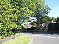 Montrose Close at the junction of Aldershot Road - geograph.org.uk - 4514216.jpg 2,560 × 1,920; 2.02 MB
-
 My Maison - geograph.org.uk - 2801971.jpg 640 × 480; 83 KB
-
 Norris Hill Road, Cycle Path - West short offroad segregated (13176794215).jpg 4,000 × 2,248; 1.99 MB
-
 Reading Road South, Basingstoke - geograph.org.uk - 3090464.jpg 640 × 480; 65 KB


.jpg)
