Category:Alderminster
Jump to navigation
Jump to search
village in United Kingdom  | |||||
| Upload media | |||||
| Instance of | |||||
|---|---|---|---|---|---|
| Location | Stratford-on-Avon, Warwickshire, West Midlands, England | ||||
| Population |
| ||||
| Area |
| ||||
| Said to be the same as | Alderminster (Wikimedia duplicated page, civil parish) | ||||
| official website | |||||
 | |||||
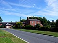
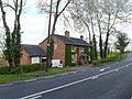
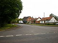
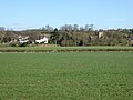
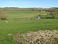
English: Alderminster is a village and civil parish in the Stratford-on-Avon district of Warwickshire, England. It is on the River Stour and the A3400, between Stratford-upon-Avon and Shipston-on-Stour. Nearby places are Wimpstone, Atherstone-on-Stour and Newbold-on-Stour. In the 2001 census, the parish had a population of 452.
Subcategories
This category has the following 3 subcategories, out of 3 total.
Media in category "Alderminster"
The following 200 files are in this category, out of 206 total.
(previous page) (next page)-
 A host of golden daffodils - geograph.org.uk - 5325000.jpg 4,320 × 3,240; 3.93 MB
-

-

-
 A3400 at Wimpstone Lane - geograph.org.uk - 4851182.jpg 640 × 480; 42 KB
-

-

-

-

-

-
 A3400 towards Stratford-upon-Avon - geograph.org.uk - 3399198.jpg 640 × 480; 86 KB
-
 A3400-Preston Lane junction - geograph.org.uk - 4851181.jpg 640 × 481; 78 KB
-
 Alderminster Farmland - geograph.org.uk - 5360867.jpg 1,600 × 1,200; 459 KB
-

-
 Alderminster, milepost - geograph.org.uk - 1395769.jpg 640 × 481; 118 KB
-
 Alderminster-The Old Schoolhouse - geograph.org.uk - 5360954.jpg 1,600 × 1,200; 484 KB
-
 Approach to Alderminster Farm - geograph.org.uk - 3308086.jpg 640 × 427; 233 KB
-
 Approaching Junction at Park Leys - geograph.org.uk - 3152432.jpg 640 × 456; 122 KB
-
 Arable Land near Crimscote - geograph.org.uk - 60889.jpg 640 × 478; 145 KB
-
 Avenue to Alscot Park - geograph.org.uk - 2234513.jpg 640 × 480; 126 KB
-
 Badger Track - geograph.org.uk - 3220909.jpg 640 × 480; 117 KB
-
 Banbury Road - geograph.org.uk - 2846208.jpg 4,320 × 3,240; 4.92 MB
-
 Banbury Road, Shennington - geograph.org.uk - 5995431.jpg 1,960 × 1,412; 1.13 MB
-
 Beecham Spinney - geograph.org.uk - 120076.jpg 640 × 480; 93 KB
-
 Blooming Alderminster - geograph.org.uk - 5327676.jpg 4,320 × 3,240; 3.56 MB
-
 Blue Lane - geograph.org.uk - 5712909.jpg 1,024 × 680; 227 KB
-
 Blue Lane - geograph.org.uk - 5712942.jpg 1,024 × 680; 227 KB
-
 Blue Lane Farm - geograph.org.uk - 1716716.jpg 2,000 × 1,496; 305 KB
-
 Blue Lane Farm - geograph.org.uk - 1716841.jpg 2,000 × 1,497; 273 KB
-
 Boundary Covert - geograph.org.uk - 2849055.jpg 4,320 × 3,240; 5.28 MB
-
 Bridge over Goldicote cutting - geograph.org.uk - 1716774.jpg 2,000 × 1,497; 334 KB
-
 Bridge over the Stour at Wimpstone - geograph.org.uk - 1727415.jpg 2,000 × 1,501; 237 KB
-
 Bridge under the old SandMJR embankment - geograph.org.uk - 1718907.jpg 2,000 × 1,503; 340 KB
-
 Bridle Path to Rough Hill - geograph.org.uk - 3915993.jpg 640 × 480; 138 KB
-
 Bridleway to Ettington Park Hotel - geograph.org.uk - 5114062.jpg 640 × 480; 87 KB
-
 Bridleway to Ettington Park Hotel - geograph.org.uk - 5114065.jpg 640 × 480; 133 KB
-
 Bridleway to Ettington Park Hotel - geograph.org.uk - 5114069.jpg 480 × 640; 147 KB
-
 Bridleway to Ettington Park Hotel - geograph.org.uk - 5114072.jpg 640 × 480; 89 KB
-
 Bridleway to Ettington Park Hotel - geograph.org.uk - 5114074.jpg 640 × 480; 73 KB
-
 Bridleway to Ettington Park Hotel - geograph.org.uk - 5114076.jpg 480 × 640; 80 KB
-
 Bridleway to Ettington Park Hotel - geograph.org.uk - 5114077.jpg 640 × 480; 91 KB
-
 Cottage by the inn - geograph.org.uk - 2846189.jpg 4,320 × 3,240; 5.04 MB
-
 Cottages, Alderminster - geograph.org.uk - 3399203.jpg 1,024 × 661; 95 KB
-
 Country at Crimscote - geograph.org.uk - 4162932.jpg 2,592 × 1,944; 1.36 MB
-
 Country road near Ettington - geograph.org.uk - 5307927.jpg 1,024 × 768; 347 KB
-
 Countryside near Alderminster - geograph.org.uk - 2542648.jpg 640 × 480; 69 KB
-

-
 Covered reservoir (1) - geograph.org.uk - 2847897.jpg 4,320 × 3,240; 4.45 MB
-
 Covered reservoir (2) - geograph.org.uk - 2849047.jpg 4,320 × 3,240; 4.26 MB
-
 Dismantled Railway near Shennington - geograph.org.uk - 2542592.jpg 640 × 480; 85 KB
-
 Distant view of Meon Hill - geograph.org.uk - 5713779.jpg 1,024 × 680; 277 KB
-
 Disused Telephone Repeater Station - geograph.org.uk - 2914318.jpg 640 × 480; 150 KB
-
 Down and up - geograph.org.uk - 2847887.jpg 4,320 × 3,240; 5.09 MB
-
 Drive to Ettington Park Hotel - geograph.org.uk - 5307899.jpg 1,024 × 768; 400 KB
-
 Drive to Knavenhill Hall - geograph.org.uk - 5713902.jpg 1,024 × 680; 311 KB
-
 Entrance to Alderminster - geograph.org.uk - 4494240.jpg 3,776 × 2,520; 4.03 MB
-
 Entrance to Ettington Park Hotel - geograph.org.uk - 3311920.jpg 640 × 444; 256 KB
-
 Entrance to Goldicote House from A422 - geograph.org.uk - 3152430.jpg 447 × 640; 126 KB
-
 Ettington Grove - geograph.org.uk - 3915988.jpg 640 × 480; 85 KB
-
 Ettington Park Business Centre - geograph.org.uk - 2802057.jpg 4,320 × 3,240; 4.69 MB
-
 Farm and business centre - geograph.org.uk - 2802051.jpg 4,320 × 3,240; 5.04 MB
-
 Farm driveway - geograph.org.uk - 2846304.jpg 4,320 × 3,240; 4.54 MB
-
 Farmland near Crimscote - geograph.org.uk - 3399200.jpg 640 × 480; 64 KB
-
 Farmland near Shenningham Farm - geograph.org.uk - 5712953.jpg 1,024 × 680; 270 KB
-
 Farmland off Shipston Road - geograph.org.uk - 3399735.jpg 640 × 480; 73 KB
-
 Farmland off Shipston Road - geograph.org.uk - 3399745.jpg 640 × 480; 61 KB
-
 Farmland towards the River Stour - geograph.org.uk - 3399730.jpg 640 × 480; 96 KB
-
 Field entrance - geograph.org.uk - 5713773.jpg 1,024 × 680; 316 KB
-
 Field entrance of Shipston Road - geograph.org.uk - 3399205.jpg 640 × 413; 56 KB
-
 Fields at Blue lane - geograph.org.uk - 2542572.jpg 640 × 480; 94 KB
-
 Fields at Churchill Farm - geograph.org.uk - 2542655.jpg 640 × 480; 72 KB
-
 Fields by Banbury Road, Shennington - geograph.org.uk - 5995432.jpg 1,990 × 1,454; 1.18 MB
-
 Fields near Alderminster - geograph.org.uk - 3204895.jpg 640 × 480; 81 KB
-
 Footpath near The Stalls - geograph.org.uk - 2234524.jpg 640 × 480; 88 KB
-
 Footpath to Coombe Farm - geograph.org.uk - 121366.jpg 640 × 480; 82 KB
-
 Forgotten milepost by the A422 - geograph.org.uk - 4882214.jpg 1,440 × 2,560; 2.33 MB
-
 Former railway bridge near Alderminster - geograph.org.uk - 5712949.jpg 1,024 × 680; 408 KB
-
 Former railway bridge near Alderminster - geograph.org.uk - 5712952.jpg 1,024 × 680; 398 KB
-
 Gently up the hill - geograph.org.uk - 2847638.jpg 4,320 × 3,240; 5.21 MB
-
 Goldicote Business Park (1) - geograph.org.uk - 2847337.jpg 4,320 × 3,240; 4.78 MB
-
 Goldicote Business Park (2) - geograph.org.uk - 2847344.jpg 4,320 × 3,240; 4.68 MB
-
 Goldicote Cutting Nature Reserve - geograph.org.uk - 2847396.jpg 4,320 × 3,240; 4.9 MB
-
 Goldicote Lane approaching Loxley - geograph.org.uk - 5712911.jpg 680 × 1,024; 311 KB
-
 Goldicote Lodge - geograph.org.uk - 2542466.jpg 640 × 480; 133 KB
-
 Hide near Rough Hill - geograph.org.uk - 1775110.jpg 2,000 × 1,502; 189 KB
-
 Hill Farm - geograph.org.uk - 2542660.jpg 640 × 480; 70 KB
-
 Holly Cottage - geograph.org.uk - 2846000.jpg 4,320 × 3,240; 4.92 MB
-
 Hookend Coppice from A3400 - geograph.org.uk - 1773237.jpg 2,000 × 1,502; 207 KB
-
 Hotel driveway (1) - geograph.org.uk - 2802140.jpg 4,320 × 3,240; 5.14 MB
-
 Hotel driveway (2) - geograph.org.uk - 2802395.jpg 4,320 × 3,240; 5.29 MB
-
 Houndshill Inn on A422 - geograph.org.uk - 3152564.jpg 640 × 410; 82 KB
-
 House at Heath Wood - geograph.org.uk - 2913516.jpg 640 × 480; 105 KB
-
 House in Alderminster - geograph.org.uk - 3205308.jpg 640 × 480; 56 KB
-
 Houses at Blue Lane Farm - geograph.org.uk - 5712915.jpg 1,024 × 680; 293 KB
-
 Ilmington Downs transmitter masts - geograph.org.uk - 5054627.jpg 2,000 × 1,052; 1.03 MB
-
 Jubilee Covert from the footpath to Beecham Farm - geograph.org.uk - 1718974.jpg 2,000 × 1,500; 264 KB
-
 Knavenhill Farm - geograph.org.uk - 1736184.jpg 2,000 × 1,510; 214 KB
-
 Knavenhill Farm - geograph.org.uk - 2542642.jpg 640 × 480; 71 KB
-
 Knavenhill Farm - geograph.org.uk - 5712957.jpg 1,024 × 680; 284 KB
-
 Knavenhill Wood - geograph.org.uk - 1775734.jpg 2,000 × 1,501; 163 KB
-
 Lane to Alderminster - geograph.org.uk - 1716753.jpg 2,000 × 1,502; 298 KB
-
 Lay-by on Long Hill - geograph.org.uk - 2542562.jpg 640 × 480; 59 KB
-
 Mast atop the hill - geograph.org.uk - 2847686.jpg 3,240 × 4,320; 5.54 MB
-
 Millennium House - geograph.org.uk - 2802060.jpg 4,320 × 3,240; 5.13 MB
-
 Minor road - geograph.org.uk - 5327720.jpg 4,320 × 3,240; 4.72 MB
-
 Much changed junction - geograph.org.uk - 2847303.jpg 4,320 × 3,240; 4.6 MB
-
 Muddy way - geograph.org.uk - 2849050.jpg 4,320 × 3,240; 4.76 MB
-
 New Road - geograph.org.uk - 1590794.jpg 640 × 480; 60 KB
-
 New Road, near Alderminster - geograph.org.uk - 1736203.jpg 2,000 × 1,484; 212 KB
-
 Newbold sea scouts - geograph.org.uk - 3311917.jpg 640 × 427; 219 KB
-
 No longer the main road - geograph.org.uk - 5327649.jpg 4,320 × 3,240; 2.67 MB
-
 Not opened recently - geograph.org.uk - 2802044.jpg 4,320 × 3,240; 4.82 MB
-
 Old Milepost by the A3400, Alderminster - geograph.org.uk - 5566170.jpg 1,200 × 1,600; 622 KB
-
 Old school house, Alderminster - geograph.org.uk - 3399208.jpg 640 × 480; 61 KB
-
 Once was traffic (1) - geograph.org.uk - 2847362.jpg 4,320 × 3,240; 5.05 MB
-
 Once was traffic (2) - geograph.org.uk - 2847367.jpg 4,320 × 3,240; 4.95 MB
-
 Once were trains (1) - geograph.org.uk - 2847309.jpg 4,320 × 3,240; 5.09 MB
-
 Once were trains (2) - geograph.org.uk - 2847377.jpg 4,320 × 3,240; 5.02 MB
-
 Once were trains (3) - geograph.org.uk - 2847386.jpg 4,320 × 3,240; 5.44 MB
-
 Ploughed Field near Shennington - geograph.org.uk - 3220907.jpg 640 × 480; 56 KB
-
 Ploughed field off the A3400 - geograph.org.uk - 3399740.jpg 640 × 480; 88 KB
-
 Preston Lane - geograph.org.uk - 2140918.jpg 640 × 480; 130 KB
-
 Preston Lane - geograph.org.uk - 2824324.jpg 640 × 480; 90 KB
-
 Private rear drive to Goldicote House - geograph.org.uk - 1716693.jpg 2,000 × 1,503; 288 KB
-
 Quince Cottage (geograph 5325003).jpg 4,320 × 3,240; 3.45 MB
-
 Recently Ploughed Field - geograph.org.uk - 3205302.jpg 640 × 480; 112 KB
-
 Recently renewed - geograph.org.uk - 2802089.jpg 4,320 × 3,240; 4.89 MB
-
 River Stour near Alderminster - geograph.org.uk - 3308104.jpg 640 × 411; 244 KB
-
 River Stour near Wimpstone - geograph.org.uk - 60884.jpg 480 × 640; 179 KB
-
 River-road bridge left - geograph.org.uk - 2234539.jpg 640 × 480; 71 KB
-
 Rough Hill - geograph.org.uk - 1775748.jpg 2,000 × 1,499; 166 KB
-
 Rough Hill from the bridleway to Goldicote cutting - geograph.org.uk - 1775820.jpg 2,000 × 1,501; 177 KB
-
 Ruin building on Long Hill - geograph.org.uk - 5711741.jpg 1,024 × 680; 450 KB
-
 Sea Scout hall - geograph.org.uk - 2802391.jpg 4,320 × 3,240; 4.65 MB
-
 Shakespeare's Way - geograph.org.uk - 4762232.jpg 640 × 407; 55 KB
-
 Shakespeare's Way - geograph.org.uk - 4762237.jpg 640 × 480; 88 KB
-
 Shakespeare's Way - geograph.org.uk - 4762252.jpg 640 × 480; 72 KB
-
 Shakespeare's Way - geograph.org.uk - 4762277.jpg 640 × 480; 97 KB
-
 Shakespeare's Way approaching Alderminster Farm - geograph.org.uk - 4494254.jpg 3,776 × 2,520; 4.19 MB
-
 Shakespeare's Way on a bank overlooking the River Stour - geograph.org.uk - 4494250.jpg 3,776 × 2,520; 4.06 MB
-
 Sheep on Blue Lane Farm - geograph.org.uk - 1716704.jpg 2,000 × 1,493; 338 KB
-
 Shennington House - geograph.org.uk - 2847544.jpg 4,320 × 3,240; 4.89 MB
-
 Shennington Wood - geograph.org.uk - 2847580.jpg 4,320 × 3,240; 4.76 MB
-
 Shennington-Abandoned Road Bridge - geograph.org.uk - 5360853.jpg 1,600 × 1,200; 963 KB
-

-

-

-
 Shipston Road and New Road - geograph.org.uk - 5324999.jpg 4,320 × 3,240; 4.39 MB
-
 Shipston Road, Alderminster - geograph.org.uk - 1590763.jpg 640 × 480; 76 KB
-
 Side entrance, Ettington Park Hotel - geograph.org.uk - 5307868.jpg 1,024 × 768; 377 KB
-
 Start of bridleway - geograph.org.uk - 2847526.jpg 4,320 × 3,240; 4.73 MB
-
 Stour valley from Crimscote Hill - geograph.org.uk - 1727375.jpg 2,000 × 1,265; 217 KB
-
 Stratford Road, Alderminster - geograph.org.uk - 6500303.jpg 1,920 × 1,280; 1.43 MB
-
 Stratford upon Avon - geograph.org.uk - 5054267.jpg 2,000 × 1,306; 1.37 MB
-
 Telecommunications tower near Hawkswood Farm - geograph.org.uk - 5055591.jpg 2,000 × 1,333; 1.12 MB
-
 The A3400 at Alderminster - geograph.org.uk - 5713926.jpg 800 × 531; 112 KB
-
 The Houndshill Inn (1) - geograph.org.uk - 2846032.jpg 4,320 × 3,240; 5.01 MB
-
 The Houndshill Inn (2) - geograph.org.uk - 2846175.jpg 4,320 × 3,240; 4.77 MB
-
 The Houndshill Inn - geograph.org.uk - 5713947.jpg 1,024 × 680; 179 KB
-
 The Lost Village of Whitchurch - geograph.org.uk - 60886.jpg 640 × 480; 133 KB
-
 The Old School - geograph.org.uk - 5327664.jpg 4,320 × 3,240; 3.01 MB
-
 The Old Schoolhouse - geograph.org.uk - 5327670.jpg 3,017 × 4,021; 2.77 MB
-
 The view from Goldicote - geograph.org.uk - 2847357.jpg 4,320 × 3,240; 4.49 MB
-
 The view from the hill (1) - geograph.org.uk - 2847649.jpg 4,320 × 3,240; 4.78 MB
-
 The view from the hill (2) - geograph.org.uk - 2847664.jpg 4,320 × 3,240; 4.91 MB
-
 The way into the fields - geograph.org.uk - 5327714.jpg 4,320 × 3,240; 4.77 MB
-
 Thin people only^ - geograph.org.uk - 2847516.jpg 4,320 × 3,240; 4.67 MB
-
 Three ways to go (1) - geograph.org.uk - 2849060.jpg 4,320 × 3,240; 4.73 MB
-
 Three ways to go (2) - geograph.org.uk - 2849064.jpg 4,320 × 3,240; 5 MB
-
 Three ways to go (3) - geograph.org.uk - 2849071.jpg 4,320 × 3,240; 5.18 MB
-
 Towards Alderminster Farm - geograph.org.uk - 3308090.jpg 640 × 427; 190 KB
-
 Towards Alderminster Farm - geograph.org.uk - 3308097.jpg 640 × 448; 203 KB
-
 Track into the wood - geograph.org.uk - 2846004.jpg 4,320 × 3,240; 4.82 MB
-
 Track to Alderminster Farm - geograph.org.uk - 3205315.jpg 640 × 480; 70 KB
-
 Track to Churchill Farm - geograph.org.uk - 5713775.jpg 1,024 × 680; 325 KB
-
 Track to Shennington - geograph.org.uk - 2847892.jpg 4,320 × 3,240; 4.83 MB
-
 Tree by Stratford Road, Alderminster - geograph.org.uk - 6500337.jpg 1,920 × 1,280; 2.02 MB
-
 Trig point on Long Hill - geograph.org.uk - 5711719.jpg 1,024 × 680; 425 KB
-
 View across meadowland to Alderminster - geograph.org.uk - 5306917.jpg 800 × 600; 131 KB
-
 View ENE from New Road - geograph.org.uk - 1737496.jpg 2,000 × 1,498; 201 KB
-
 View NE from A422 towards Goldicote cutting - geograph.org.uk - 1716806.jpg 2,000 × 1,519; 252 KB
-
 View North from A422 towards Goldicote cutting - geograph.org.uk - 1716820.jpg 2,000 × 1,504; 316 KB
-
 View north from New Road - geograph.org.uk - 1736142.jpg 2,000 × 1,511; 204 KB
-
 View over the Stour valley from Crimscote - geograph.org.uk - 5306962.jpg 1,024 × 768; 270 KB
-
 View SW from the eastern edge of the square - geograph.org.uk - 1775793.jpg 2,000 × 1,432; 185 KB
-
 View to Goldicote Coppice - geograph.org.uk - 5711742.jpg 800 × 531; 111 KB
-
 View to the river and beyond - geograph.org.uk - 5325002.jpg 4,320 × 3,240; 4.1 MB
-
 View towards Coombe Threecorner - geograph.org.uk - 1716745.jpg 2,000 × 1,500; 294 KB
-
 View towards Spurshill Barn from New Road - geograph.org.uk - 1737469.jpg 2,000 × 1,492; 212 KB
-
 View west from Long Hill - geograph.org.uk - 4296886.jpg 6,000 × 1,607; 5.06 MB
-
 View west from the eastern edge of the square - geograph.org.uk - 1775769.jpg 2,000 × 1,498; 170 KB
-
 Wimpstone Bridge - geograph.org.uk - 2836763.jpg 640 × 480; 91 KB
-
 Wimpstone Lane - geograph.org.uk - 4494257.jpg 3,776 × 2,520; 4.1 MB
-

-
 Bridge under the SMJR - geograph.org.uk - 121361.jpg 640 × 480; 126 KB
-
 Bridge under the SMJR - geograph.org.uk - 121362.jpg 640 × 480; 90 KB
-
 Crimscote Fields Farm - geograph.org.uk - 60902.jpg 640 × 480; 133 KB
-
 Goldicote Cutting - geograph.org.uk - 117712.jpg 640 × 480; 107 KB
-
 Knavenhill Wood - geograph.org.uk - 181017.jpg 640 × 480; 61 KB
-
 Military building in Beecham Spinney - geograph.org.uk - 121908.jpg 640 × 480; 124 KB
-
 Plantation at Coombe Farm - geograph.org.uk - 120075.jpg 640 × 480; 83 KB


_-_geograph.org.uk_-_2847897.jpg)
_-_geograph.org.uk_-_2849047.jpg)


_-_geograph.org.uk_-_2847337.jpg)
_-_geograph.org.uk_-_2847344.jpg)


_-_geograph.org.uk_-_2802140.jpg)
_-_geograph.org.uk_-_2802395.jpg)


_-_geograph.org.uk_-_2847362.jpg)
_-_geograph.org.uk_-_2847367.jpg)
_-_geograph.org.uk_-_2847309.jpg)
_-_geograph.org.uk_-_2847377.jpg)
_-_geograph.org.uk_-_2847386.jpg)


.jpg)


_towards_Stratford-upon-Avon_-_geograph.org.uk_-_3399206.jpg)
,_heading_towards_Stratford-upon-Avon_-_geograph.org.uk_-_3399741.jpg)
,_towards_Stratford-upon-Avon_-_geograph.org.uk_-_3399746.jpg)


_-_geograph.org.uk_-_2846032.jpg)
_-_geograph.org.uk_-_2846175.jpg)


_-_geograph.org.uk_-_2847649.jpg)
_-_geograph.org.uk_-_2847664.jpg)


_-_geograph.org.uk_-_2849060.jpg)
_-_geograph.org.uk_-_2849064.jpg)
_-_geograph.org.uk_-_2849071.jpg)


