Category:Alderley, Gloucestershire
Jump to navigation
Jump to search
village and civil parish in the Stroud district of Gloucestershire, England  | |||||
| Upload media | |||||
| Instance of | |||||
|---|---|---|---|---|---|
| Location | Stroud, Gloucestershire, South West England, England | ||||
| Population |
| ||||
 | |||||
English: Alderley is a village and civil parish in the Stroud district of Gloucestershire, England, about fourteen miles from Stroud, and near to Wotton under Edge . The parish has a population of 144 (2001 census). It is on the Cotswold Way and is near to the hamlets of Hillesley and Tresham.
Subcategories
This category has the following 3 subcategories, out of 3 total.
A
- Alderley House (4 F)
M
- Mount House, Alderley (3 F)
Media in category "Alderley, Gloucestershire"
The following 75 files are in this category, out of 75 total.
-
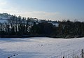
 Above Alderley - geograph.org.uk - 1650795.jpg 640 × 480; 70 KB
-
 Alderley Farm - geograph.org.uk - 5363117.jpg 1,024 × 768; 259 KB
-
 Alderley Farm - geograph.org.uk - 5363483.jpg 1,024 × 768; 208 KB
-
 Alderley Farm from Hillmill Lane - geograph.org.uk - 2837912.jpg 1,024 × 769; 163 KB
-
 Alderley House, Alderley near Wotton-under-Edge - geograph.org.uk - 5616374.jpg 5,184 × 2,920; 4.58 MB
-
 Alderley Wood - geograph.org.uk - 1650778.jpg 640 × 480; 64 KB
-
 Alderley, Winterspring Lane - geograph.org.uk - 5627364.jpg 1,600 × 899; 666 KB
-
 Beaufort Hunt, Tresham, Gloucestershire 2015 - geograph.org.uk - 6621719.jpg 2,314 × 1,470; 755 KB
-
 Beaufort Hunt, Tresham, Gloucestershire 2015 - geograph.org.uk - 6621791.jpg 3,775 × 2,398; 2.45 MB
-
 Benchmark in Alderley village - geograph.org.uk - 6594840.jpg 1,600 × 1,200; 1.06 MB
-
 Church and school, Alderley - geograph.org.uk - 1650933.jpg 640 × 480; 94 KB
-
 Church of St Kenelm and Alderley House, Alderley - geograph.org.uk - 5483106.jpg 3,776 × 2,520; 3.32 MB
-
 Church of St Kenelm, Alderley - geograph.org.uk - 5483126.jpg 3,776 × 2,520; 4.25 MB
-
 Cotswolds near Hillesley, 2000 - geograph.org.uk - 5575210.jpg 2,166 × 1,220; 207 KB
-
 Cottages in Alderley - geograph.org.uk - 314667.jpg 640 × 426; 111 KB
-
 Cottages in Alderley - geograph.org.uk - 5092712.jpg 6,000 × 4,000; 4.21 MB
-
 Cut benchmark on St Kenelm's - geograph.org.uk - 6594831.jpg 1,600 × 1,096; 1.02 MB
-
 Enclosed track up to Alderley - geograph.org.uk - 5092351.jpg 6,000 × 4,000; 4.82 MB
-
 Farmland near Alderley (geograph 5092748).jpg 6,000 × 4,000; 5.29 MB
-
 Foxholes Wood on the Hillside - geograph.org.uk - 5437915.jpg 3,264 × 2,448; 1.69 MB
-
 Hillside above Kilcott Mill - geograph.org.uk - 5094248.jpg 6,000 × 4,000; 4.77 MB
-
 House at Alderley - geograph.org.uk - 5437919.jpg 3,264 × 2,448; 931 KB
-
 House Behind Trees - geograph.org.uk - 5437923.jpg 3,264 × 2,448; 2.33 MB
-
 House on the edge of Alderley - geograph.org.uk - 5092706.jpg 6,000 × 4,000; 4.1 MB
-
 Knowles' Mill - geograph.org.uk - 193181.jpg 640 × 480; 74 KB
-
 Old Boundary Marker - geograph.org.uk - 6435815.jpg 742 × 1,024; 328 KB
-
 On Cotswold Way heading NW towards Alderley (geograph 5616373).jpg 5,184 × 2,920; 5.54 MB
-
 On the flank of Winner Hill (geograph 5483074).jpg 3,776 × 2,520; 4.2 MB
-
 Road leaving Tresham by The Furlongs - geograph.org.uk - 2990392.jpg 1,024 × 722; 169 KB
-
 Road triangle in Alderley - geograph.org.uk - 5092725.jpg 6,000 × 4,000; 4.9 MB
-
 Roadside housing in Alderley - geograph.org.uk - 2837941.jpg 1,024 × 769; 218 KB
-
 Rose Hill (School), Alderley - geograph.org.uk - 311944.jpg 640 × 426; 93 KB
-
 The Belvedere, Alderley - geograph.org.uk - 5362226.jpg 1,024 × 768; 159 KB
-
 The Belvedere, Alderley - geograph.org.uk - 5363416.jpg 1,024 × 768; 167 KB
-
 The Cotswold Way at Alderley - geograph.org.uk - 3452170.jpg 800 × 600; 138 KB
-
 The Cotswold Way at Alderley - geograph.org.uk - 3452178.jpg 800 × 600; 143 KB
-
 The Cotswold Way at Alderley - geograph.org.uk - 3452185.jpg 800 × 600; 162 KB
-
 The Cotswold Way at Alderley - geograph.org.uk - 3452189.jpg 800 × 600; 164 KB
-
 The Cotswold Way at Alderley - geograph.org.uk - 3452201.jpg 800 × 600; 148 KB
-
 The Cotswold Way at Kilcott Mill - geograph.org.uk - 3452274.jpg 800 × 600; 168 KB
-
 The Cotswold Way at Old Farm - geograph.org.uk - 3452206.jpg 800 × 600; 149 KB
-
 The Cotswold Way near Kilcott Mill - geograph.org.uk - 5094237.jpg 6,000 × 4,000; 4.92 MB
-
 The Cotswold Way near Newmills Farm - geograph.org.uk - 3452257.jpg 800 × 600; 152 KB
-
 The Cotswold Way near Newmills Farm - geograph.org.uk - 3452261.jpg 800 × 600; 155 KB
-
 The Cotswold Way passing through Alderley - geograph.org.uk - 5092718.jpg 6,000 × 4,000; 4.43 MB
-
 The Cotswold Way towards Alderley - geograph.org.uk - 3450851.jpg 800 × 600; 172 KB
-
 The Cotswold Way towards Alderley - geograph.org.uk - 3450854.jpg 800 × 600; 140 KB
-
 The Cotswold Way towards Alderley - geograph.org.uk - 3450862.jpg 800 × 600; 174 KB
-
 The Cotswold Way towards Alderley - geograph.org.uk - 3450867.jpg 800 × 600; 155 KB
-
 The Cotswold Way towards Kilcott Mill - geograph.org.uk - 3452314.jpg 800 × 600; 182 KB
-
 The Cotswold Way towards Newmills Farm (geograph 3452216).jpg 800 × 600; 171 KB
-
 The Cotswold Way towards Newmills Farm (geograph 3452219).jpg 800 × 600; 186 KB
-
 The Cotswold Way towards Newmills Farm (geograph 3452223).jpg 800 × 600; 152 KB
-
 The Cotswold Way towards Newmills Farm (geograph 3452239).jpg 800 × 600; 141 KB
-
 The Cotswold Way towards Newmills Farm (geograph 3452242).jpg 800 × 600; 196 KB
-
 The Cotswold Way towards Newmills Farm (geograph 3452246).jpg 800 × 600; 159 KB
-
 The minor road from Tresham to Alderley - geograph.org.uk - 2990399.jpg 1,024 × 748; 98 KB
-
 The Mount House, Alderley - geograph.org.uk - 1650904.jpg 640 × 446; 74 KB
-
 The Mount House, Alderley - geograph.org.uk - 5092733.jpg 6,000 × 4,000; 4.28 MB
-
 The road entering Alderley from the east - geograph.org.uk - 2990408.jpg 1,024 × 768; 308 KB
-
 The road west from the bend at Park Farm track junction - geograph.org.uk - 4262142.jpg 2,560 × 1,920; 2.96 MB
-
 Track to Park Farm, near Alderley - geograph.org.uk - 4262136.jpg 2,560 × 1,920; 2.82 MB
-
 Valley below Hillmill Lane - geograph.org.uk - 1659873.jpg 640 × 441; 51 KB
-
 Valley, nr Alderley, Gloucestershire 2009 - geograph.org.uk - 5815870.jpg 1,694 × 1,018; 559 KB
-
 Abandoned building - geograph.org.uk - 193194 (cropped).jpg 202 × 164; 20 KB
-
 Abandoned building - geograph.org.uk - 193194.jpg 480 × 640; 110 KB
-
 Hill Mill House - geograph.org.uk - 193171.jpg 640 × 480; 84 KB
-
 Lake - geograph.org.uk - 193185.jpg 640 × 480; 73 KB
-
 Muscovy Bottom, Newark Park - geograph.org.uk - 130038.jpg 640 × 437; 77 KB
-
 Park Farm - geograph.org.uk - 193197.jpg 640 × 480; 99 KB
-
 Road to Kingswood from Hillesley - geograph.org.uk - 314189.jpg 640 × 426; 111 KB
-
 The Cotswold Way near Alderley - geograph.org.uk - 314668.jpg 640 × 426; 138 KB
-

-
 The Monarch's Way, Tresham - geograph.org.uk - 303659.jpg 640 × 480; 81 KB
-
 Valley to the south-west of Tresham - geograph.org.uk - 312008.jpg 640 × 426; 107 KB


.jpg)


.jpg)
.jpg)


,_Alderley_-_geograph.org.uk_-_311944.jpg)


.jpg)
.jpg)
.jpg)
.jpg)
.jpg)
.jpg)


.jpg)


